Amazing results one week into the Gooseneck Swamp restoration trial!
I managed to head back to Gooseneck Swamp on Monday the 2nd of September to check on how things were responding 1 week into the trial, after also being tipped off by a neighbour that water levels upstream of the outlet had risen.
Sure enough, I made it out there to find that the level had risen by about 20cm from when we left a week earlier – see gauge-board photos below (click them to enlarge, press “stop slideshow” to hold the image on screen).

50cm – The wetland depth in the channel, just upstream of the sandbag weir site prior to construction

53cm – The wetland depth at the end of construction on the 26th August 2013

72cm – The wetland depth 1 week into the trial – on the 2nd September 2013
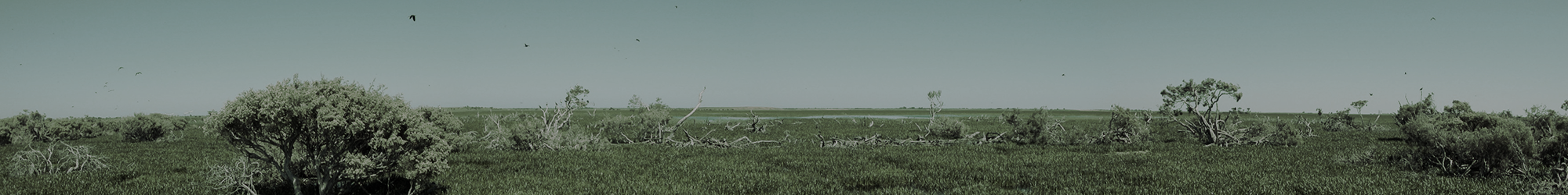
After checking on the levels, I took a short walk to the end of the lunette (to the west), and got a very pleasant surprise to find the natural outflow between the two swamps was now carrying a significant flow – both in the deeper defined channel and shallow sheet flows over a wider area of floodplain to the west (total of about 50-60m wide). The appearance of the flow-path – which was completely dry 1 week earlier – was particularly stark! I could hardly believe my eyes…

Dry on the 26th August – The natural flowpath between Gooseneck Swamp and Brady Swamp, to the west of the artificial cutting in the lunette that separates the two wetlands.

1 week later on the 2nd September – The natural flowpath (and 50m wide shallow floodplain to the right of image) now carrying a significant volume of water through to Brady Swamp, at the natural sill level for Gooseneck Swamp.
A much larger additional area of Red Gum floodplain to the west of Gooseneck Swamp – that was dry a week earlier – was now also under ankle deep water…

A small example of the now inundated Red Gum floodplain west of Gooseneck Swamp – 2nd September 2013
When I got back to the office, I decided to compare the situation on the ground to what the Digital Elevation Model (based on LiDAR imagery) had predicted. Although we haven’t yet had our gauge board in Gooseneck Swamp surveyed in precisely, the swamp was filled to something around the 241.6m AHD level when we started working on the sandbag weir on the 26th August.

241.6m AHD – the light blue indicates the approximate extent of Gooseneck Swamp on the 26th August
However now, 1 week (and 20cm of increased depth) later: the flow pattern and levels now appear to more closely resemble the 241.8m AHD scenario.

241.8m AHD – the difference an extra 20cm of water makes: light blue indicates the approximate extent of Gooseneck Swamp on the 2nd September.
Note: as indicated, at this elevation the natural flowpath and associated floodplain at the end of the lunette become active with flows.
Based on the on-ground observations, the LiDAR information appears to have given us a very accurate indication of what would happen as Gooseneck Swamp levels increased – with a wider expanse of floodplain the west now inundated and the natural flowpath to Brady Swamp activated. Used in this way, accurate elevation data is a great planning tool for wetland restoration projects.
It appears that current flow conditions may now also have changed, with an apparent decrease in drain inflows (from the north and north-east) and possible increase in Wannon River floodplain inflows (from the north-west). Although now flowing out of Gooseneck Swamp at a higher elevation than was the case when water was passing through the artificial drain cutting in the lunette, the capacity of the 50-60m zone of natural overflow between Gooseneck and Brady Swamps (at the western end of the lunette) is large – capable of carrying much higher volumes of water than the drain cutting itself. In this way, Gooseneck Swamp will remain an “open system” capable of enabling water to pass through during higher flows or floods (should we have a big downpour in the next month). In fact, from debris in the natural channel, it is clear that the swamp has reached its current level semi-regularly during higher flows in recent years already. The major – and extremely important – difference now will be that when inflows cease, the swamp won’t empty prematurely into Brady Swamp below its natural sill height, as was previously the case.
This gives the wetland flora and fauna at the site a much better opportunity to complete their life cycles, and provide refuge habitat that will last longer into the summer months – very good news for the Growling Grass Frogs that started calling in the distance at Gooseneck Swamp just as I was leaving the other day…
Growling Grass Frogs – Gooseneck Swamp – 2nd September 2013

Lachlan standing on the completed sandbag weir structure on the 26th August 2013, with the (now inundated) temporary bund visible in the background – no longer having an effect on flows or water level.

The sandbag weir working nicely – 1 week later – 2nd September 2013