Hanna Swamp Discussion Paper: Analysing the gaps in policy and planning for wetlands within Melbourne’s urban growth areas
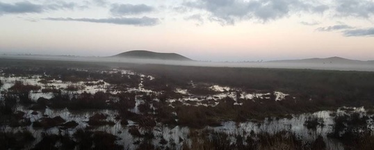
Last month we introduced you to Hanna Swamp, a little known wetland near Wallan, north of Melbourne.
This month, we are exploring in fine detail the intricacies of how overarching Victorian Government water policy (like the Integrated Water Management (IWM) Framework and Healthy Waterways Strategy) converges with the development planning system in Melbourne’s urban growth areas.
You will learn how – through no one’s fault – there are a number of critical gaps and inconsistencies that have emerged in the planning process that potentially impact natural but previously modified waterways and wetlands – like Hanna Swamp and Herne Swamp. As a result, we are approaching a key decision point for Hanna Swamp, where alternative strategies will be required if we are to avoid planning outcomes that directly contradict those overarching Victorian state government policies.
One significant gap is a lack of shared knowledge about exactly where the waterways and wetlands were, where they are now, why they have changed, and how this might influence decisions about future waterway management as the area is urbanised.
To understand the complete picture, you really need to read the full paper, but a quick glance at the 2 maps below will help give you a sense of just how differently we can view the landscape today as a result of these changes.
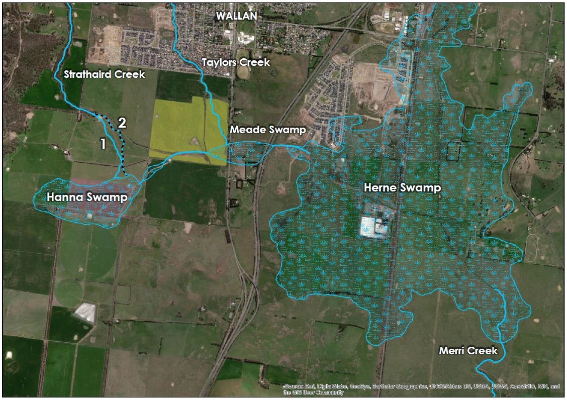

The first map is essentially an historic map of the traditional cultural landscape for waterways, and by association provides a potential future vision for a scenario where the waterways and wetlands in this area are restored. The second map is the modified landscape that we have inherited today, coming out of 150 years of intensive agricultural use.
Clearly they are at opposite ends of a broad spectrum of possibilities.
The key questions that we now face, with the progressive shift away from agriculture and the process of urbanisation now underway, is:
“what do we want this landscape to look like in the future, and
how do we want the waterways and wetlands to function in this area once urbanised?”
If you are interested to learn more, including about the other gaps we’ve identified, you can download the pdf of the Discussion Paper here, or view it directly further down the page.
This is an incredibly complex issue and as a result things don’t always go to plan. There are no simple answers. But there is a lot of goodwill from a wide range of the parties with a stake in the Wallan Wallan wetlands. We hope that this detailed analysis will make a positive contribution to help progress that discussion.