Pacific discoveries: sharing stories from an island adventure
Following my recent family holiday at Rarotonga in July, I’ve spent some time learning more about the spectacular landscapes of the Pacific region. So I thought I’d share the highlights!
Some 65 to 50 million years ago the upper surfaces of the Manihiki Plateau, part of the largest oceanic floor on earth, fractured. Violent plumes from the inner mantle forced their way to the surface. Mountainous peaks emerged from the sea, appearing one after another as the oceanic plate below slowly drifted; another volcanic chain of islands was formed in the South Pacific Basin.
More recently, somewhere in the Pliocene (up to two million years ago), two more short periods of volcanic activity formed a new island that rose through 5,000 metres of ocean. The first volcanic event resulted in flows of liquid basalt lava, which cooled to form extensive cliffs and motu (islets). The second threw fragmented rock from the earth’s crust, creating thick breccias in the form of rocky mountainous peaks. This island, Rarotonga, is the youngest and highest of a cluster of islands, including those of the Manihiki Plateau, now known as the ‘Cook Islands’.
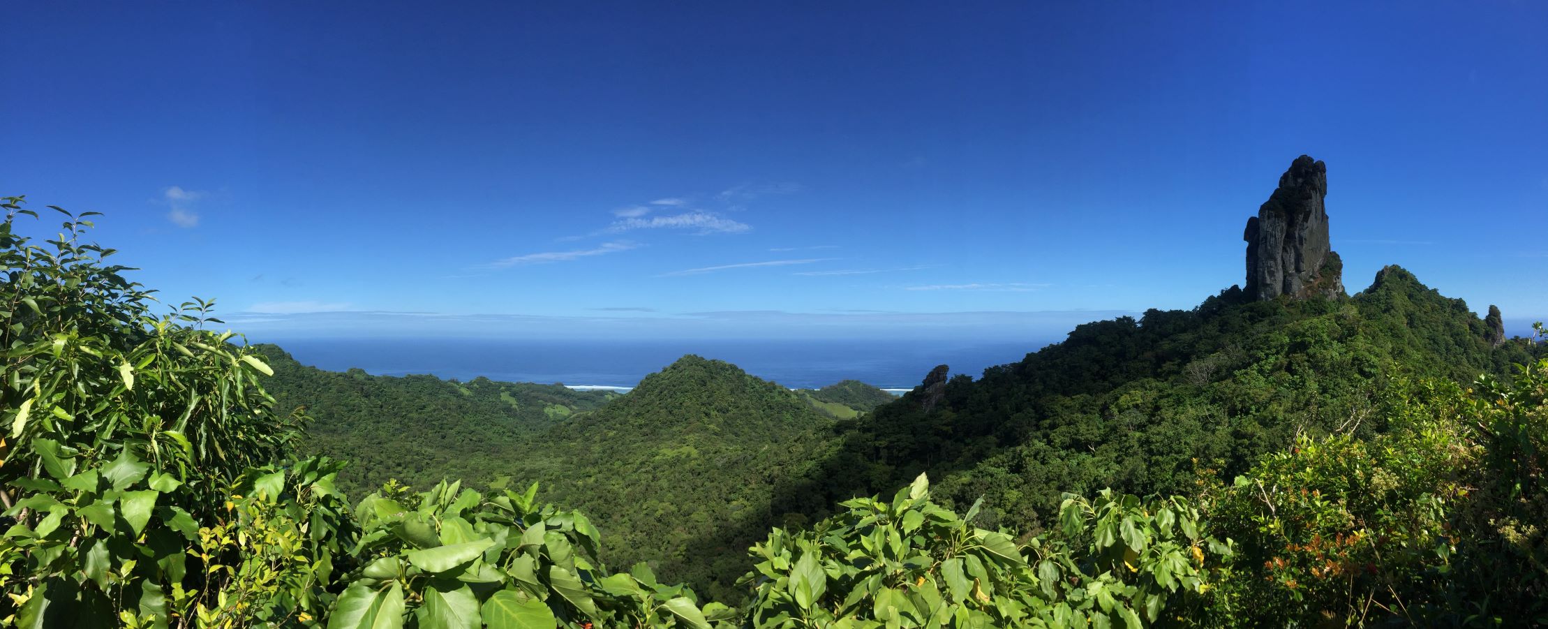
The rocky peak of Te Rua Manga (The Needle), Rarotonga. This structure is called a ‘breccia’ with many of its stones being magnetic. It is thought you can locate the many lightning strikes that have occurred on the peak by a drastic change in compass bearing due to lightning realigning the magnetised minerals from magnetic north to the current pole. (Photo: Lauren Kivisalu)
Over geological time to the present day, these volcanic islands continued to transform, as did the fluctuating seas surrounding them. Extensive coral reefs grew around emergent mountain peaks, expanding as the new crusts cooled and the extinct volcanoes disappeared below rising seas, only to emerge again as oceans receded and froze into ice. Over time, the oldest and highest peaks of these island chains submerged completely, leaving only the very shallowest of land masses and coral rings or ‘atolls’.
A line around all fifteen of the Cook Islands would create an area of 2.25 million square kilometres; an area almost the size of Western Australia. However, as with many other small volcanic islands of the Pacific Group, they appear no more than a fine sprinkling of dust on a map, barely visible amongst the vast open waters of the Pacific Ocean.
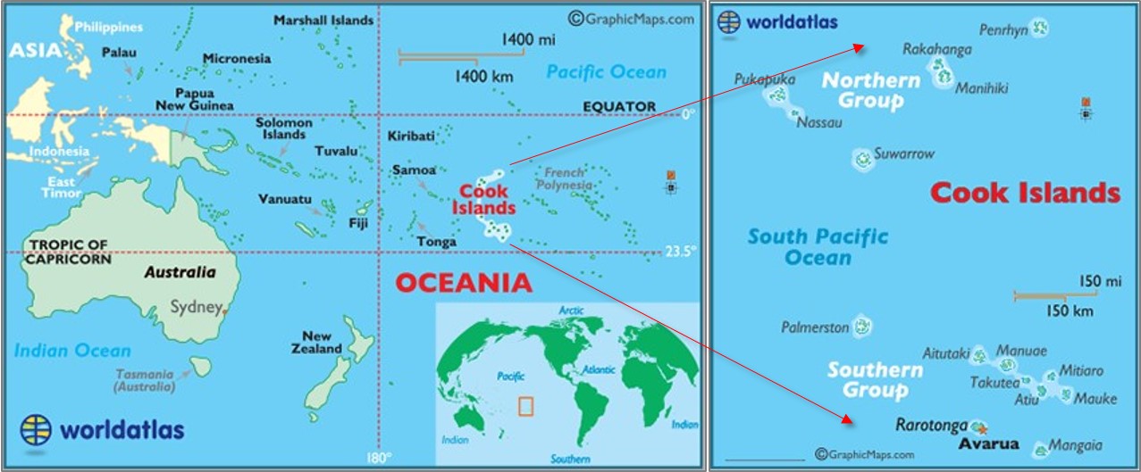
A map of the Cook Islands (left) within the Indo-Pacific region and (right) the northern and southern groups. (Maps: WorldAtlas).
This vastness makes the first discoveries and human occupation of the Pacific islands so impressive and somewhat mysterious. Just as wondrous is the biodiversity of the islands which has evolved in context of isolation and a complex geological history.
Intrigued? I hope so, as am I; still learning about these beautiful Pacific islands. There’s so much to share, and to entice fellow naturalists and adventurers. I hope you can read on next month to continue the discovery …