Special World Wetlands Day 2019 news! Announcing NGT’s newest reserve in South Australia – Hutt Bay Wetland
February the 2nd each year is World Wetlands Day, and this year we’re making a very special announcement to mark the occasion!
On the day itself (Saturday morning), I had a chat to Rod Sparks on ABC South East to talk all about it – which you can listen to below – but for all the finer details please continue reading…
Thanks to the foresight and incredible generosity of Rob and Deb Thompson, NGT is establishing our newest wetland restoration reserve at Hutt Bay, about 5 km west of the township of Port MacDonnell, on the South Australian coast south of Mount Gambier.
The Thompsons first started chatting to me about their future vision for the wetland about five years ago, and over that time we’ve been able to work together to turn their inspiring long-term vision for the property into a reality. So it has taken a little while to unfold, but with the second stage of a two-stage land donation process now complete, we’re able to finally share the wonderful news with you all… and it was definitely worth the wait!
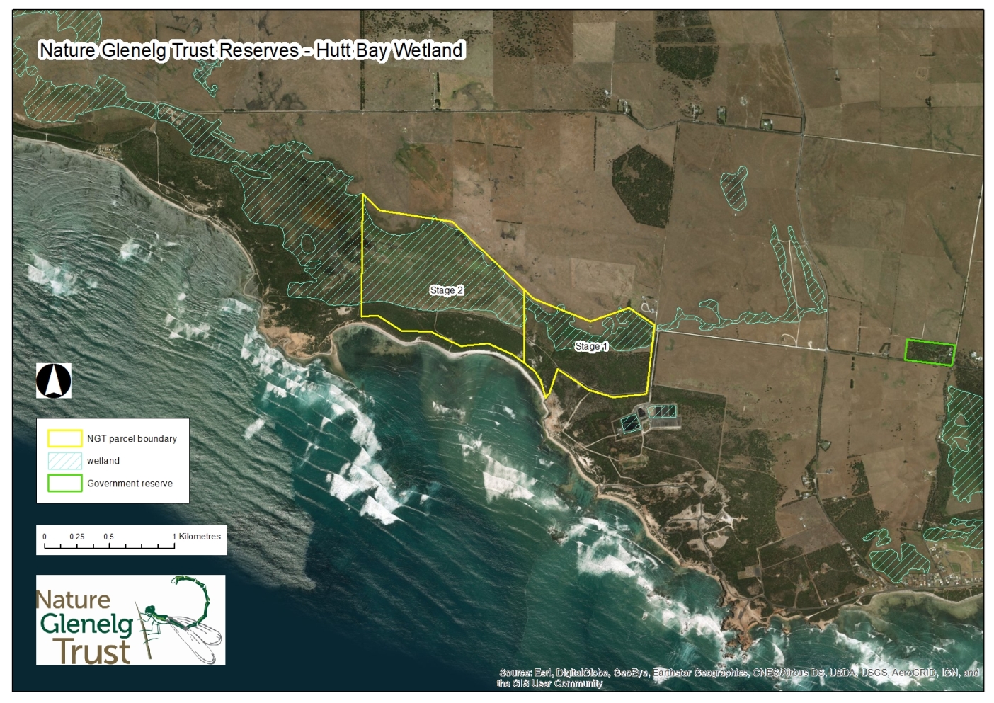
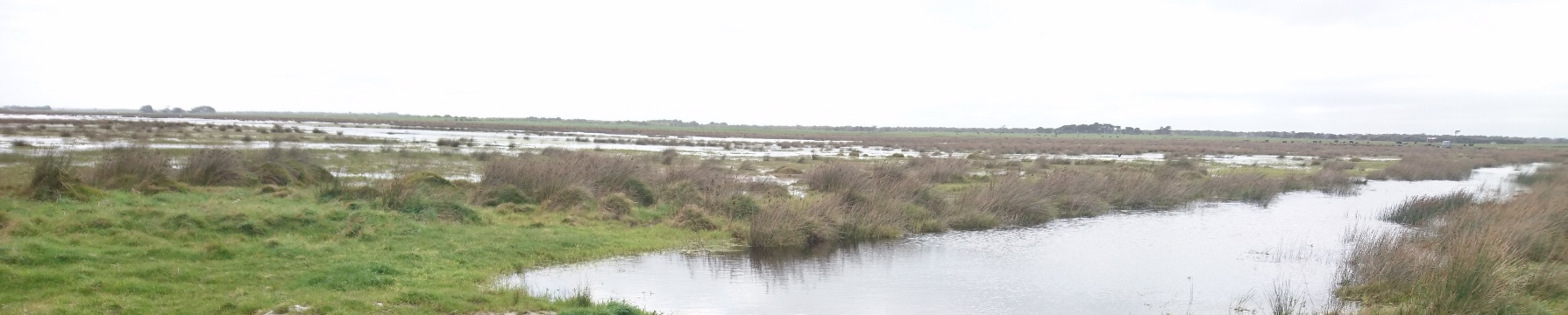
This private reserve, which is situated immediately to the west of the (SA Water managed) Finger Point water treatment plant, is a little under 160 hectares (or roughly 400 acres) in size, and includes extensive areas of coastal wetland, complemented by dry-land tea-tree woodland and coastal dune scrub which adjoins Hutt Bay.

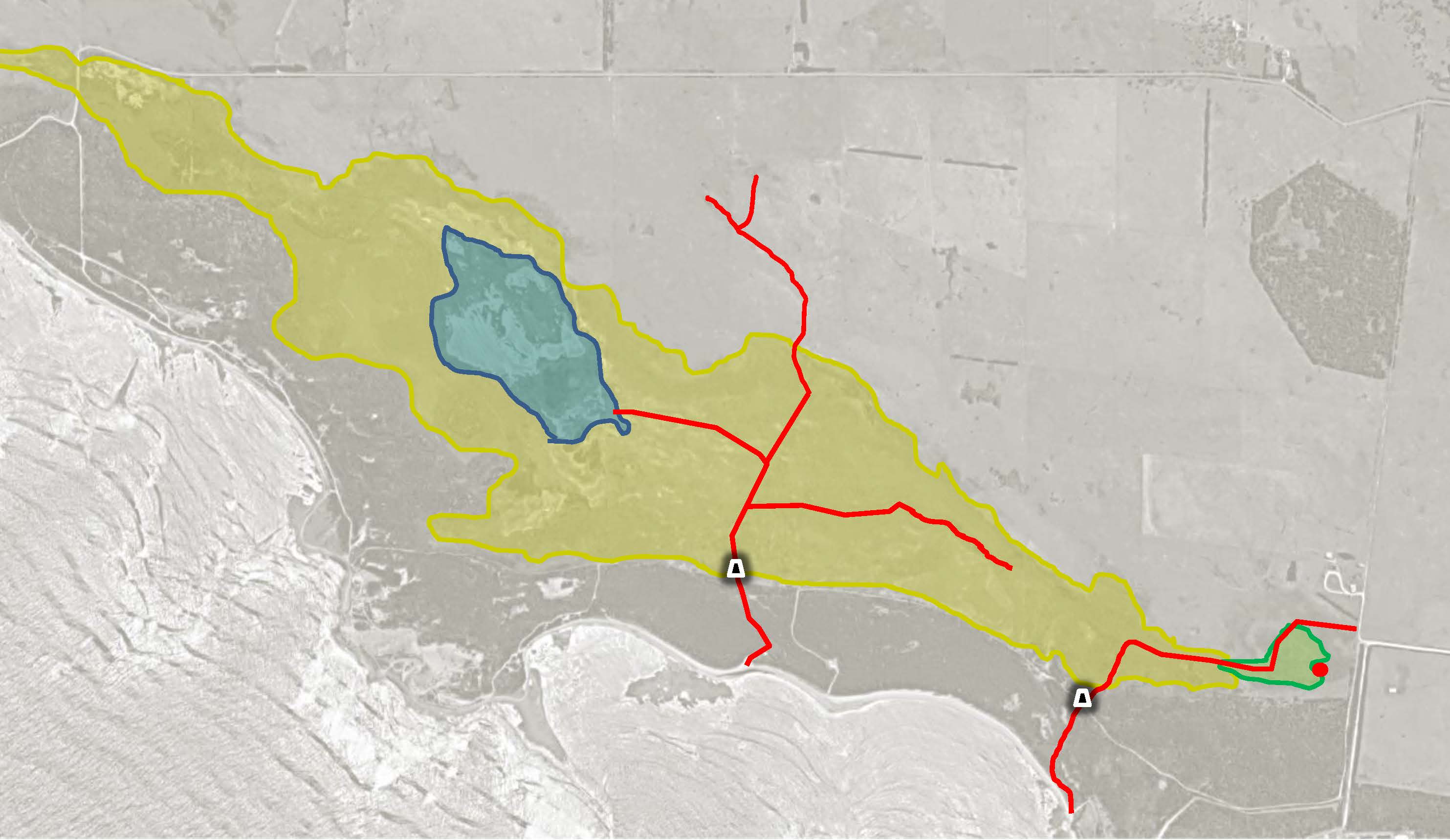
The Thompsons’ connection to this area goes back a long way, as Rob’s great-grandfather took up his first block (Section 677) when the land was made available by the State Government in 1880, and the family has farmed in the area ever since (read Rob’s family story in his own words here). We are fortunate to have some idea of what the country was like back then, as state government surveyors at the time paid attention to both the swamps and the native vegetation growing on the land, which gave strong indications about its productive capacity.

I have highlighted a few features of interest on the map above, namely: the red dot is a small freshwater spring, the green is freshwater (silky/woolly tea-tree) swamp scrub fed by those permanent groundwater spring flows, the yellow area is more open cutting grass and rush dominated terminal swamp, and the blue area (on neighbouring private land – Section A) is open water.
The Thompson family have grazed the swamp ever since Rob’s grandfather purchased Sections B and C in 1935 (adding to their adjacent land holdings), and several decades ago two cuttings were also made through the dunes in an attempt to drain the swamp and increase its productive capacity. Fortunately for us today however, two key things set this site apart from most other similar coastal wetlands, that made it a high priority area for permanent protection and restoration, include the fact that:
- despite past development efforts, the swamp retained much remnant native vegetation, and
- about 15 years ago, the Thompsons started working with SA Government wetland project officers (in what is now called the Department for Environment and Water) to begin the process of regulating outflows from the swamp to improve its biodiversity value as wetland habitat.
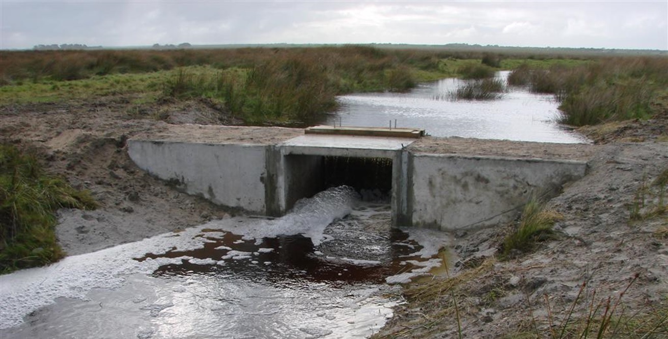
The first of those works were completed by Ben Taylor (now a Senior Ecologist with NGT), whose recollection of working on the property in 2005-2006 can be seen here.
The second set of works on the final remaining outlet (right) were undertaken by the late Steve Clarke, who sadly passed away last year.
Needless to say, the series of changes, both negative and positive (in ecological terms) over the past 140 years, mean that the wetland looks a little different now to what the surveyors first mapped in 1880.
As you’ll see below, we have drains (one blocked, the other partially regulated) to contend with, key habitats have shrunk, and the permanent small spring (where the Thompsons’ forebears used to fill up with water for the house every day) has long stopped flowing as a result of falling regional groundwater levels.
So yes, we have some challenges – however, and quite significantly, the key past management decisions already made by the Thompsons mean that the wetland is now on a recovering trajectory. This means that things are actually looking a lot better than they did 15 years ago.
NGT will now simply look to build on that momentum, and, as resources allow, we will develop a long-term restoration and management plan for the property to implement, which will most likely include activities like:
- destocking the wetland;
- re-aligning fences in key areas to improve management flexibility and remove internal barriers preventing wildlife movement;
- removing internal drains which can force water to move to the lowest points of the wetland (even with the outlets regulated), prematurely drying out fringing wetland habitats (this is especially significant for the fresh spring-fed area);
- reviewing the options for wetland levels currently set by the second artificial outlet regulator (which still discharges surface flows to the sea in most years); and
- hosting future community events (like education sessions, revegetation days and bird watching).
Given that things are a bit dry at present, our first community event to introduce you to the Hutt Bay Wetland will be an open day a little later in the year (probably in the spring) when the wetland is looking at its best – so keep an eye on the NGT newsletter for all the details.

Finally, on behalf of everyone at NGT, I wish to express my sincere gratitude to Rob and Deb Thompson for entrusting this special environmental area to us. Now we look forward to working with them, and our supporters, to turn Hutt Bay Wetland into a permanent NGT nature reserve and community asset for generations to come.
If you would like to help us make that happen, then please consider donating to the NGT Reserve Fund today. All donations over $2 are fully tax-deductible.
Donate to the NGT Reserves Fund Today