Wetland Condition Field Guide launch a big success

A huge thankyou to everyone who came out to Mount Burr Swamp on Tuesday 14 March 2017 for the launch of the Wetland Condition Field Guide, by Troy Horn and myself.
The guide has been five years in the making and fills a gap in rapid wetland assessment applicable across southern Australia, covering topics including:
· Rapid condition assessment, complete with visual guide
· Methodology for finding the edge or boundary of a wetland
· Tips for mapping and recording wetland plant communities, and
· Ideas for prioritising the level of protection and management works for a site, with specific ideas relating to the forest industry
The day was well attended and after the talks, book launch and lunch (within the shearing shed) overlooking the magnificent Mt Burr swamp (which still has lots of water), the afternoon involved a field walk to wetlands of differing condition states on the property and the adjacent native forest reserve.
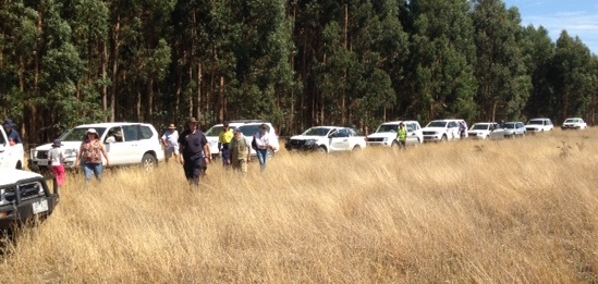
Convoy of participants

Participants looking in a very high condition wetland on the boundary between The Marshes NFR and NGT property (Mt Burr Swamp)
A special thanks to Sharn Lucas, Abigail Goodman and Justin Cook for providing comments and edits of previous versions of the guide, and to Ockert Le Roux, Tony Hay (Flying Ant GIS), and Yvonne Riley for the artwork, and photography provided and Steve Biasibetti (Genesis Creative) for design and printing
Copies of the field guide are available from the ForestrySA Office (Mt Gambier) 08 8724 2888, and the NGT Office (Vansittart Park, Mt Gambier) 08 8797 8596.