A retrospective look at southern Grampians wetlands in the 1890s
For anyone with an interest in natural history, coming across a revealing historic reference is always an exciting moment.
While doing some homework looking for historic material for the recently released report on Gooseneck Swamp, I came across a couple of fantastic articles from the Australasian newspaper in 1892, written by a bloke with the pen name “Bruni”. After an interesting email exchange comparing notes with Rod Bird from the Hamilton Field Naturalists Club, we managed to work out that Bruni was in fact Mr George A Brown, a Tasmanian who took his pen name from a favourite haunt of his youth – Bruni Island. If you are interested in reading more about George Brown, you can click on this link to read a pdf of the original article about his death in 1909.
So, you might be wondering… what can we learn from the articles by Bruni in 1892?
The answer is two-fold. Firstly, a revealing insight into early settler life in the southern Grampians district, but secondly, a fascinating, highly descriptive view the landscape prior to most modern clearance, drainage and development had occurred.

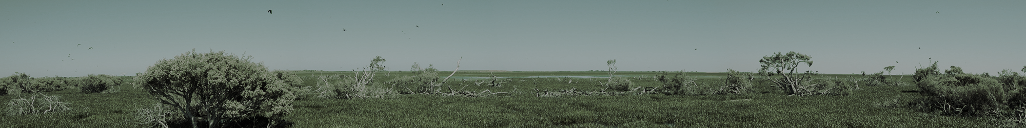
A pre-development 1800s view of the Grampians and surrounding district
What comes through clearly in reading these articles is a strong and pervasive sense of the need to develop the land and, for the district near Glenthompson, that meant drainage of vast wetland areas. In this regard, Bruni wrote:
“The drainage of these marshes is a subject that would well repay the attention of the Government. If the right to cut a drain through the land between the Heifer Station and Brady’s swamps could be obtained the work would be a very simple one… The work I have sketched would make a complete transformation in the appearance of the country. Where now many thousands of acres are covered with water for two-thirds of the year one would see cultivated fields and pastures of the finest description. …thorough drainage is hopeless until a main channel is cut through the whole series of marshes to the outfall from Brady’s Swamp into the Wannon.”
Little did Bruni know that this process would began in earnest less than a decade after his visit, with an official government scheme to drain Heifer Swamp underway around the turn of the 20th century; drains that were progressively used as a terminus for much wider drainage of private lands to the east towards Glenthompson. By the 1950s, the transformation of the landscape was completed with a channel excavated across Brady Swamp to the Wannon.
While there is no denying it has taken a while for attitudes to change, it is nice to know that this was far from the end of the story; with many people beginning to recognise that wetland drainage probably went a little too far in some districts. As a result, thanks to the support and foresight of a number of dedicated landowners in the districts around Dunkeld and Glenthompson, we now have restoration projects underway at a number of southern Grampians wetlands, including Brady Swamp.
So, if you are interested to go back in time and learn more about the wetlands near Dunkeld and Glenthompson before major drainage works and development were undertaken, then please have a read of the 1892 articles (that I have also transcribed to make reading them a little easier – by clicking here) – you won’t be disappointed!
Finally, Lachlan sent through these images looking from Mt Rouse towards the southern Grampians, which will be of interest as an accompaniment to this blog, because they give a fascinating perspective on the transformation of the plains nearby [click on the images to enlarge them].

The Southern Grampians – view from Mt Rouse in 1861

The Southern Grampians – view from Mt Rouse today