Let’s go ‘around the grounds’… an end of year visual update on some of our major wetland restoration projects after a wet spring
Over the past month, I have tried to drop in to a number of our major wetland restoration sites in SA and Victoria, given the unusually wet spring weather which has given most of these sites a real boost heading in to a later-than-usual summer that seems to be finally arriving. Let’s start over in the east and work our way west…
Rowan Swamp
Rowan Swamp, a Parks Victoria managed Wildlife Reserve situated north of Benalla in northern Victoria, has probably experienced the most extreme year of rainfall events of any of the NGT wetland restoration sites. Given that several Boosey Creek floods that have passed through the site, and the immense magnitude of a couple of them (see here for an example), we are very happy to report that – yes – we still have a trial structure in place and in-tact!
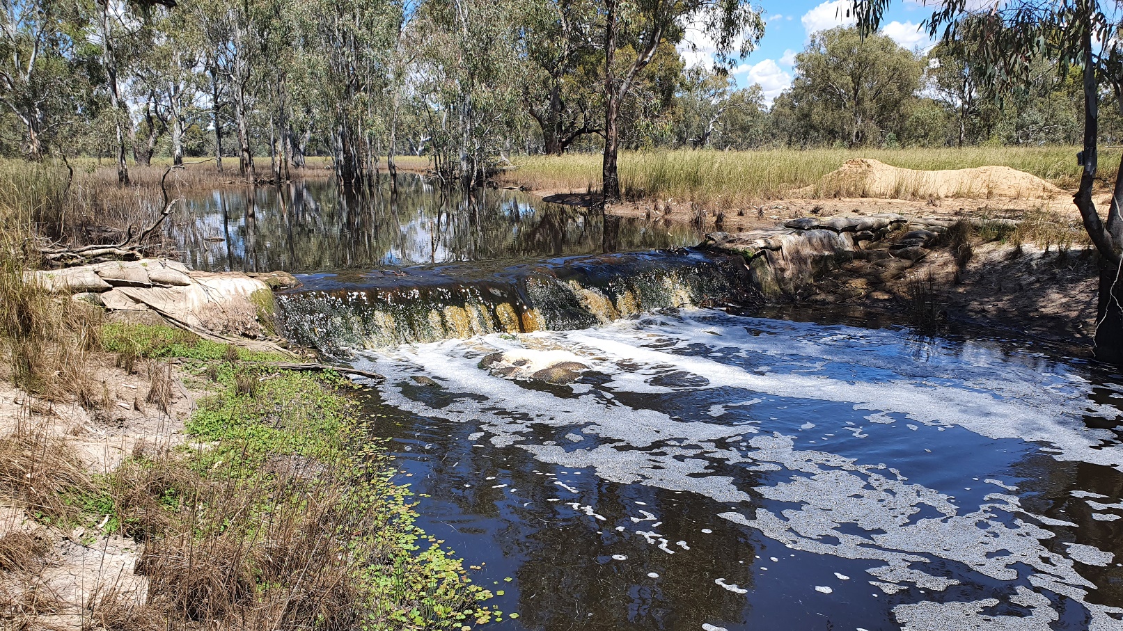
We should have some more complete and detailed data to share next year from these flood events, once we have a chance to download and analyse the water level data loggers, but for now, the video below shows the latest bird’s eye view of Rowan Swamp – illustrating the positive influence of the trial structure on wetland hydrology – taken on the 6th of December 2022.
Despite the receding flows, the trial structure is still holding about 50-60 cm of water in the deepest parts of the wetland upstream, as we head into the summer months. Doesn’t it look absolutely magnificent out there?
Green Swamp
Like all of our wetland restoration sites in the southern Grampians region of western Victoria, NGT’s Green Swamp Restoration Reserve had an absolutely bumper spring for inflows. Surcharging well above its normal full-supply level for several weeks, given the magnitude and sustained nature of flows, Green Swamp is still slowly easing back to the fixed outlet sill that was established when the wetland was restored to its pre-colonisation water level in 2014.
Green Swamp provides critical flocking habitat for western Victoria’s Brolga population, as well as key habitat for a number of other threatened species including the Growling Grass Frog and Western Swamp Crayfish. The video below shows the latest view of the outlet spillway, panning out to show the full extent of Green Swamp, taken on the 12th of December 2022…
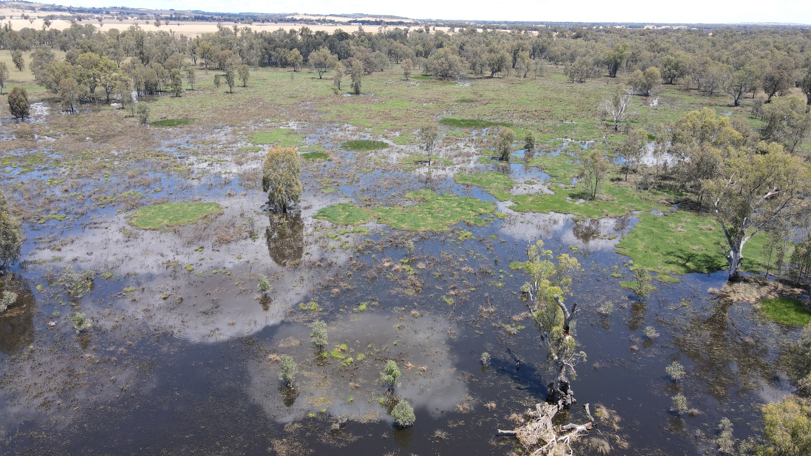
Walker Swamp, Gooseneck Swamp and Brady Swamp
This whole floodplain wetland complex, associated with the inland delta of the Wannon River on the edge of the Grampians, reached its peak back in November and is now gradually receding – as shown below.
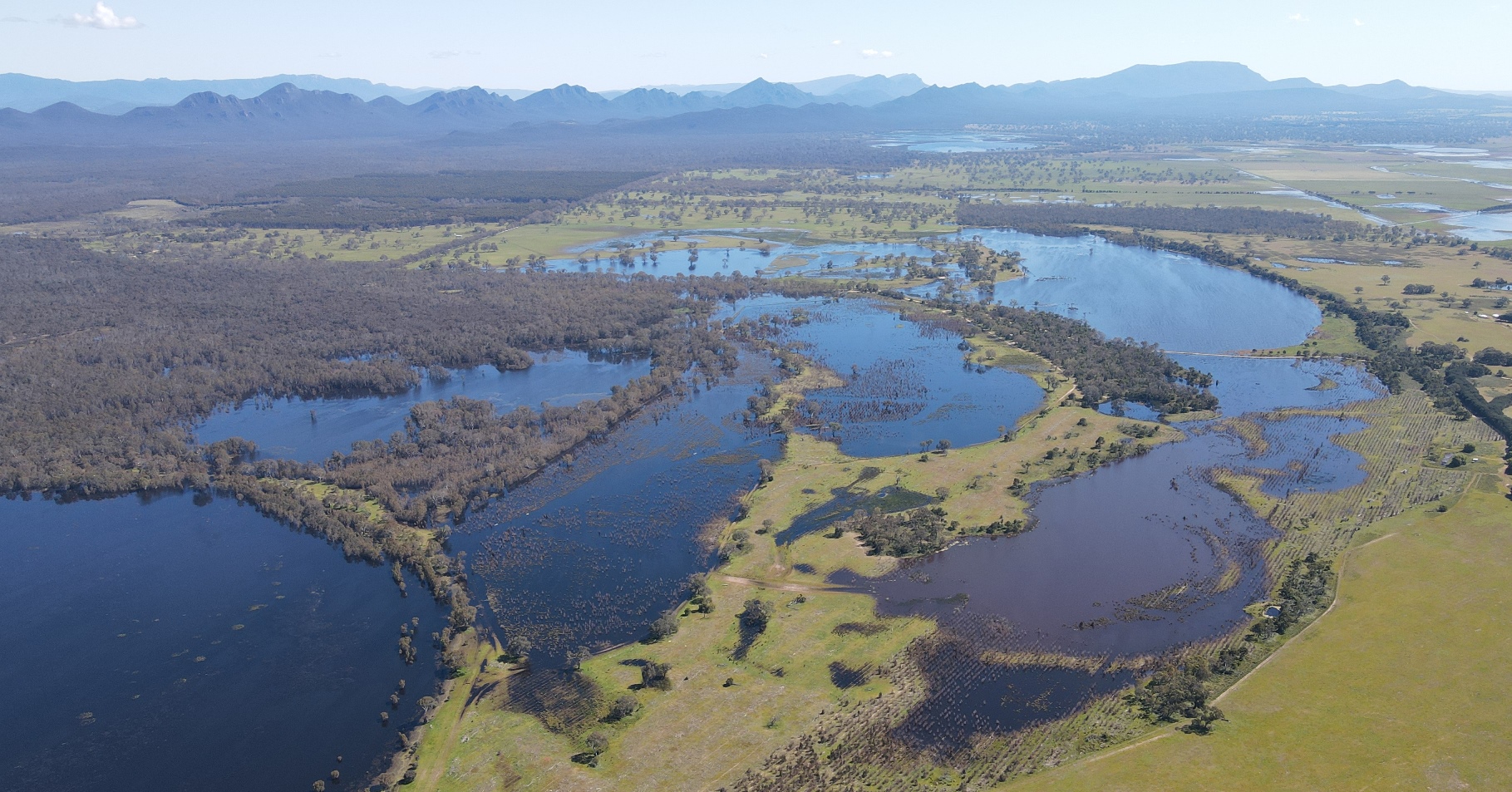
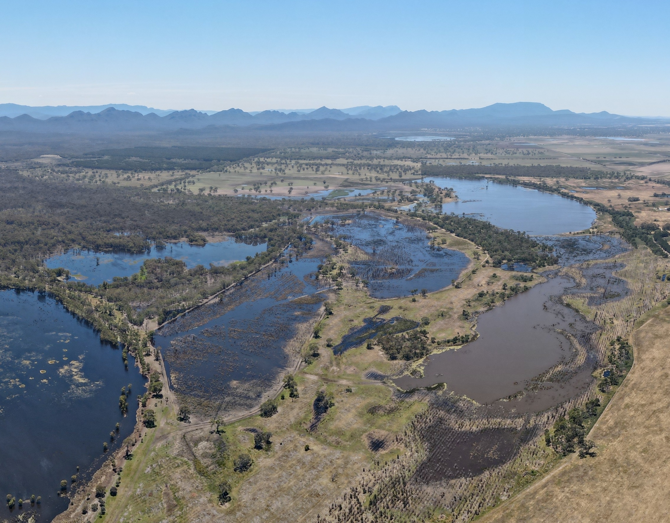
Despite the falling water levels across the various wetlands, this is still the by far the most water we have seen at Walker Swamp and its floodplains since it was fully restored in 2019, and it will give an immense boost to large areas of the property where we have been controlling coppicing blue gum stumps (which are a legacy of the previous land use) on the southern portion of the reserve, as shown below.

Long Swamp
On the 9th of December, I also managed to pop in to Discovery Bay Coastal Park, to see how Long Swamp near Nobles Rocks is looking, noting that this was one of our very first major wetland restoration projects which commenced way back in 2012.
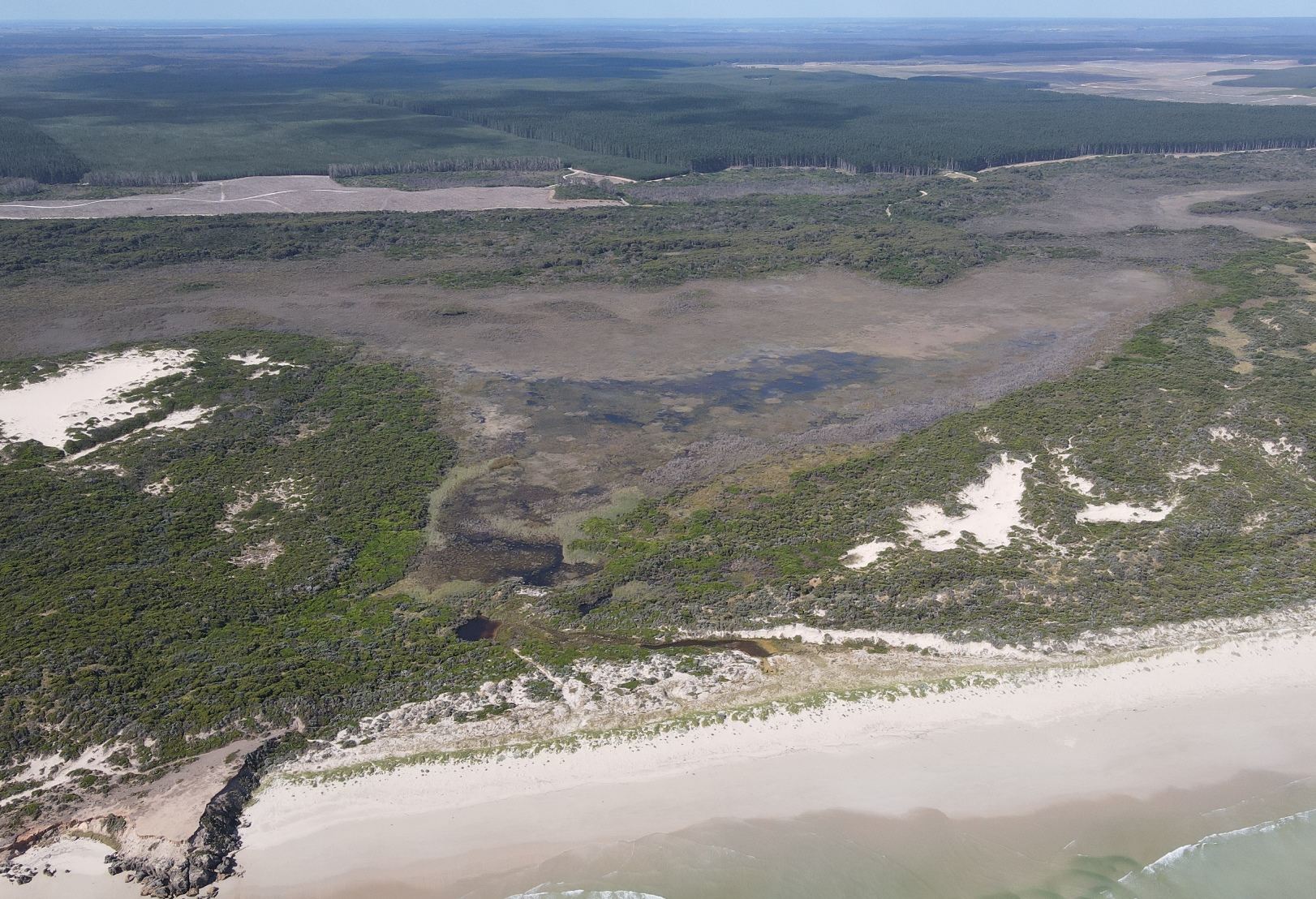
Since the location of the original restoration trial on the artificial outlet drain was reinstated as a sand dune, a rapid transformation continues, with both revegetation and natural regeneration now effectively stabilising the restored dune – as shown below. This is a perfect example of a philosophy of “leave no trace” in ecological restoration, as a natural landform achieves our ongoing hydrological restoration goal instead of adopting more intrusive (and expensive) engineering approaches that involve hard, built infrastructure.
We think it will be a successful outcome when in the near future people will walk past Nobles Rocks and ask, “so, precisely where was the artificial outlet drain”?
Hutt Bay Wetlands
Now let’s head west and hop over the border into SA…
On my most recent visit to NGT’s Hutt Bay Wetland Reserve in November, it was great to see the eastern wetlands still holding water, in what has not been an exceptionally wet year for this site – in fact, the lower South East area of the Limestone Coast region in SA has actually missed out on many of the bigger rainfall events that have hit other parts of south-eastern Australia.
In the image below, you can see the fully remediated (backfilled) artificial outlet to the sea in the top left, and the recovering wetlands in the foreground. If you are interested to learn more, we explained these works in some detail earlier in the year.
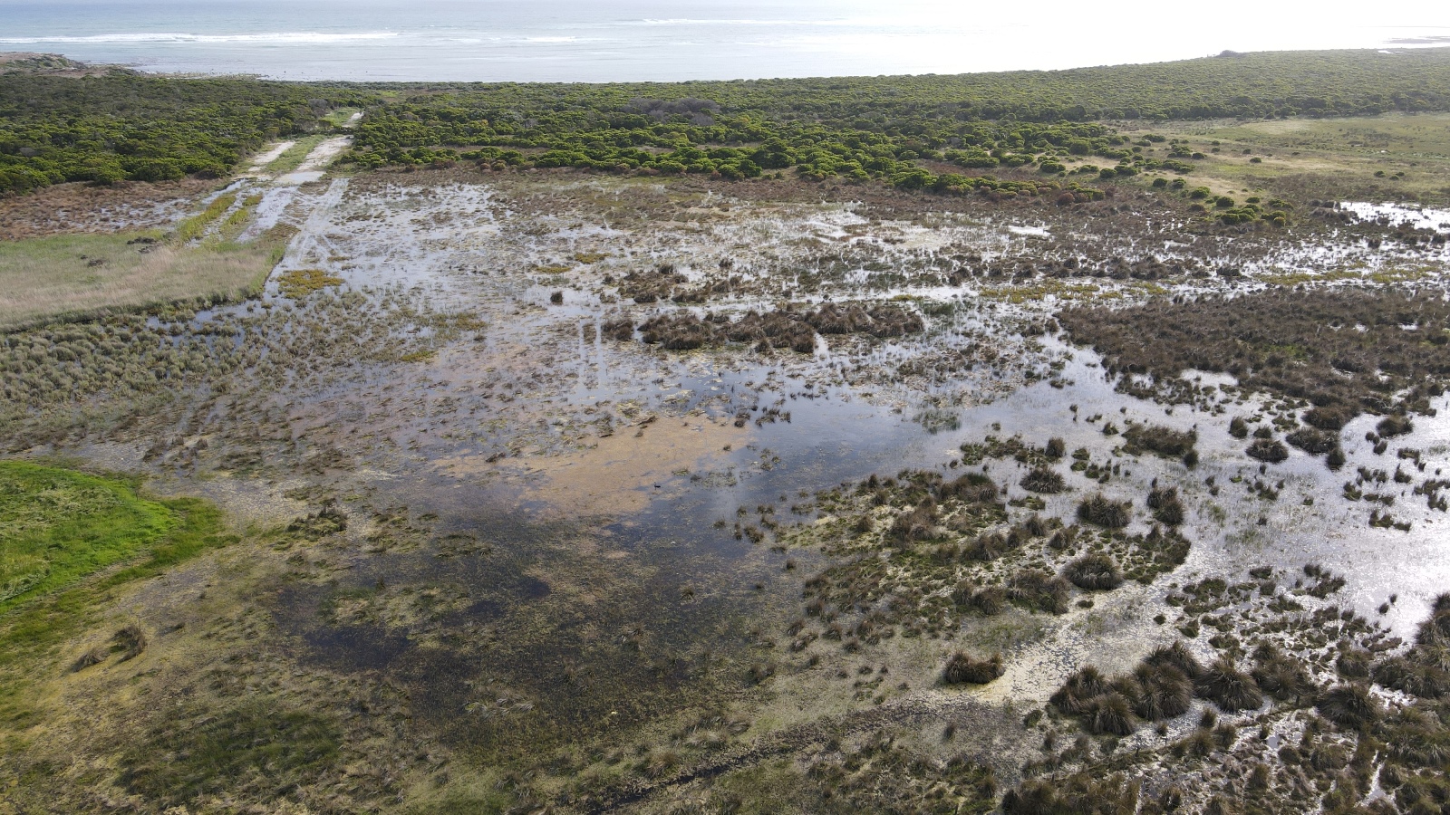
This year, despite lower rainfall in the area, thanks to the restoration works this is the most water held in this eastern part of the Hutt Bay Wetlands since the drain was cut to the ocean approximately 100 years ago. At this stage we are only able to estimate the drain construction date, because it was already present in the first aerial photography taken in the 1940s and we are yet to uncover other clues… noting that this area was not under the jurisdiction of (what is now known as) the South Eastern Water Conservation and Drainage Board at that time. If anyone has any useful leads on this, as we are very interested to put together an accurate history of change at this site, please let us know!
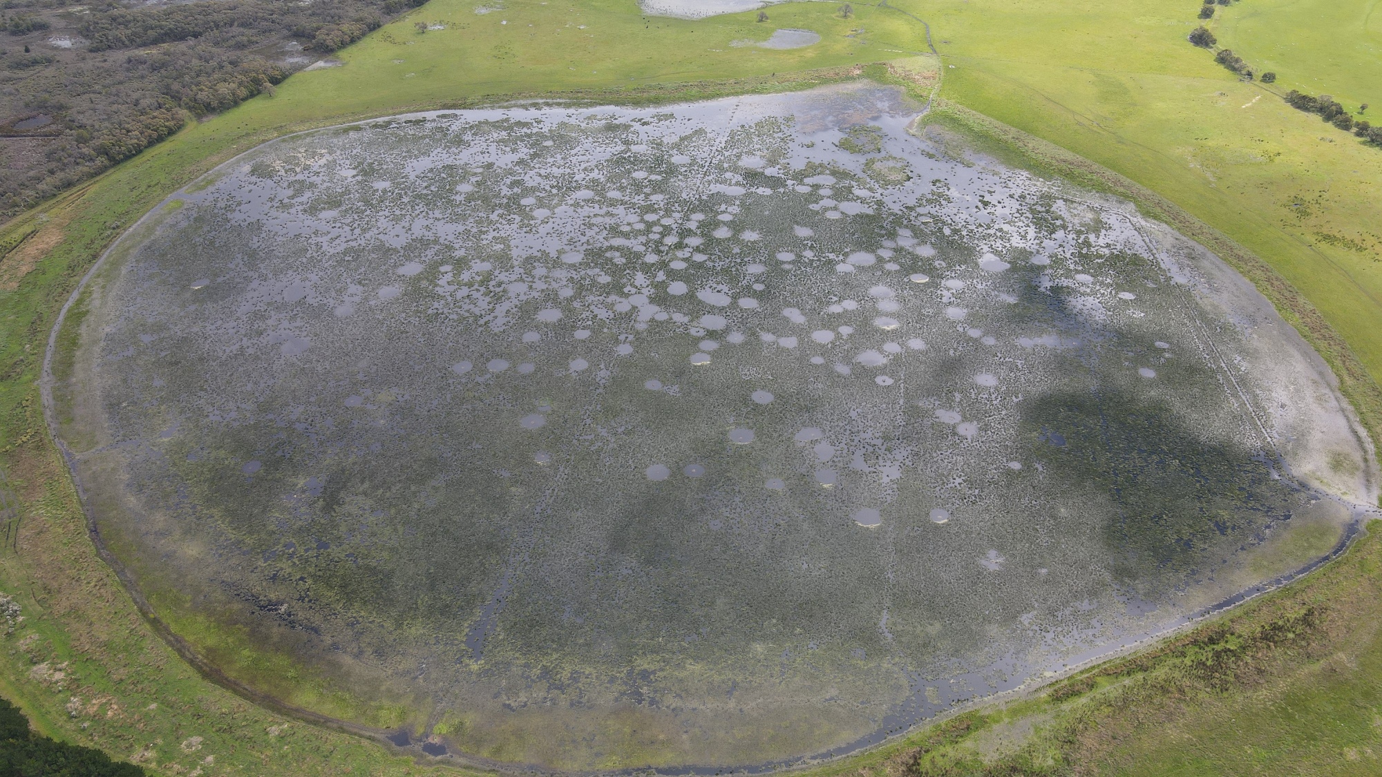
Mt Burr Swamp
A visit with the NGT team to Mt Burr Swamp, NGT’s first Restoration Reserve focussed on wetland restoration, in early November, gave me a chance to take a nice photo of Mt Burr Swamp, as shown below. This peat wetland was restored in 2016 and is looking fantastic, having now held water continuously since 2016.
By the way, are you game to count the circles below? In case you are wondering what they are, every one is an active swan’s nest!
Glenshera Swamp
Our final stop of this whirlwind, end-of-year, wetland restoration tour is on the Fleurieu Peninsula, south of Adelaide in SA. In late November, I was able to pop in to Glenshera Swamp within Stipiturus Conservation Park, to see how the area of peatland that was restored back in the autumn is now looking…

And the good news is… heading into summer, the extra slope saturation (note the puddles and greenness) is clearly visible in the image above, with water now unable to be more rapidly drawn down the network of artificial drains that were installed to dewater the northern slopes of Glenshera Swamp many decades ago (an artefact of when the area was used for grazing).
Now after that mega-update, I think this will do for today (and also for the year!), but stay tuned next year as we embark on new restoration works at some of these sites, as well as others not mentioned here!
PS. If you like what we get up to, and are keen to make a donation to help NGT expand our wetland restoration programs, then please free to contact our Senior Partnerships Advisor, Paula Thomson, anytime on / 0401 043 007, or visit our donation page.