NGT kicks off a complex eco-hydrological investigation on the east coast of Tasmania
Over the past couple of weeks, Ben and I have had the opportunity to kick off a new project on the east coast of Tasmania, near Freycinet National Park, and it turns out we arrived just in time to experience a major episodic rainfall event and witness the subsequent floods!
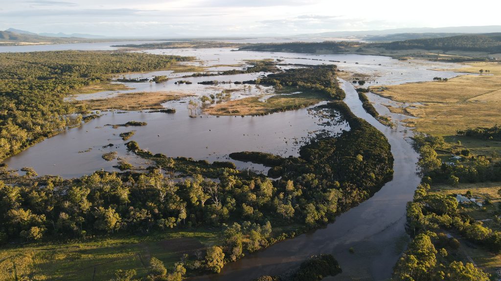
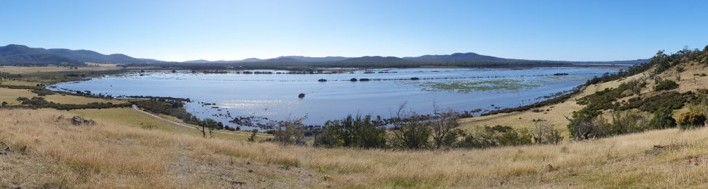
NGT has been engaged by NRM South, to undertake an independent eco-hydrological investigation into Moulting Lagoon and the Apsley Marshes, side-by-side wetlands that encompass public and private land on Tasmania’s east coast. These wetlands, which provide incredibly important habitat for waterbirds and other wildlife, were the 3rd and 7th sites respectively declared by the Australian Government (in November 1982) under the Ramsar International Convention on Wetlands.
The investigation that has now commenced, will enable us to piece together the ecological (biodiversity) and hydrological (water management) story of the site to understand its trajectory of change through time. Of note, these two vital elements are often assessed in isolation or only at a single point in time, which in our experience can be detrimental for making sound, informed decisions about wetland management.
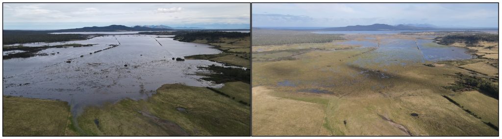
The receding flood from near its peaks on the 25th March 2021 (left), and again a few days later on the 29th March 2021 (right).
Photos by Mark Bachmann.
Key questions that we will be progressively investigating as part of the project over the next 2 years include:
- Using historic sources of information, what can we say about how this wetland complex has changed over the past 220 years – i.e. can we more accurately define its original condition, water regime and biodiversity values?
- Based on more recent information sources, and by documenting the modifications made to the sites and/or their catchments (like artificial drainage works undertaken in and around both wetlands in the past), what is the current “baseline” condition and values of the Ramsar sites?
- What additional information do we need to collect today (both biological / hydrological), to help improve our confidence in our understanding of trends in site condition / values? (Via this project, we will be in a position to help collect any new, critical information required to help answer this question)
- By analysing past modifications and any trends, are there positive improvements to water regime, site drainage and/or management that could be made in the future, within or surrounding both Ramsar sites, to improve condition and biodiversity values of the wetland complex?
- If future positive changes are technically feasible, can they be progressed in a way that is acceptable and/or mutually beneficial to landowners and the environment?
We are now encouraging anyone who knows this area well and has any observations, photos, maps, records or stories from either Ramsar site (or the surrounding area), especially older historic information, to contact me by email and share these valuable insights with us.
In conjunction with our fresh scientific analysis, this information will greatly assist in answering the questions posed above, as we seek to determine if future works can be recommended that will result in a positive improvement to site conditions, with the support of landholders and the local community.
The item of work being undertaken by NGT is one of several components within a wider project being delivered by NRM South that is focussing on the improvement of environmental values around the Ramsar sites.
We look forward to keeping you informed over next two years – as we peel back the layers of history, and uncover these wetlands’ secrets.
This important work is supported by NRM South, with funding provided via the Australian Government’s National Landcare Program.