A big step forward on the road to recovery for the Hutt Bay Wetland Restoration Reserve
It was just over three years ago in February 2019 that we shared the exciting news of the donation of the Hutt Bay Wetland to NGT, thanks to the incredible generosity and foresight of Robert and Debra Thompson. During that time (click here to learn more), we’ve been using this NGT reserve mostly for coast and marine education purposes, while the bulk of the site has been kept in a holding pattern as we waited for the right opportunity to come along to enable us to begin the next stage of the recovery process for the wetlands at the site.
With the announcement of a new partnership with the Limestone Coast Landscape Board in September last year, Hutt Bay Wetland was one of two of our reserves (the other is Mt Burr Swamp) that are now benefitting from the new “Regional Recharge Farms” project.
Autumn 2022 has been a busy time for this project, as we were able to take advantage of the long dry period we have just experienced to complete the remedial earthworks required to set the site up – from a water management point of view – for the long term.
There were two networks of drains on the property, which date to sometime before the 1950s, each with an artificial outlet to the sea that have been the focus on these works.
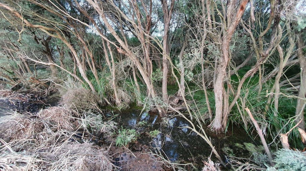
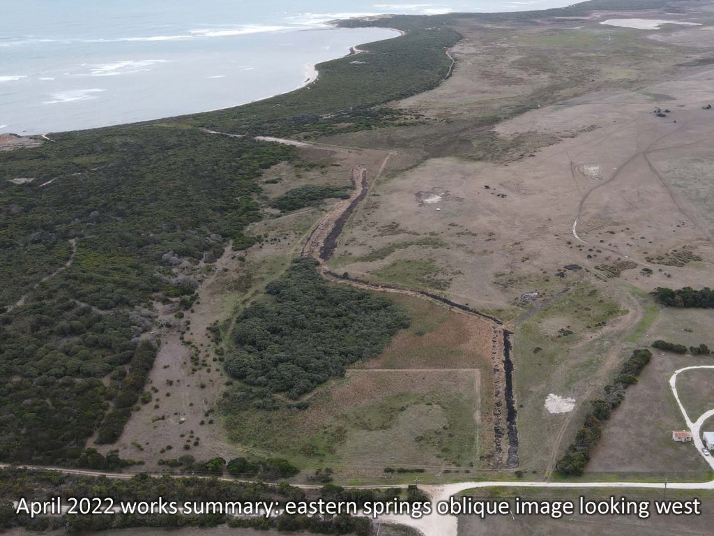
The first of these is situated at the eastern end of the property, in the vicinity of a small spring and patch of associated tea-tree, shown right. Please click through the pdf viewer below to see the before and after images, and an annotated description of the works.
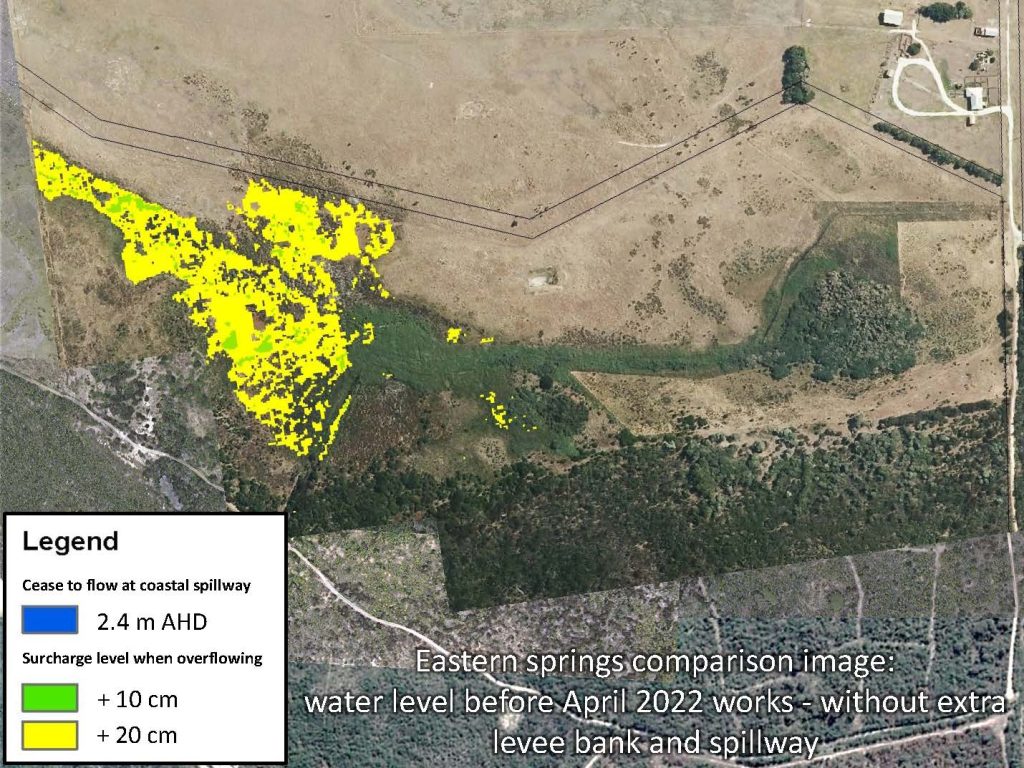
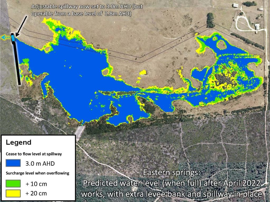
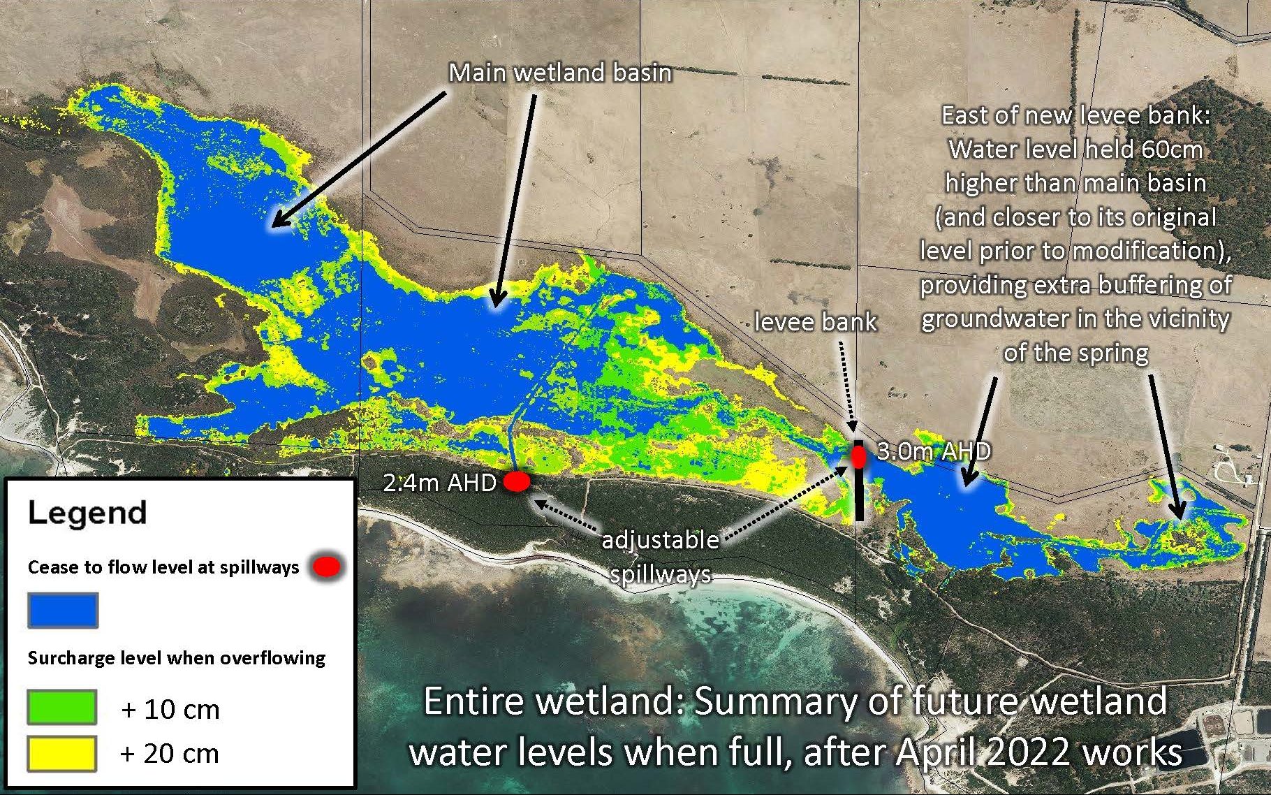
At this end of the property, we were also able to take advantage of and reinforce a built up track crossing across the swamp to act as a minor levee bank, and enable the reinstatement of a water regime much more closely resembling its pre-drained state. This is because the currently agreed water retention level with our neighbours across the rest of the wetland to the west is significantly (60 cm) lower. The improvement in how water can be managed in this part of the Hutt Bay Wetland is illustrated below. Also, in case you are not familiar with the abbreviations used below and are wondering, please note that the ‘cease to flow’ levels stated are the height of the spillways above sea level (i.e. metres AHD), not wetland depth.
Finally for this part of the property, this oblique image gives an overview of the completed works…
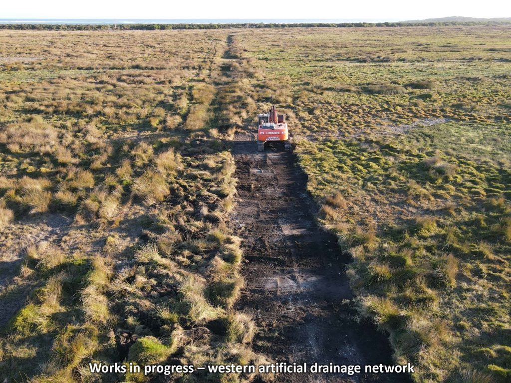
In the western portion of the wetland, we’ve now also backfilled the internal drains and relocated the spillway which sets the current water level by using a more stable and logical long-term location in the dunes adjacent to the wetland.
Firstly, here is an image of those works underway…
Again, you can also click through the pdf below to see the before and after image of these completed works, as well as an annotated map of the works, and a map showing the inundation regime of this part of the wetland.
Western-wetand-drain-works-from-Hutt-Bay-2022To summarise all of the above in one place, the final image below shows the way the whole wetland is now able to function as a result of the autumn 2022 works.
With the works completed and now in place, the project will be shifting in focus to a range of other tasks including monitoring of water levels, ecological response and a wide range of management activities to get this important NGT coastal wetland reserve really up and running.
Finally, we’re also planning to invite our supporters to come and have a look around the wetland with us later in the year, for a hike around the site in the spring, to continue our 10th anniversary celebrations and give you a chance to see a little more of the diversity of NGT’s various Restoration Reserves. So stay tuned, and keep your fingers crossed for some good winter rainfall over the next few months!
This project is supported by the Limestone Coast Landscape Board, through funding from the South Australian Government’s Landscape Priorities Fund and the Australian Government’s National Water Grid Connections Funding Pathway.