Baseline saltmarsh monitoring undertaken at Long Point, Moulting Lagoon, prior to restoration works
Ecological assessment and monitoring continues at Long Point, Moulting Lagoon. During two hot and windy trips to Long Point in November and December 2021, Bec and Justine, together with John Aalders (University of Tasmania), undertook vegetation surveys at established transects across Long Point. John’s work at Long Point for his PhD in 2013 has provided us with valuable baseline data, as well as a robust sampling method.
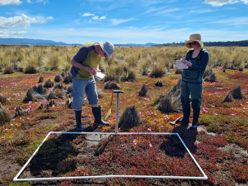
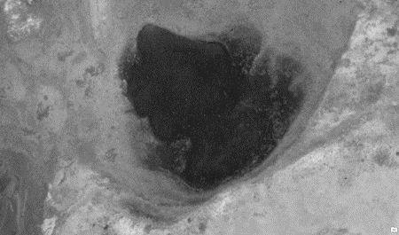
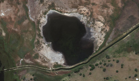
John’s transects were resampled along with a number of established Tasmanian Land Conservancy (TLC) transects. NGT’s transects have been set up to run perpendicular to the main levees and bisect them, in order to assess existing vegetation type and cover, and monitor changes going forward. Quadrats (plots) were placed at marked intervals along each transect and species noted for percentage cover. Relative abundance of plant species (or bare ground) was recorded. Overall, the presence and cover of species were similar along both NGT transects and between plots on the inland and lagoon sides of the levees. However, a comparison of aerial imagery captured in 1948 and recently in 2021 suggests that in some low-lying areas, saltmarsh has been replaced by bare ground, mudflats and open water. These long-term changes are consistent with observations by TLC and John Aalders. In a comparison of John’s data from 2013 and 2021, vegetation in several plots had visibly changed over time, particularly in low-lying areas. The most noticeable change was an increase in bare ground and a loss of saline vegetation species. This apparent transformation suggests that these areas are now being inundated more frequently and for longer periods.
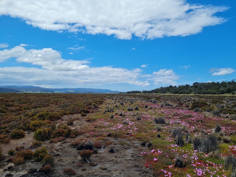
Looking across the colourful saltmarsh, it was apparent how relatively small changes in elevation were reflected by stark changes in vegetation type. Slight rises were typified by clumps of Chaffy Saw-sedge (Gahnia filum), while the lowest ground held only the very salt-tolerant samphire or glasswort (Sarcocornia quinqueflora), or no vegetation at all. Gahnia, a sedge that is tolerant of brackish conditions, had disappeared from several plots entirely. A decline in Gahnia health and extent has also been observed by TLC’s photo-point and vegetation transect monitoring over the past 5-10 years. These changes are likely marking an inland retreat of this vegetation type in response to sea level rise and associated changes to the inundation regime.
The vegetation data from John’s PhD work, and TLC’s historic datasets, combined with NGT’s recently acquired data, will provide a valuable baseline prior to undertaking wetland restoration works. It is expected that these surveys will be repeated post works and into the future to track eco-hydrological change and recovery at the site over time.
This important work is supported by NRM South, with funding provided via the Australian Government’s National Landcare Program.