Exploring new terrain and restoring wetlands on Victoria’s Volcanic Plain
When I first moved to Warrnambool in the early 1990s, I made almost weekly trips back and forth to Melbourne, across the western Victorian volcanic landscape. Dotted with dormant and extinct volcanoes, and pockmarked with lakes and wetlands, it’s a landscape I have grown fond of. However, I had not had a chance to see too much of what lies beyond the major highways. Over the past twelve months I’ve been getting out more into the stony country, beyond the highways, and exploring the nooks and crannies. This recent focus has been exploring wetlands and finding opportunities for restoration. Like many of the other regions where we work, wetland drainage is a common theme and threat.
Autumn is usually our busy on-ground work period, when the land is sufficiently dry to access the wettest parts of the landscape. This year has obviously been quite different in the face of COVID-19 but, as the situation stabilises, we have been able to resume some form of normality and get a number of tasks underway.
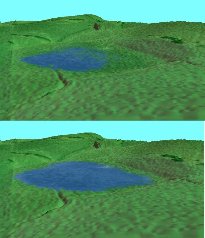
Greg and I recently ventured to a wetland I first visited last year. This 10 hectare ephemeral wetland near Derrinallum is pretty typical of the many seasonal wetlands on the Victorian Volcanic Plain. It is relatively shallow, filling from winter and spring rains and then drying down during late spring. Like many, it has a drain running through the middle of it, reducing both the frequency and duration it fills for and also the area which is covered by water. Through my initial observations and discussions it seemed like a pretty simple fix. Some careful analysis of elevations and factoring in the existing farm plan with the sites owners have allowed us to determine a restored inundation area. Using our trusty sandbag method, we have now set a restored spill height so that when the rains return, and the wetland fills, it should stay wetter for a bit longer.
As part of my assessment, I have also looked at the existing wetland vegetation and we’ll continue to monitor this over the next few years to see how the restored water level improves the quality of this vegetation. The wetland has pretty good coverage of native species in the deeper parts, which still get wet most years. Species include Silver Tussock-grass (Poa labillardierei), Prickfoot (Eryngium vesiculosum), Australian Sweetgrass (Glyceria australis) and a variety of rushes, but the fringes are dominated by Phalaris. Based on what we have observed elsewhere, the increased inundation area should drive the Phalaris back upslope, and allow the native species to expand. And with that comes more habitat for the crayfish, frogs and birds which rely on these wetland areas.
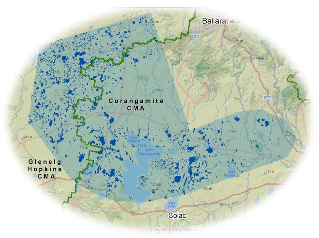
If you have a wetland in the project area (below) and you’re interested in getting some advice regarding restoration and bringing the water back, I’d love to come out for a look and see what we can do. Feel free to send me an email () or give me a call (0401 208 717).
This project has been funded by the Victorian Government’s Biodiversity Response Planning program and is helping to ensure that Victoria’s natural environment is healthy, valued and actively cared for.


