In search of Eel Creek… A day of exploration in Long Swamp – rewarded by a glimpse of Robbie the bittern!
After a very hectic run over recent weeks, on Tuesday I finally managed to go for an exploratory hike through the depths of the central portion of Long Swamp – something I have been meaning to do for the last 3 years, but just hadn’t got around to until now. Rising levels at Nobles Rocks and the prospect of flows possibly soon making their way downstream through several kilometres of swamp towards the Glenelg River provided just the incentive I needed to get out there…
After working my way through inundated sedgelands and several areas of (almost) impenetrable tea-tree (not for the faint hearted!) I finally came across what I had been looking for – the remnants of the old channel (Eel Creek) that it appears would have once carried flows downstream from Nobles Rocks towards the swamps of the central portion of Long Swamp. Some sections of this channel are visible in the aerial and LiDAR imagery we have access to, but we weren’t sure if it was continuous the whole way.

The remnants of Eel Creek, at the base of the dunes, in the remote central portion of Long Swamp
So it was pleasing to discover that not only is the channel continuous from a certain point in this section of Long Swamp – despite sometimes being completely covered in tea-tree – but as you progress west, the flow in that direction becomes more apparent. The photo below is an example of how dense vegetation can obscure readings of the true land surface, and is why the accuracy of elevation data that covers Long Swamp is indicative only (and cannot be trusted in the same way that we apply it for inundation modelling in cleared farm land or open wetlands that have dried out).

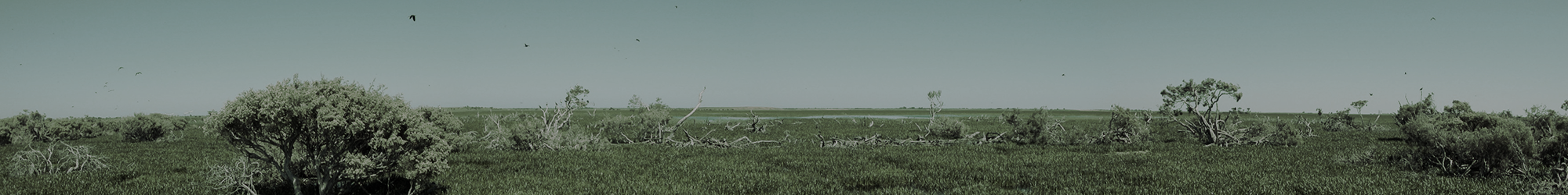
Further downstream, Eel Creek is completely concealed by tea-tree from above. A slight westward flow was detected at this location.
Despite there being no obvious surface flow yet entering this part of Long Swamp from the Nobles Rocks area (although as the swamp is filling this appears to be now getting very close), the elevated water level in that area does appear to already be having a positive influence on downstream hydrology, probably through sustaining elevated surface/groundwater levels and associated lateral seepage. Hopefully this will soon be supplemented by true surface flows, once the levels at Nobles Rocks rise a bit further. Because the accuracy of the LiDAR elevation data is not perfect (as explained above), we don’t know exactly when (or more to the point, at what height) this will occur, but based on the distance between the start of the Eel Creek channel to the west and the inundated zone at Nobles Rocks – it appears that we are now getting quite close.
Interestingly, it just so happens that the zone that needs to fill and spill in order to convey flows downstream, is an area of swamp that shows signs of vegetation change, as a result of the long-term drying trend we have talked about previously – a change that our project is aiming to help address, so it will be interesting to see if these young shrubs can be displaced before they fully establish.

The shrubbing up of wetland habitat in Long Swamp. This image shows the establishment of Woolly Tea-tree (Leptospermum lanigerum) seedlings, a wetland fringe species, moving downslope into this reed and sedge dominated habitat.
In contrast, the newly restored and rapidly growing area of aquatic habitat at Nobles Rocks is shown below.

The appearance of Long Swamp, inland of Nobles Rocks:
ABOVE: The swamp in October 2014, near (around 5 cm below) its maximum depth reached during the first stages of the trial – with no surface water visible (due to shallow depth) from this angle.
BELOW: The same view in May 2015, with the phase 3 structure operational. Significantly, the winter rains are yet to arrive, so this restored aquatic habitat is now hopefully here to stay!

The newly restored area of aquatic habitat inland of Nobles Rocks.
Oh, and by the way – to top off a massive day, in my several kilometres of wading and navigating through the swamp, I also captured a glimpse of Robbie the bittern in flight. I managed to spot his transmitter to confirm ID – before grabbing my camera – so I can report that it was definitely him. This is consistent with recent news from the Bitterns in Rice Project, which confirms that Robbie is still getting to know the general Long Swamp area – good news for both Robbie and our project!
I’m sure you’ll agree this is not the best photo I will ever take, but this folks, is Robbie!

The full photo of Robbie in flight

Close up of Robbie – clearly a bittern silhouette – in flight.
Finally, just in case you are wondering what Robbie actually looks like up-close with the transmitter fitted, Matt Herring was kind enough to post the below photo on the Bitterns In Rice Facebook page.

Here is Robbie on the day of his release at Coleambally, NSW on the 21st, April 2015 (Image courtesy of Matt Herring, Bitterns in Rice Project).