Just how wet has it been at Walker Swamp this spring? Here is a local and historical perspective
Rainfall across south-eastern Australia has been noteworthy this year with many areas receiving well-above average spring rainfall and flood levels along some of the major tributaries of the Murray Darling Basin (MDB) exceeding anything in living memory. Despite largely missing the big events over the past three years under La Niña conditions, parts of western Victoria also had their turn in October.
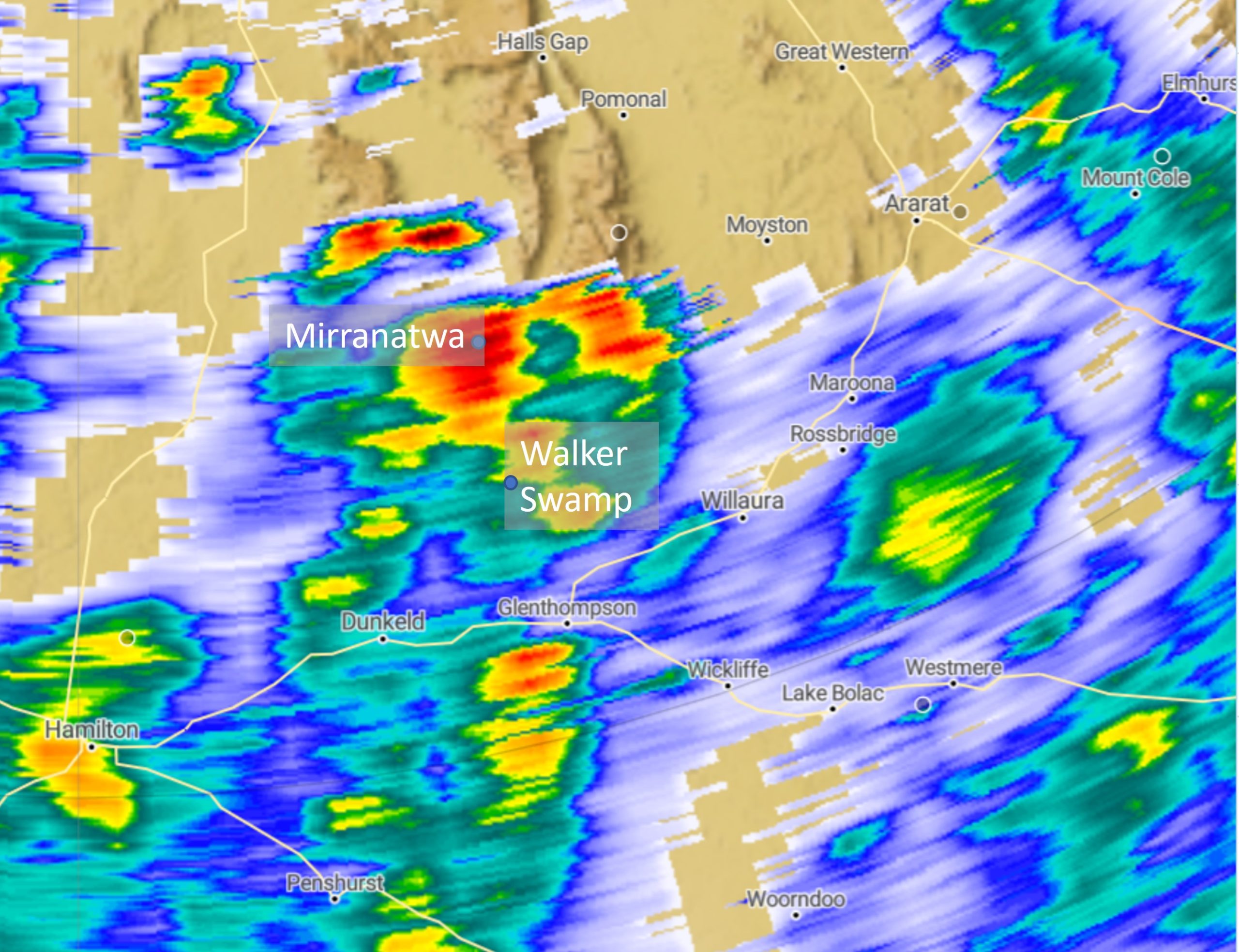
For us working in the catchments of the Southern Grampians region, it was the first time we have experienced and observed a truly big rainfall event. In 2016, we saw the effects of a wet September and that pretty much had set our benchmark. October this year was, however, next level. The image below, shows a radar capture of one large event on October 21st which delivered between 60 to 100 mm of rain over several hours across the Southern Grampians region. Locations that are mentioned in the text below (Mirranatwa, Willaura and Wickliffe) are also shown for geographical context.
In terms of assessing how significant spring rainfall has been in the Southern Grampians region, we are fortunate to have some long-term data from Bureau of Meteorology weather stations and these are summarised below:
Willaura (Weather station 89034) (since 1902):
- October 2022 wettest month on record
- October 14th second highest daily rainfall on record (89.2 mm) behind 91.4 mm in February 1973
- Fourth wettest spring on record (282.6 mm) without including November rainfall
Mirranatwa (Weather station 89019) (since 1902)
- October 2022 second wettest month (205.8 mm) on record behind 240.5 mm in July 1963
- October 22nd equal seventh wettest day on record and wettest spring day on record
- Wettest spring on record (412.6 mm to 23rd November)
Wickliffe (Weather station 89033) (since 1879)
- Second wettest month on record (182 mm) behind March 1946 (189.2 mm)
- October 14th fourth wettest day on record (91.8 mm)
- 40 mm less than wettest spring on record without including November rainfall
One trend I noticed when looking through this data is that many of the historically big events have occurred in either summer or autumn, when catchments are typically drier. The winter of 2022 wasn’t particularly noteworthy in terms of rainfall although, by the start of spring things were starting to wet up (as described in this previous article). By mid-October the catchments were saturated and a bulk of the rain that fell translated directly into runoff. We are now on the doorstep of summer, the wetlands are full to the brim and waterways are still running at some of the highest levels we have seen.
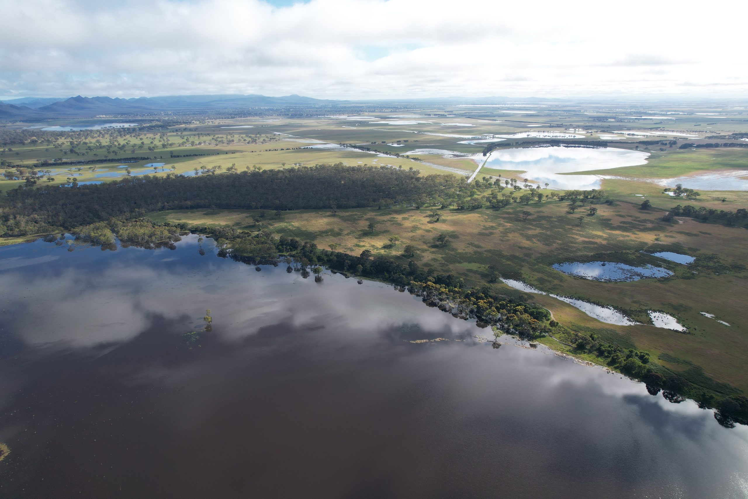
The following picture was taken last week, looking north from Walker Swamp. It gives you a perspective on just how much water is still moving through these upper catchments.