Kayaking through Bulrush to get Apsley Marshes monitoring underway
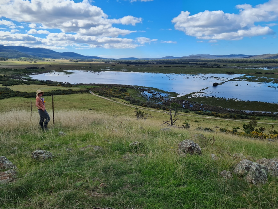
After much discussion, planning and preparation, the second week of April was ear-marked for the exciting task of deploying water level and salinity loggers across the Apsley Marshes Ramsar site. Luckily, the weather was fine and despite some recent rain, the tracks into the main site remained relatively dry. Despite this knew we had a tricky logistical challenge ahead, deploying a dozen paired loggers across nine square kilometres of wetland, most of which is only accessible via waders and a kayak!
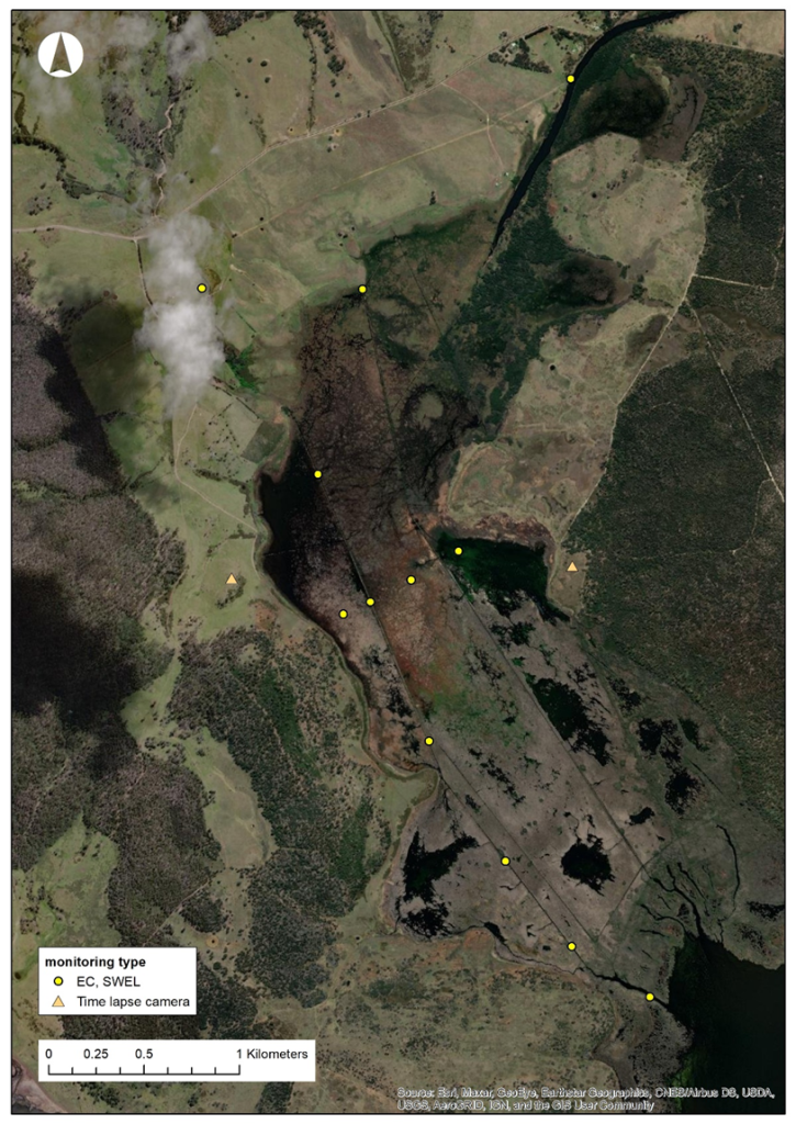
Locations for loggers were chosen to best capture all aspects of the hydrological regime, including groundwater, freshwater inflows from the Apsley River, tidal ingress from Moulting Lagoon, and the impacts of the levees and drains throughout the Marshes. A north–south transect of loggers was installed in the main western drain to determine the extent of freshwater flows and tidal movement. A east-west transect of loggers was also installed across the central region of the Marshes where the variation between freshwater and lagoon water is most apparent and where recent changes in vegetation have been observed.
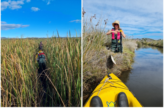
The installation of loggers commenced in the north, where the Apsley River pools before entering the Marshes complex. We then worked southward and lastly, eastward, accessing the sites from the wetland perimeter where possible. In the hard to reach central and southern areas, we used a double kayak to carry ourselves and all the gear required to install 1-2 sites at a time. At some sites, where Typha and other aquatic plants grew in dense swathes, we pushed and pulled the kayak through the wetland, stopping to install stilling wells and paired loggers at pre-determined locations. Elsewhere we were able to paddle across open water or along drains.
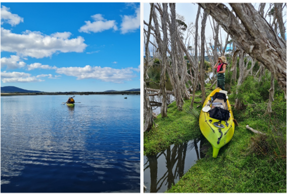
As the main western drain ran downstream towards Moulting Lagoon, it became deeper (up to 3 metres) and wider (2-3 meters), though there were a couple of occasions where portage was required (dragging the kayak around impassable fallen trees across the channel or over drain spoil heaps). A variety of installation techniques were used at the site. Where the bottom of the drain was too deep for a stilling well, we attached the loggers in purpose-built cases to a besser block weight which sits on the bottom and is connected to the bank with a star picket. In shallow, low-flow areas, we were able to use the more traditional stilling wells to house the loggers.
Along with the data loggers, we also installed trail cameras at high points on either side of the marsh complex, looking across the wetland. These were set to take regular photos during daylight hours and will allow us to correlate the water level data with the inundation patterns observed by the cameras. These should also result in some nifty time-lapse animations in future. All in all, the loggers were successfully deployed, and an epic adventure was had at another amazing wetland site which we are lucky enough to call work!
This important work is supported by NRM South, with funding provided via the Australian Government’s National Landcare Program.
