Peeling back the layers of change to kick-start saltmarsh recovery at Moulting Lagoon, Tasmania
After 12 months of extremely interesting background research, site assessment and planning, the first phase of on-ground works have just commenced as part our eco-hydrological investigation into the Moulting Lagoon and Aspley Marshes Ramsar sites on the east coast of Tasmania – an important project we are delivering in partnership with NRM South and the Australian Government.
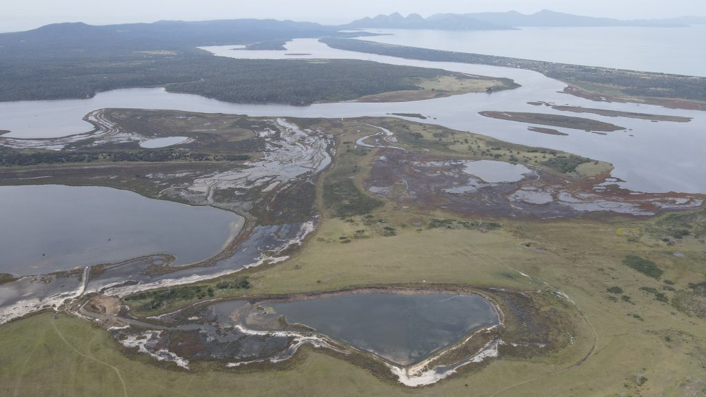
As I write this blog, I am on-site supervising two excavator operators (Steve and Andrew) undertaking remedial earthworks at Yards Hole, an important wetland on a private property called The Grange, which is adjacent to (and hydrologically connected with) Moulting Lagoon. For a birds eye view of my mobile office this week, see the image below, showing Yards Hole in the foreground, the Tasmanian Land Conservancy property Long Point behind and then Moulting Lagoon and Freycinet National Park in the background. Not a bad part of the world!
The goal of the works is to reinstate the natural landform (i.e. to reinstate conditions more closely resembling the natural surface profile and elevation gradient where it has been artificially modified) which will allow for the recovery of (a) the natural hydrological regime across the site, and (b) the re-establishment and recovery of saltmarsh and fringing wetland communities on the remediated ground.
At Yards Hole we have two zones of remedial works currently underway and progressing well.
Firstly, we have been busy around the the natural outlet from Yards Hole to Moulting Lagoon which had been significantly modified about 30 years ago via the establishment of a series of channels and ponds for an aquaculture project that never got fully up and running.

The sequence of images shown above shows the site last week before remedial works commenced (top left), the works underway (top right), the works almost complete this week (bottom left) and the final image (bottom right) from 1948 shows the original outlet location and surrounding zone of saltmarsh that has been used as the restoration template to guide the works.
Secondly, around Yards Hole itself, the aquaculture works 30 years ago resulted in the entire perimeter around the wetland basin being modified with the construction of a deep channel which, in turn, left a steep artificial bank (a sudden drop-off around the edge) and a large spoil heap the whole way around the wetland margin.
For a before and after image of the remediated eastern bank, please see below.
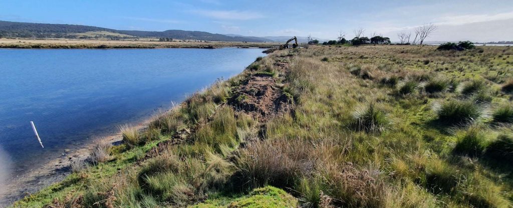
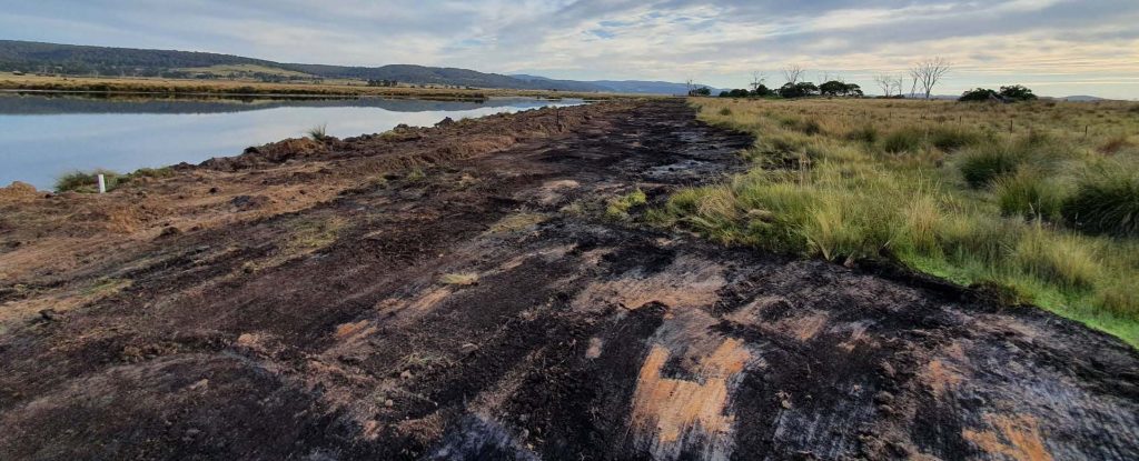
Bulk earthworks created this major change in the 1990s, and as you can see, are now also required to reverse that impact. The works are redistributing the large spoil bank back into its former location within the drain around the wetland edge, a zone where this material will slowly compact and settle to form a reinstated bank with a more gentle slope and providing fresh opportunities for fringing saltmarsh and sedgeland vegetation to establish. Additionally, if you look closely above you will also see the dark, almost black colour of the original soil/sediment surface level which has been re-exposed through the removal of the spoil heap. The presence of this clearly identifiable target layer has provided an excellent visual guide for the earthworks contractors to use to determine the natural contours and elevation of the surface during works.
In case you are wondering what evidence we have for the fact that this indeed was the original natural surface level, there a couple of key things we can share that also help back up this observation.
Firstly, in a few places where the spoil bank was not continuous, we could still see a glimpse of the original surface level, and it corresponds perfectly with this level and soil type (see patch of undisturbed ground in images above, for example).
Secondly, a close inspection of this layer, because it was suddenly buried 30 years ago, shows evidence of the compacted plants and roots of the former surface, as well as the sudden change in texture and colour caused by the deeper soil and sediment, excavated from nearby, being dumped on top.
Peeling back the layers like this makes it possible to see these things very clearly!

By re-exposing large areas of former saltmarsh sediment and sedgeland topsoil, there is a pretty good chance that the long buried, dormant seedbank in this layer will be reactivated by exposure to light and water, fast-tracking the process of ecological recovery. Throw in future flood and tidal inundation events which will help to settle the remediated soil surface and deposit seed and nutrients, and we have just triggered a fascinating natural restoration process that is about to unfold. We have also prepared the site for the slow but inevitable upslope migration of plant communities that is set to occur in response to ongoing sea-level rise. Observing these trajectories of change at this remediated site over the years ahead is something we now await with great interest.
We hope you will agree that there are exciting times ahead for this site, and look forward to keeping you informed through future updates.
The restoration works at Yards Hole have been made possible thanks to the support of the owners of The Grange, as a result of the NRM South project at Moulting Lagoon, with funding provided via the Australian Government’s National Landcare Program.