Record breaking early winter rainfall in South East South Australia
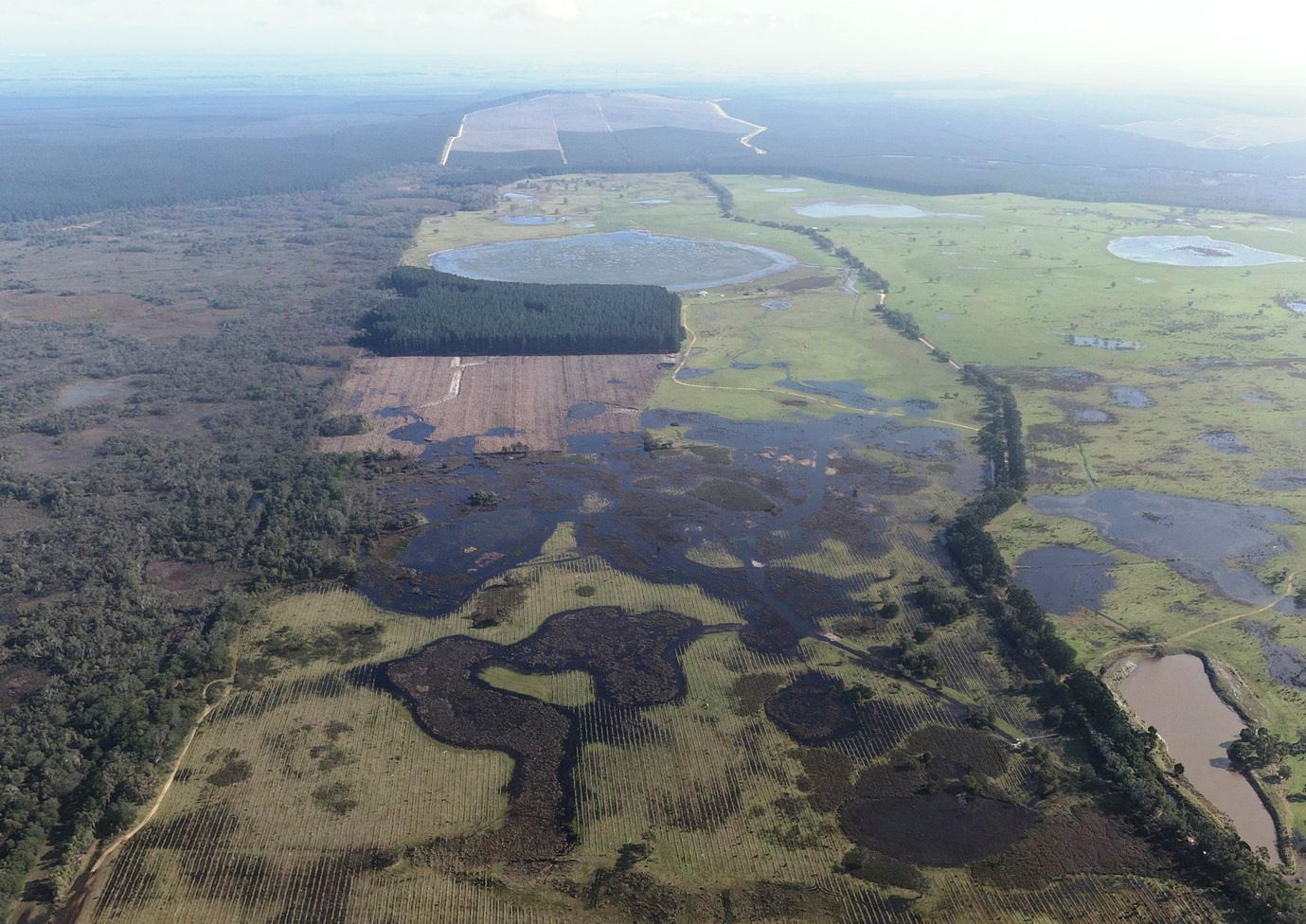
It has been a pretty wet year for those of us based in south-east South Australia and south-west Victoria. What has been surprising, in comparison to recent history, is the timing of this wet period. We are more used to seeing things start to wet up towards and during Spring so the pre and early winter wetting-up phase is a bit of a novelty. The cross-border creeks (Mosquito, Naracoorte, Morambro, Nalang and Tatiara) have all experienced flows at sites which haven’t seen water for quite some time (e.g. Poocher Swamp). The monthly rainfall charts from the Bureau (see below) tells us that this was a significant period of rainfall, with an area in the Lower South East experiencing the highest falls on record!
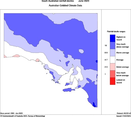
The Bureau of Meteorology’s June report provides further context and identifies weather stations which broke their June records. While some of these have only been recording data for a relatively short period (20 years), the significance of this year are really borne out at longer-term stations.

The monthly June total recorded at the Millicent weather station, which has been collecting records since 1877, was the highest June total on record. It is also worth noting that the June 2023 monthly rainfall is the third highest monthly rainfall recorded at this site. At Lucindale, where records go back to 1880, the June 2023 monthly rainfall (147.8 mm) ranks fifth highest, behind 149.4 mm in 1932, 155.6 mm in 1953, 162.6 mm in 1887 and 179.9 mm in 1889. At Penola Post Office, where records go back to 1861, the June 2023 monthly rainfall (161.8 mm) ranks fourth highest, behind 167.6 mm in 1915, 175.5 mm in 1870 and 184.6 mm in 2003.
At the other end of the spectrum (in terms of length of records) we also installed weather station at two NGT reserves (Hutt Bay and Mount Burr) early last year (2022). In June this year we recorded 108 mm and 185 mm respectively. The on-ground impact has been noticeable at both sites, with wetlands now full and spilling at their restored full supply levels.
While the months ahead remain uncertain, with an El Niño watch in place and the ocean circulation indicating an almost certain likelihood of low rainfall conditions establishing across south-eastern Australia, the actual timing of when the next “big dry” begins will play a big role in how this early winter rainfall translates into habitat availability for our key wetland species this coming spring and summer. Fingers crossed they can capitalise on these additional areas of restored habitat!