Tasmanian Field Day recap – sharing knowledge and opportunities for wetland and saltmarsh restoration at Burdens Marsh
NGT, in partnership with the Tasmanian Land Conservancy (TLC), hosted a field day on Wednesday 3rd April 2024 at Burdens Marsh – a recent and important addition to TLC’s Sloping Main Reserve, on the Tasman Peninsula, south-eastern Tasmania.
The field day provided an opportunity for locals and other interested stakeholders to share in the knowledge of the site we have assembled over the past nine months, as we’ve started to unpack its eco-hydrology and history of change. It also provided an opportunity to test and share our developing understanding, as well as likely restoration priorities and recommendations.
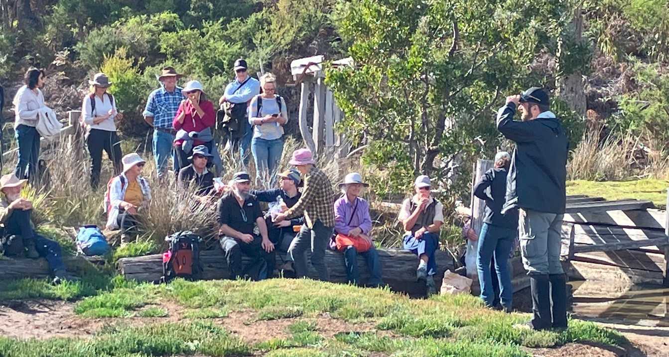
The field day was attended by approximately 40 people, including local landholders, representatives from the Aboriginal community, TLC and NGT supporters and various Tasmanian natural resource organisations and state government agencies. John Price, previous Burdens Marsh landowner and current neighbour, together with his partner Marlene, also attended the field day to share a little of their lifetime of experiences at the site. Special note was made of how rare and wonderful it had been to have John as a resource to help piece together site history and a timeline of change for the marsh (John’s family has been associated with Burdens Marsh since the 1920s).
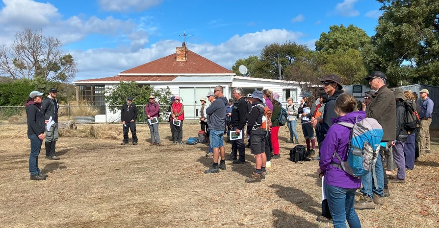
The field day commenced with an overview by Cath Dickson, Conservation Science and Planning Manager at TLC, of how and why the TLC came to purchase Burdens Marsh to add to the adjacent Sloping Main Reserve. Mark then shared NGT’s approach to eco-hydrological assessment and restoration planning. He outlined some of the major changes affecting the eco-hydrology of the marsh, including altered connection with tidal exchanges, altered catchment inflows and the historic drainage network constructed through the marsh complex, including adjacent wetland areas. As the day unfolded we began to share and discuss potential restoration activities, objectives and intended outcomes.
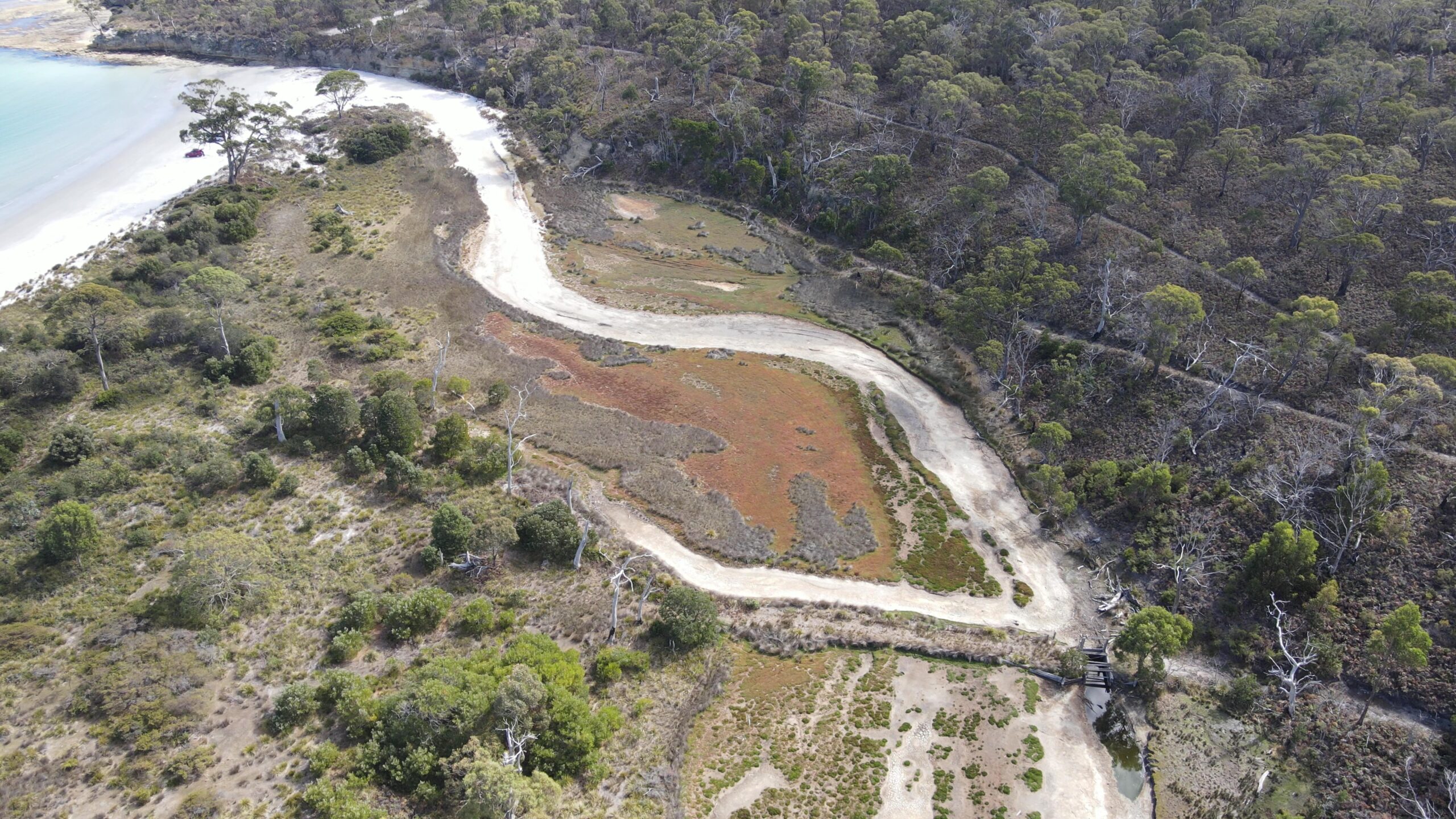
Our first stop after heading off from the homestead was to the start of an old drainage line along the western boundary of the marsh (see below).

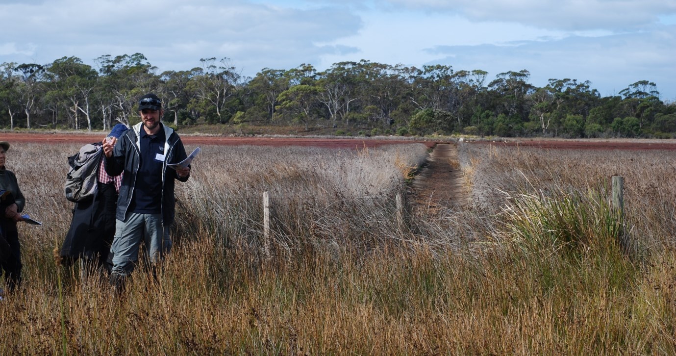
At this site we provided an account of the early drainage works undertaken by Joseph Gellibrand before 1834, before likely being expanded by convicts during the operation of the Port Arthur penal settlement. Interestingly, despite being almost two-hundred years later, given the nature of the soil in this saltmarsh environment, these drains have remained intact even with little to no maintenance. These original, central drains, together with more recent additions to the periphery of the marsh, were designed to rapidly remove water from the system to reduce waterlogging and promote vegetation growth as fodder for livestock. For more information regarding the site history and progression of drainage works, please refer to the field day handouts linked below or click this link to see past blogs.
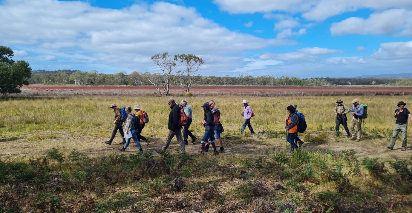
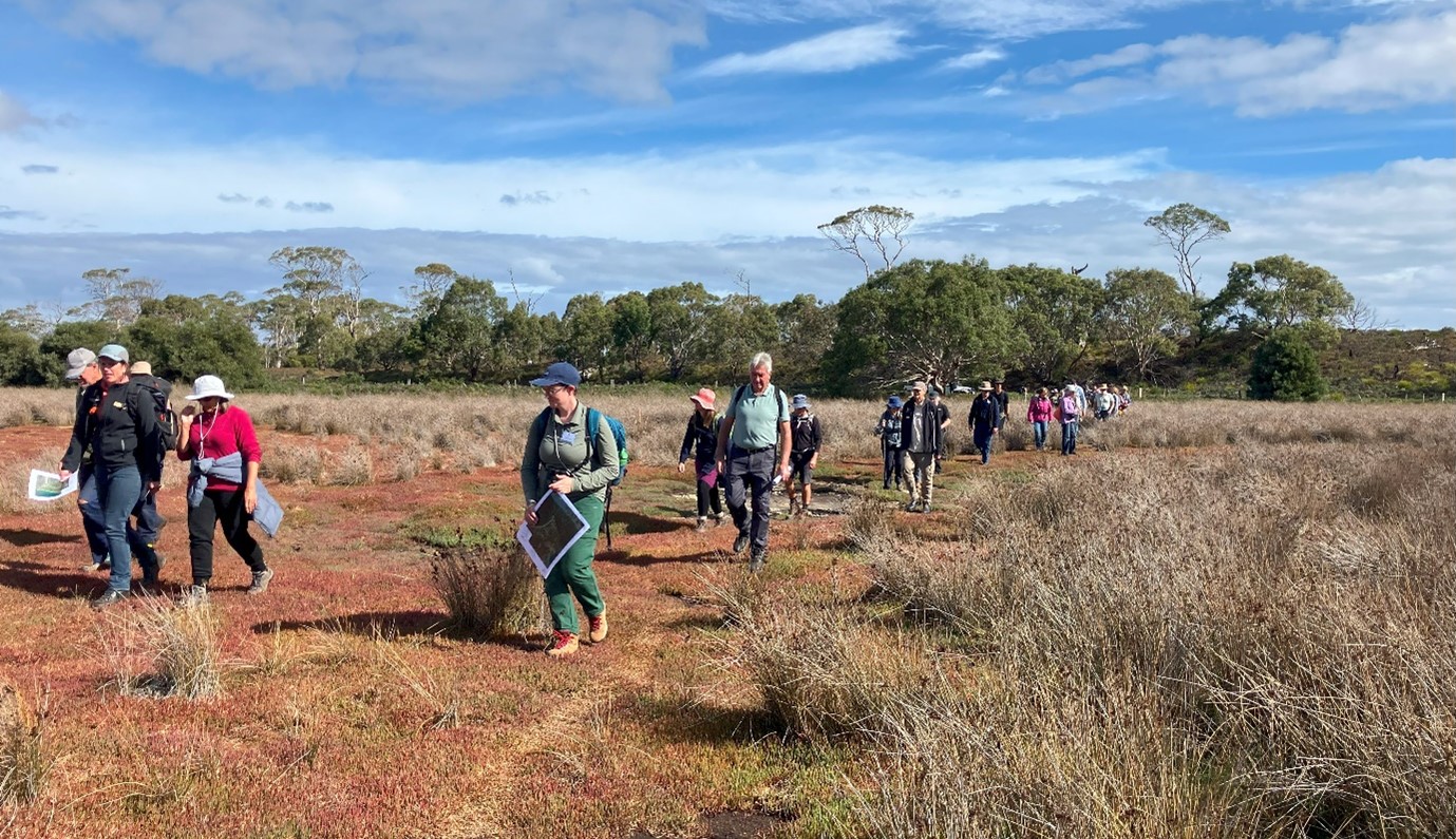
We then trekked along the western boundary of the marsh towards the outlet, with a brief stop at some of the fauna and flow monitoring sites, to discuss the objectives of some of the various long-term monitoring methods being established by the TLC and partners. After recording a current scientific baseline for the new reserve, this data will allow any future change over time to be documented, including the saltmarsh area that may be positively influenced by future restoration works.
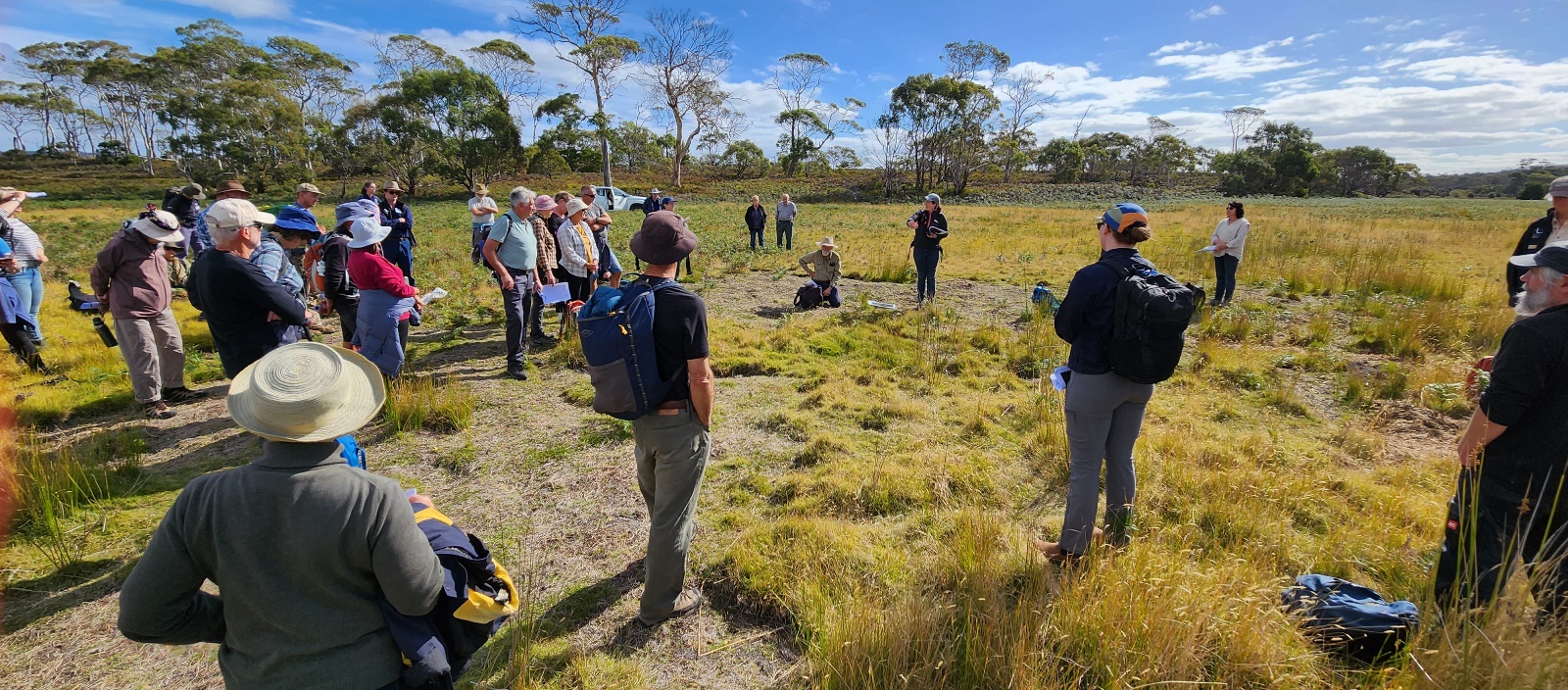
Data collection methods include fauna cameras, bird surveys and vegetation transects and plots. John Aalders (saltmarsh expert) provided an overview of the long-term saltmarsh vegetation monitoring he helped establish at the site. He also explained how data from this site can be compared with changes in saltmarsh observed at several other sites across Tasmania which have similar data collection methods and were a focus of John’s academic studies. This information will help the TLC develop and adapt management plans for the site over time.
At the northern end of the marsh we reached our final destination – the seasonal outlet from Burdens Marsh to the sea, which currently includes a timber weir/gate structure and associated levee. Together with John Price, we discussed when and why the structures were built by John in the early 1990s and how the weir was operated.
In basic terms, the timber gate structure was opened when John judged that the impounded water in the marsh had reached a level sufficient to provide enough force and volume of water to scour the sandbar at the mouth of the outlet after an artificial opening. This in turn would facilitate effective artificial drainage of the saltmarsh for grazing purposes, with the gate subsequently closed after the marsh water level had receded, to prevent tidal ingress back into the marsh through the opened mouth. This modern weir structure was located some distance behind the dunes (as shown below) to provide a small area for high tides to enter and then discharge again, as a means to generate sufficient flows to scour and maintain an open mouth for a longer period after mouth openings. The remains of the old structure and associated levee, although no longer operated, now create a constriction point in the outlet that continues to influence tidal exchanges and natural outflows from the marsh.
A primary recommendation of ours would be to remove the levee and reinstate the natural landform in this area. This would provide for improved, natural exchange between marsh outflows (after sufficient rainfall naturally opens the mouth in the future) and subsequent tidal inflows.
The information NGT have collated about Burdens Marsh, which formed the basis of the material presented to the community at the field day, will be provided in a detailed report to the TLC in June 2024. This report will include prioritised options for potential future restoration works, to address past changes and set the site on an improved trajectory of ecological recovery, should the TLC decide to pursue hydrological restoration activities at the Sloping Main Reserve.
From the outlet, the group wandered back to the homestead via the saltmarsh, giving attendees time to get up close and personal with the early autumn vibrant hues of the saltmarsh communities.
We look forward to continuing to work together with the TLC, to improve our knowledge of the site and explore restoration opportunities into the future.
For those of you who were unable to attend the field day, the information we provided to attendees on the day is now available for you to download or print by clicking on this hyperlink or read in the viewer below.
Overall, the field day was a resounding success and was well received by attendees. It was great to have the opportunity to share what we have learnt about this fascinating site to date, and explore some of the potential future restoration opportunities that are emerging.
Thank you to everyone attended and have expressed ongoing interest in this important project, and a special thanks to the TLC team for their fantastic assistance in helping to coordinate and host the event.
This project is being delivered by NGT in partnership with the Tasmanian Land Conservancy,
with support from the Purryburry Trust