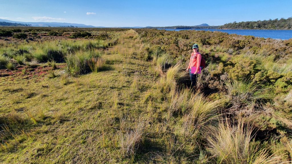
The assessment of Moulting Lagoon and the Apsley Marshes continues, with a visit to Long Point
This update is to let NGT newsletter readers know that our work on the east coast of Tassie continues.
With our first project update soon to be sent out to landholders and community members by email, if any NGT newsletter subscribers know this part of Tassie well, and may have observations or insights to share with us, then please let NGT’s Bec Sheldon know and we can include you in those direct (and more detailed) project communications.
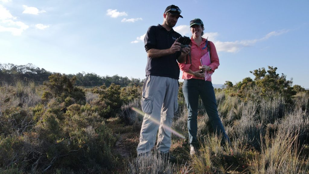
In my most recent visit a few weeks ago, it was great to catch up with Cath Dickson who (as long-term followers of NGT will know) along with yours truly, was one of NGT’s first two employees when we first started back in January 2012 and is still on the NGT Committee of Management. Cath now lives in Hobart and works for the Tasmanian Land Conservancy, so it was great that Cath was able to show me around one of the TLC’s very first permanent reserves, Long Point.
The visit to Long Point is just one of many that we will embark on over the next 2 years, as we work our way within and around the edge of the wetlands that make up the Ramsar sites, piecing together the history, ecological values and trajectory of change of these wetlands, and look for opportunities where we can suggest works that will improve their future management.
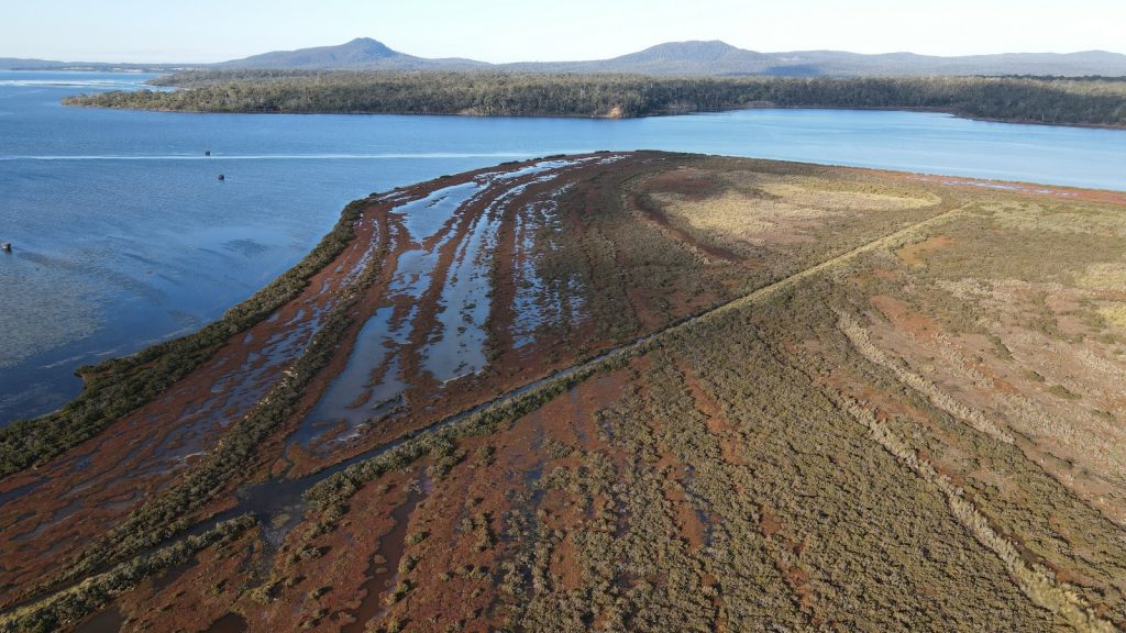
For those of us interested in eco-hydrology – the relationship between hydrological regime and ecological values – the first thing that you notice out at Long Point is the series of channels that are etched into the saltmarsh landscape. Speaking with the previous owner of Long Point (then part of “The Grange”), it was interesting to hear how he recalled that some of the drains were there his entire life and probably dated to the 1800s.
In fact, while I was meeting with the previous owner in Swansea, NGT’s Ben Taylor was back in the office busily processing the earliest imagery we have for the site – from 1948 – which verified this account.

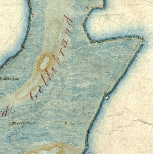
The earliest detailed map we have so far encountered for this area is the survey plan for the original Grange property in 1854. This map predates the construction of the drains, and shows the extent of saltmarsh habitat, which also provides some clues about the purpose of the drains.
Based on our inspection of the site, analysis of the mapping (both new and old) and discussions so far, it now seems most likely that this perimeter drain was perhaps less a drain, and actually more simply the inevitable byproduct of an early levee bank which was built around the eastern margin of Long Point. To build a levee you need material, and the simplest way to obtain it – especially with the basic equipment available back in the late 1800s – was to gain it right there, onsite, next to where you wanted to build the levee.
So why was the levee bank built?
In what was then a pastoral grazing setting like this, the levee bank would have been an attempt to prevent high tides (and all that salt) from pushing regularly into the low lying ground on the inland side of the bank. Drier land, slowly freshening with each rainfall event equals better feed for livestock – at least that would have been the theory!
It is unclear how successful the plan was, and today the bank has deteriorated and is breached in many places, but (despite the ongoing presence of saltmarsh habitat either side of the bank) it is still very likely having an impact on site hydrology. This is evidenced by the fact that the vegetation experiences sudden changes in character and composition in many places along the levee, as shown in the image above – disturbing the natural gradient and vegetation ecotones that should be present as you move upslope from the water’s edge through the saltmarsh.
Given the generally low-energy nature of tidal flows, small changes in elevation and topography in coastal areas can have a significant impact on flow patterns and inundation regime, especially in very flat saltmarsh areas (see this previous NGT assessment for another example). Needless to say, this is the first of many similar issues we are flagging for follow-up as part of the project, so it will be interesting to see where this lands, especially as we factor in issues like like sea level rise (which will be the subject of a future blog).
As Ben continued to work through the available aerial images, he was able to document when any new drainage works first appeared, which simply means they happened some time before the date when they are first recorded. A summary for Long Point, and an adjacent area on the property next door still known as The Grange, is shown below.
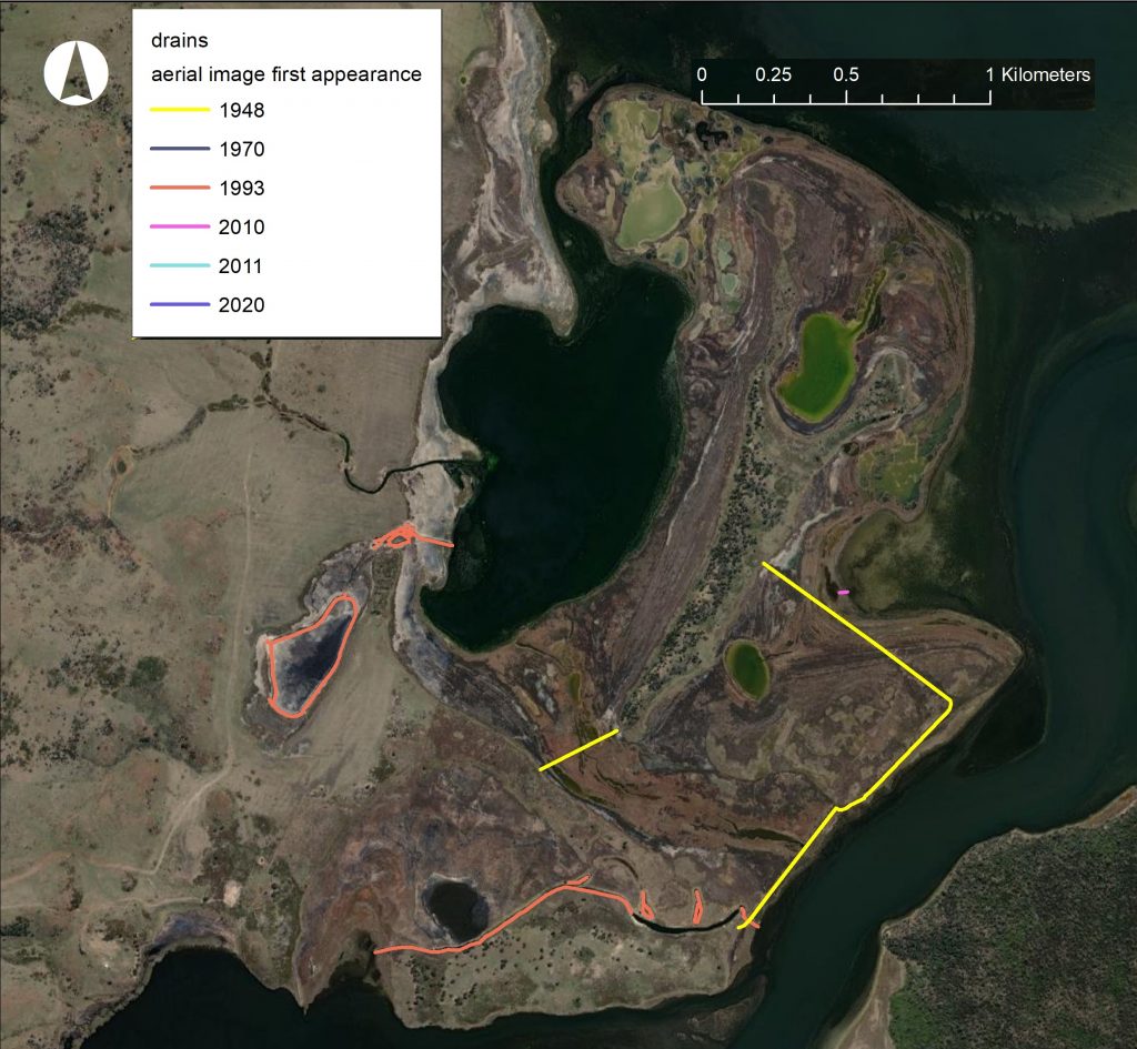
While we continue with the assessment, there is one more map that we can also share, to give you a sense of how much early drainage work was done in and around these two Ramsar sites. As you will see in the overview below, which shows all the drains that were already present before the 1948 aerial imagery was flown, there was a lot of them! Note that Long Point is near the centre of the image, which will also give you a sense of the scale of these magnificent wetlands.
Stay tuned for more updates as the project continues…

This important work is supported by NRM South, with funding provided via the Australian Government’s National Landcare Program.