The long-term transformation of Walker Swamp truly begins
So far 2020 has certainly been a year of extremes and, with the arrival of a La Niña event this spring, that trend appears to be continuing. A rather disappointing winter for our wetlands that produced limited runoff has now given way to a cool and so far wetter than average spring.
Thankfully the rainfall events in early October have instantly turned around our fortunes at Walker Swamp, which has now filled to what we currently consider its full capacity (when not in flood) and – as I write this – water also continues to seep or spill into all the backwater wetlands that are directly or indirectly linked to levels in the main wetland basin. This is the time when all the planning and on-ground works we’ve invested in over several years are finally being realised and tested – so it a pretty exciting time for us at NGT!
To start us off, let’s just help you to get your bearings… this first image shows the NGT Reserve boundary and the complex network (totalling 26 km) of artificial drains that we inherited as a legacy of its prior land use for grazing and, more recently, plantation forestry. The key things to observe in this image are (1) the drain that enters from the north east, which provides Walker Swamp with a water supply that is independent of the Wannon River, and (2) the central lunette bank, which in turn allowed us to think about managing the eastern side of the property as a separate hydrological unit to the western portion.
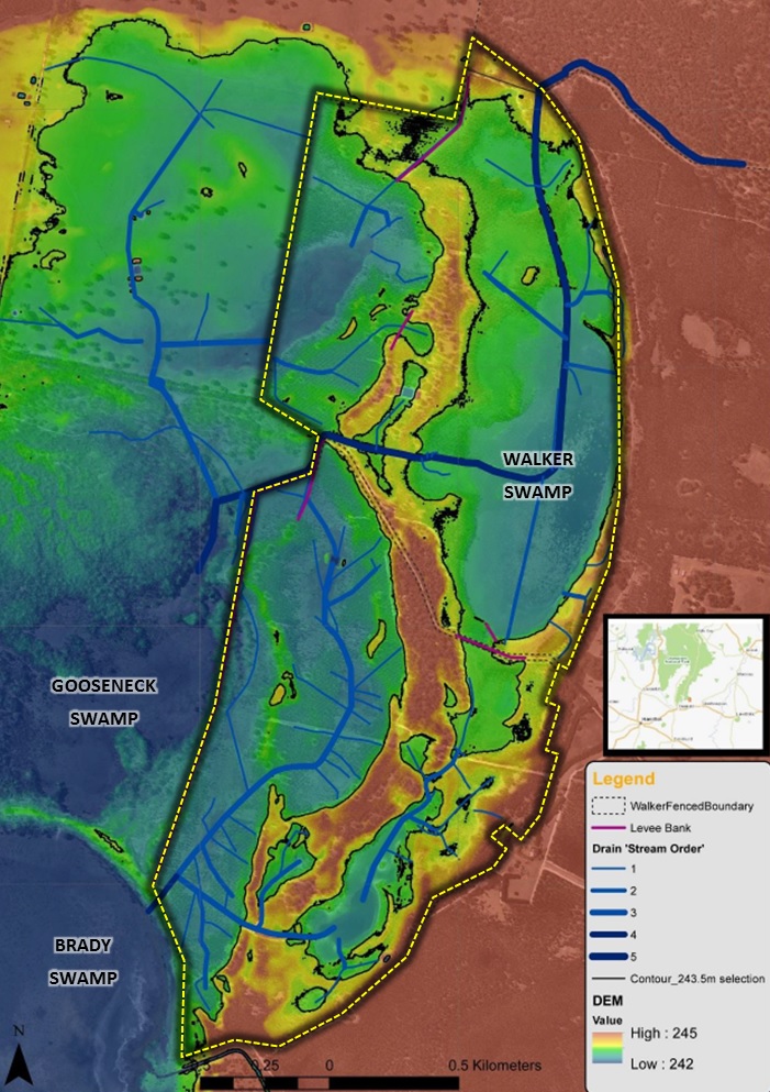
As a result of artificial diversions that have now been in place for 50 years from the uppermost tributaries of the Wannon River (off Mount William) to Lake Bellfield, this section of the Wannon River is receiving significantly less water than was historically the case. Because of this and recent climatic trends, this peripheral area of river floodplain is far less likely to experience regular inundation from Wannon River flows, which means the value of the artificial drainage catchment to the north-east for Walker Swamp cannot be understated – it is now vital.
These inflows also now contribute to a situation where, despite generally sitting at a higher elevation in the landscape than the rest of the floodplain to the west, we can actually achieve more reliable inundation of the eastern portion of the NGT Reserve at Walker Swamp. To give you a feeling for how things are looking, check out the following bird’s eye view from a video taken on the 21st of October 2020.
To complement this aerial view, the following annotated map and sequence of images and videos (numbered according to their location on the map) shows you how things are unfolding on the ground in the eastern – now fully inundated – part of the property.
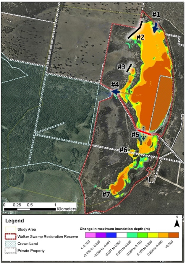
#1 – The drain inlet
The video below at the inlet drain was recorded on the 17th of October 2020.
#2 The northern levee bank
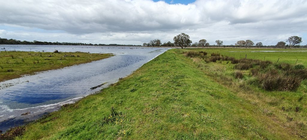
The northern levee bank is crucial for ensuring that the restoration project at Walker Swamp does not cause additional flooding impacts to our neighbour’s land to the west, as they are farming that portion of the Wannon River floodplain. This levee bank already existed when NGT purchased the property in 2018 (its purpose then was to preferentially direct drain inflows towards the deep artificial outlet drain to the south), but we have since reinforced and raised it to cope with the increased depth of inundation now occurring as a result of restoration works.
The elevation of the natural surface just outside the image below (to the right / west) was actually used by NGT to set the level of the spillway now in place on the main artificial outlet drain from Walker Swamp. We did this because, based on the levels, this general area appears to have been the main natural point of hydrological connection between the eastern and western floodplains. You should be able to see this spot if you go back to the first (digital elevation model) image in this story. However, due to land tenure constraining our options in this area, we ultimately chose an alternative solution and location for managing outflows – one that would not send additional water across our neighbour’s paddocks. The good news so far is that the northern levee is working perfectly…
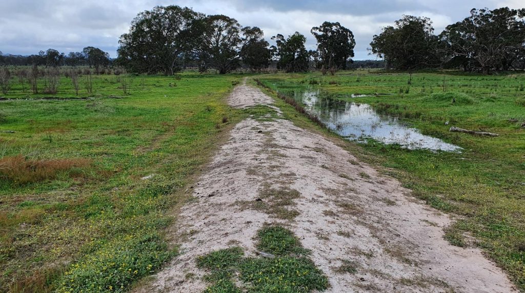
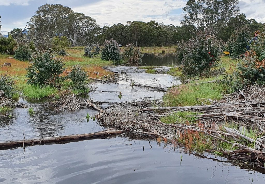
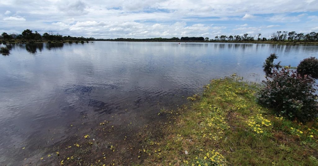
#3 – The central levee bank
This short levee bank was also in place prior to NGT’s purchase of the property, and is also a further minor point of likely natural connection between the eastern and western floodplains. Water has slowly trickled into this shallow wetland area as water levels have equalised across the chain of wetlands hydrologically linked to Walker Swamp. Walker Swamp is to the right / east of the image, over another portion of the lunette bank.
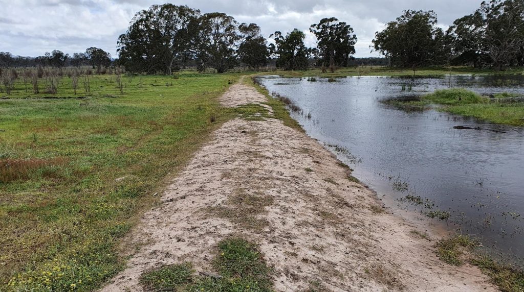
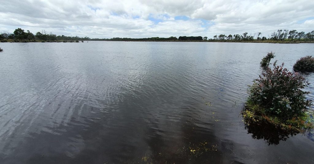
#4 – The outlet spillway
Despite not being the original, natural point of connection for flows into and/or out of Walker Swamp on the floodplain, the artificial outlet drain is now situated in the best modern location for managing outflows, operating in conjunction with the levee banks previously described. The small section of artificial drain downstream of the spillway towards the main culverts at Lynchs Crossing Road is one of a limited number of drains still present on NGT’s property and has enabled us to proceed with the restoration project in a careful, considered and controlled way – with the full support of our neighbours. The video below was recorded when outflows over the spillway were near their peak on the 17th of October 2020.
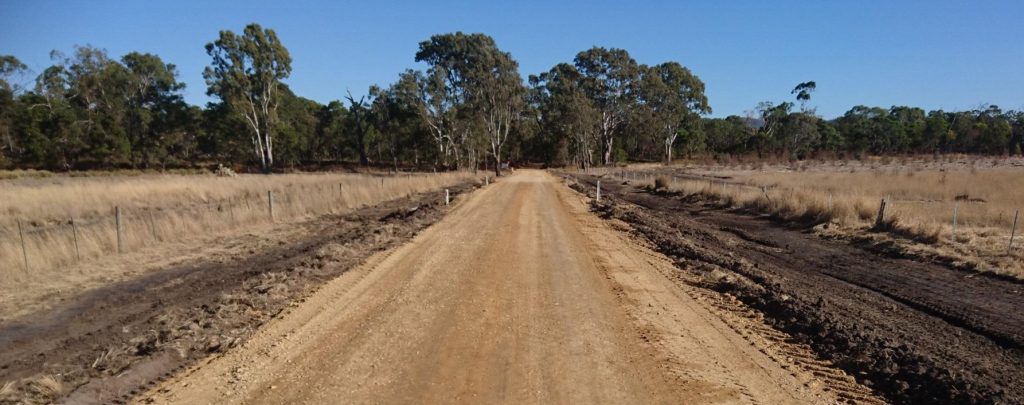
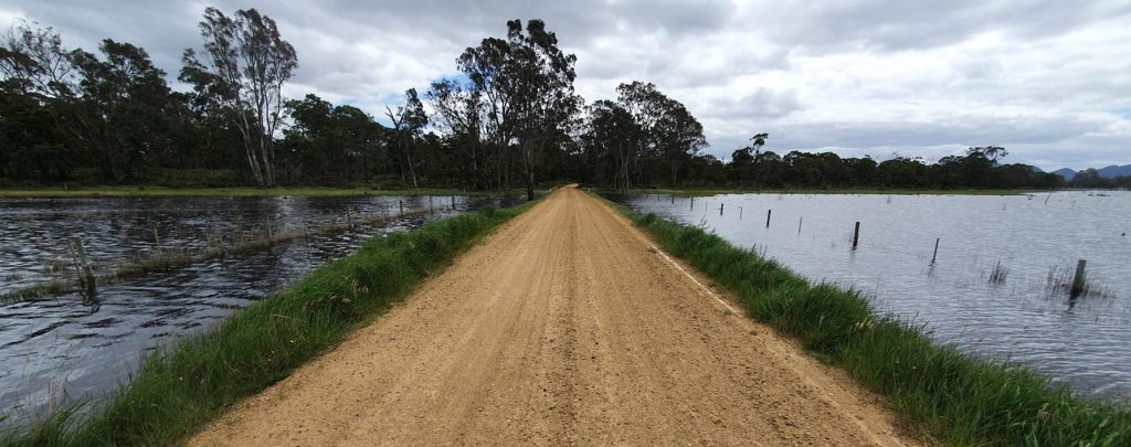
#5 – Lynchs Crossing Road
An obvious key location in the restoration project is Lynchs Crossing Road, which we raised significantly and installed additional culverts underneath, because we were aware that the road would need to become a causeway to accommodate Walker Swamp filling and retaining water. Additional support for this work was generously provided by the Rural City of Ararat.
The stark before and after images below show the dramatic transformation that has now taken place.
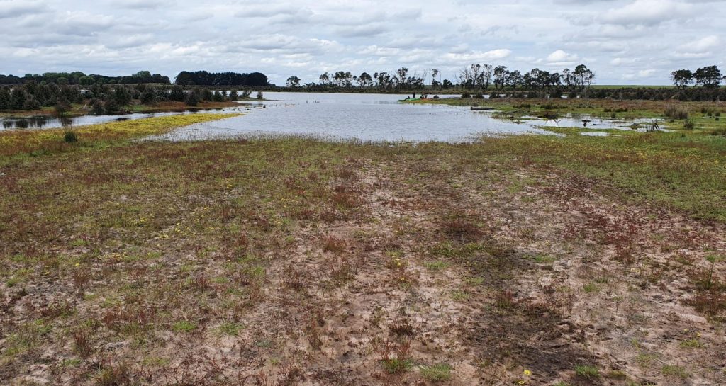
#6 – Backwaters in the southern lunette
As water levels have risen, we’ve come across some very picturesque wetlands that have appeared for the first time since we have been spending time on the property (dating back to 2013 when it was a blue gum plantation, well before NGT’s purchase in 2018). This one in the southern part of the property is situated just off to the side of the narrow flow-path that connects Walker Swamp with the southern wetland basin.
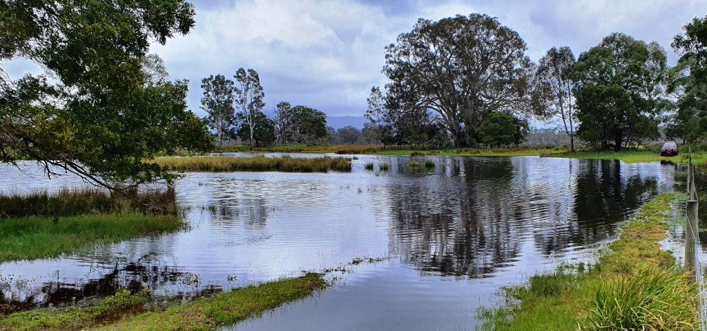
Just beyond this wetland is that narrow flow-path between the northern and southern wetlands. On the 21st of October, there was still quite a difference in the levels of water at this point, as the flows from Walker Swamp were cascading down towards the southern wetland basin (and as visible in the aerial footage above).
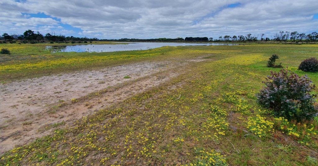
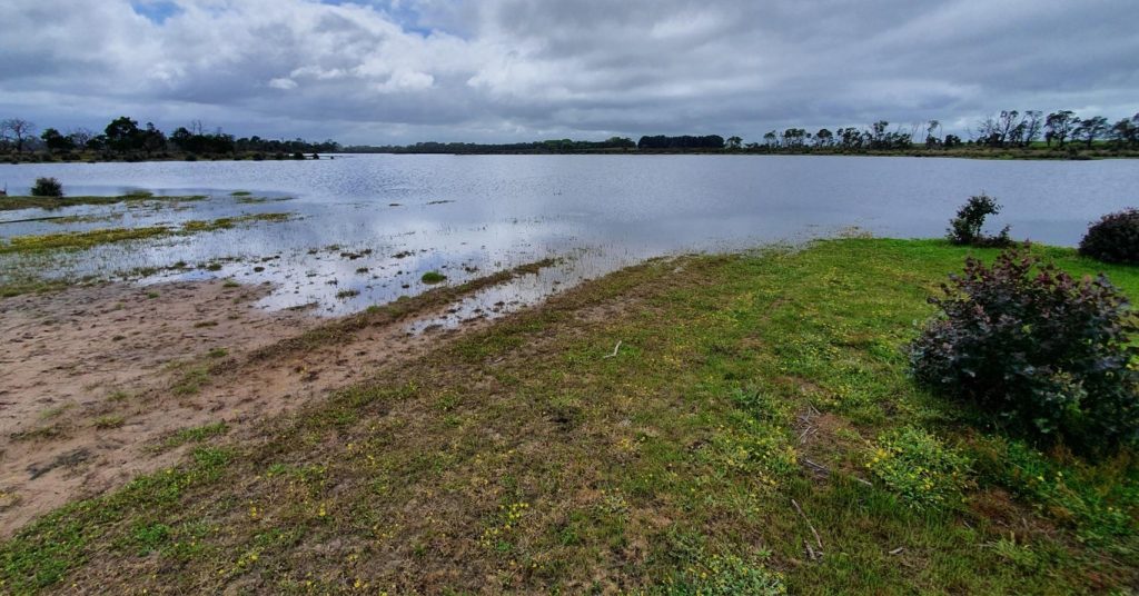
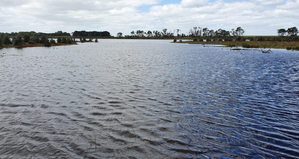
#7 – The southern wetland basin
Some of the most spectacular images come from this part of the property, which is going through a dramatic transformation as it fills for the first time in decades. The southern wetland basin will almost be as deep as Walker Swamp proper once full, so this will likely now hold water right through the summer and autumn months and also provide important wetland refuge habitat over the months ahead.
Enjoy the view of the rapid and recent changes, and say goodbye to cape weed!
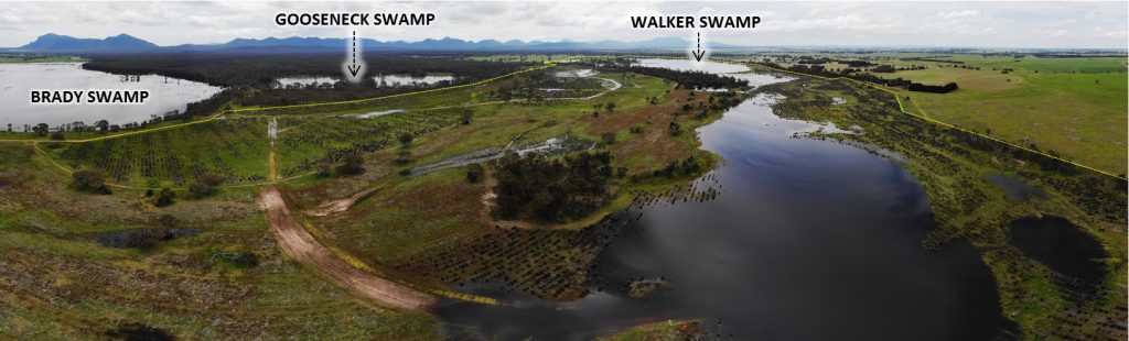
To cap off this huge update, here is a view over the project area taken on the 21st of October 2020.
Now that the water has arrived, we have a very interesting six months (and beyond) ahead as we begin to witness the explosion of wetland life that returns. The fish, frogs, birds and macro-invertebrates are already coming back, and native wetland vegetation will begin to emerge, adapt and recover. This evolving ecological recovery process will be the subject of future updates, so stay tuned!
If you wish to support NGT’s restoration work and help us to replicate results like this elsewhere in the landscape, then please consider making a tax-deductible donation by visiting www.natureglenelg.org.au/donate.
And, as always, thanks for your ongoing interest and support!
Finally, in addition to the many private supporters who have donated to this project, these results at Walker Swamp would not have been possible if not for the support of our fantastic project partners, over the past 3 years.