First Nations participate in burn to manage Themeda Grasslands of Limestone Coast
Native grasslands and grassy woodlands once sprawled across large areas of the South East of South Australia and western Victoria, generally on heavier soils and maintained by regular burning by First Nations people. After European colonisation of the region, these open grassy areas were immediately taken over for grazing of livestock. In the years since then, the cumulative effects of grazing, ploughing, clearance, drainage, over-abundance of native and introduced herbivores, and weed incursion have all contributed to both the loss of most native grassland and grassy woodland habitat, and led the loss of their cultural significance and traditional uses by First Nations people. What is left is a sparse, fragmented patchwork of typically small and degraded areas of native grassland scattered across roadsides, railway corridors, conservation reserves, and private land. We explored some of these issues in an earlier article, at the start of our current project.
Despite the widespread loss of grasslands and their lack of appropriate management, some areas of high and moderate quality native grassland still survive. Such grasslands typically persist due to their location on undeveloped roadsides or rail reserves, in conservation reserves, or unimproved paddocks.
So what can we do about the loss of native grasslands – in an ecological and cultural sense?
The protection and management of these valuable remnants requires detailed knowledge of their locations and characteristics, protection to avoid further clearance or damage, active management to conserve and improve their values, AND, to involve First Nations communities in re-discovering their significance and role in on-country experiences. However, in South Australia in particular, our knowledge of the whereabouts and quality of native grasslands is patchy and out of date, and where grassland remnants are known, their protection and management is often not sufficient to ensure their survival and to maintain their cultural significance.
While the current grassland management shortfalls are large, there are many opportunities for improvment. This project, supported by OneFortyOne, aims to identify a set of potential native grassland management sites in the South East of SA, with a focus on Kangaroo Grass Themeda triandra grasslands, by:
- identifying native grasslands through biodiversity datasets, reports, field searches and local expert knowledge;
- developing and testing a rapid assessment method;
- selecting grasslands suitable for management;
- involving First Nations communities in proposing management actions for selected sites;
- recommending an efficient monitoring methodology to track grassland quality over time – giving insight into the effectiveness of management actions; and
- implementing initial management actions, such as the use of fire and weed control.
Fire is a relatively straightforward grassland management tool and burning is considered our primary management action. However, planning, engagement and approvals are required first. There are a large number of stakeholders that need to be involved or informed of such a burn and NGT is just the crew to arrange it. We set off on the journey back in early 2020 to approach landholders, First Nations communities, local government, the Limestone Coast Landscape Board, the Country Fire Service, and the Native Vegetation Council (NVC) to plan and prepare for a grassland burn.
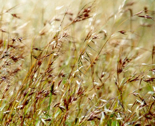
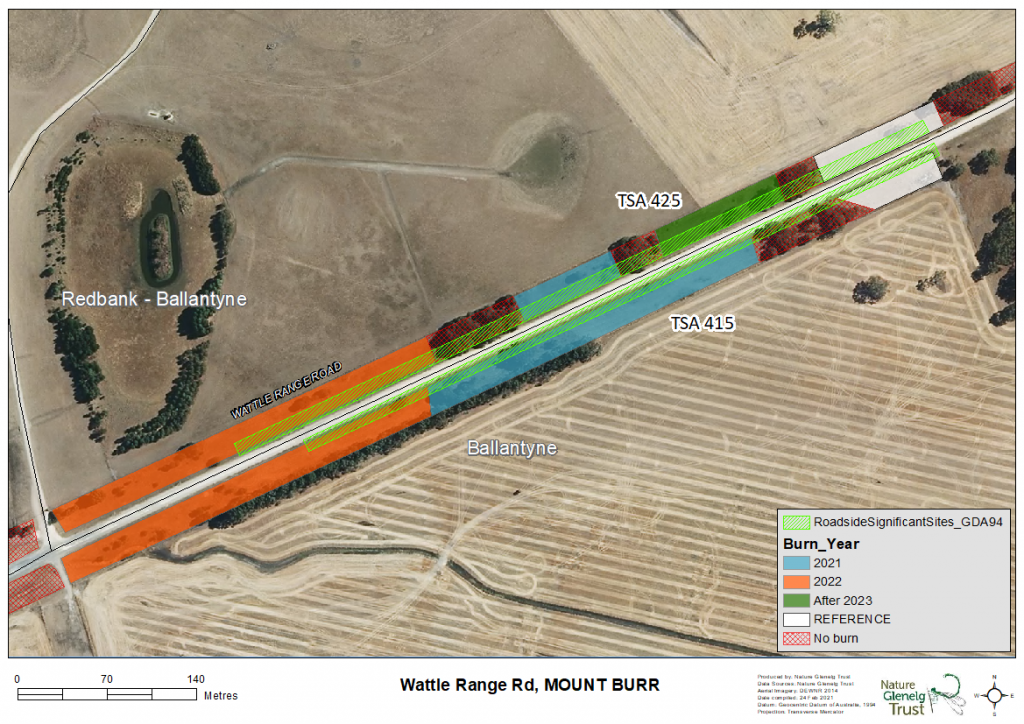
For the first year of this project, we assessed a small set of grasslands, with a roadside in the Wattle Range-Mt Burr district showing the highest habitat value (a rating combining vegetation quality, extent, and diversity). The coverage of Kangaroo Grass at this site was great, but biomass was also high… too high. The Themeda tussocks were beginning to choke on a buildup of dead material from previous years, and some smaller shrubs like Smooth Rice-flower (Pimelea glauca) were struggling to hang on amongst the dense cover. Clearly some biomass management was required, and what better tool for a native grassland than the use of fire – but could we arrange it?
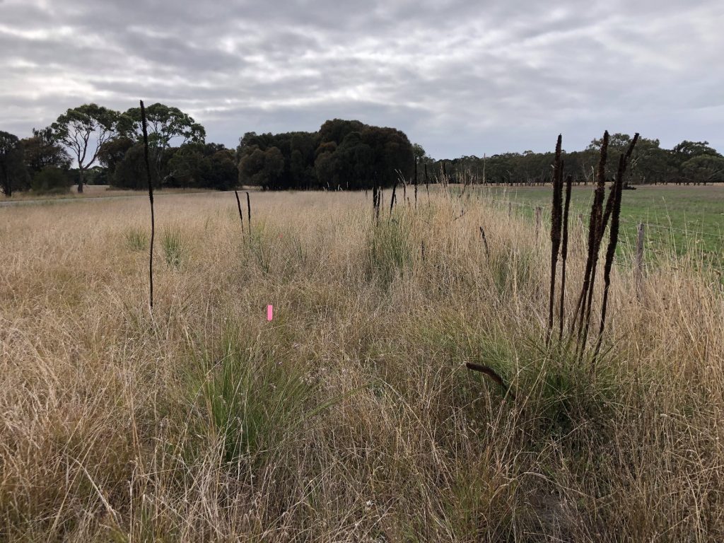
We set up flora monitoring transects and photopoints to document the site characteristics pre-burn and prepared the necessary paperwork for submission to the various organisations that needed to know and/or approve this type of activity. David New from the Limestone Coast Landscape Board came on board at this point, and has been instrumental in supporting the local First Nations representatives to participate, as well as lining up Frank, who volunteered to help with burn preparation.
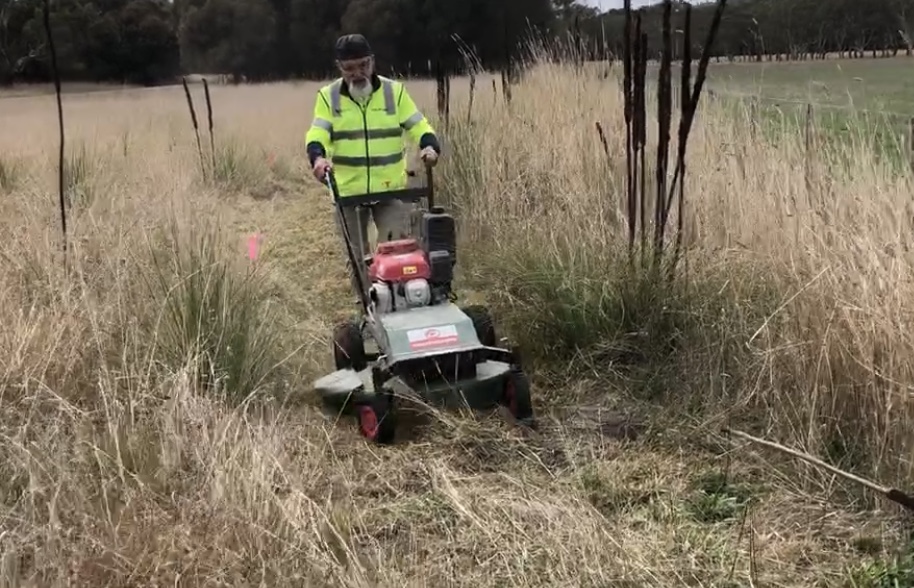
The Country Fire Service and neighbours were notified; slashing of breaks were completed; volunteers and NGT staff, First Nations representatives and the Limestone Coast Landscape Board were ready. So, after much planning, all that was left was final approval from the Native Vegetation Council. And at the 11th hour, approval came through, giving us the go ahead. But what was the weather doing? Did we have too much rain in the lead up? Could we achieve a burn this autumn?
On the day of the burn, the weather was looking fine but we assembled on site, scoped the burn area, and prepared water, rake hoes and shovels. Doug, Jack and Ethan prepared the flame to be handed over using traditional means of fire sticks, before Doug started the fire in the planned ignition point, and then we were away. Watch the video taken by David New during the burning operation, and hear from Jack during the burn.
After months of planning, the burn was completed in an hour and a half – see the results below.
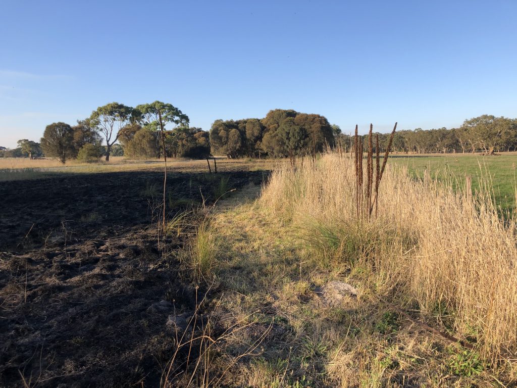
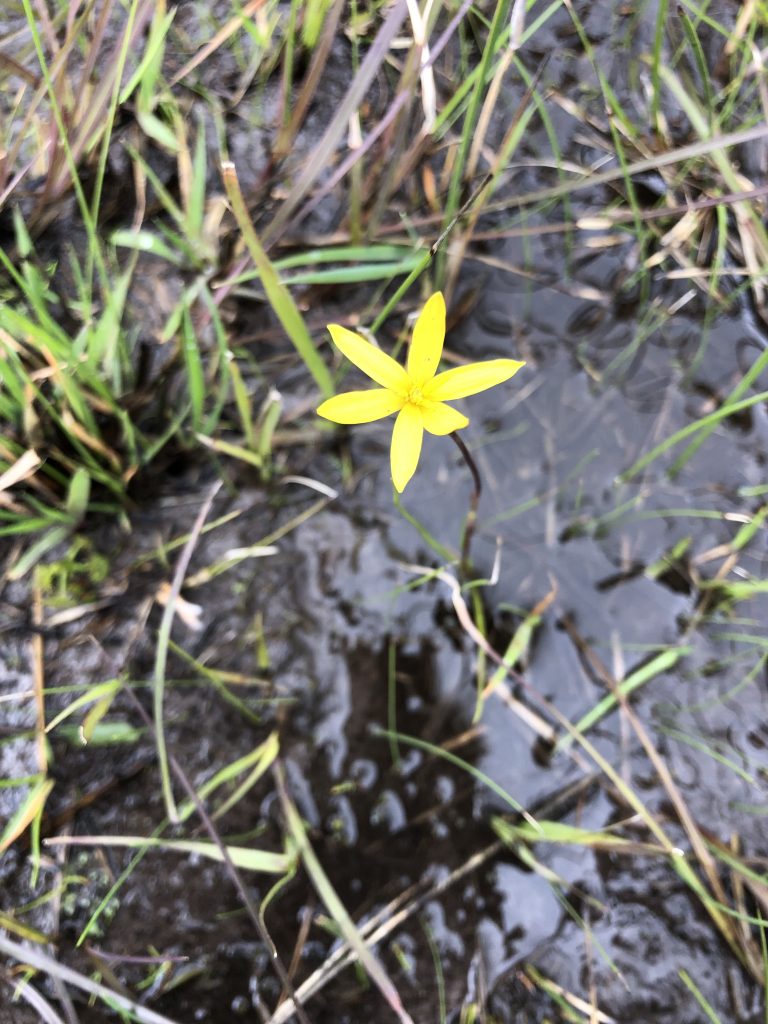
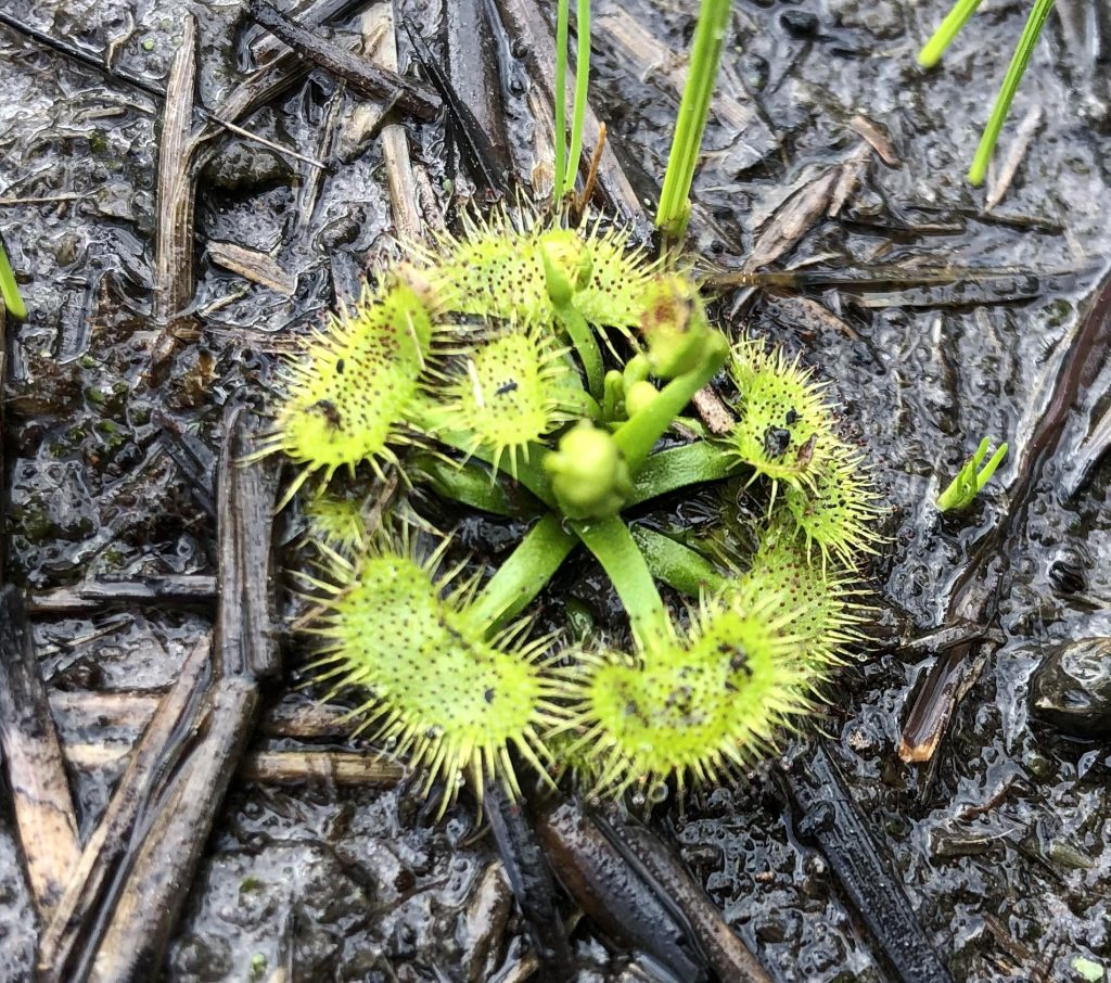
NGT looks forward to continuing and expanding on this project with Burrandies Aboriginal Corporation, local councils, and landholders in the future to reinvigorate this grassland with a more regular burn regime and targeted weed control. We will be surveying the site in spring along with the First Nations representatives who were involved in the burn, and are keen to see what pops up now that the dense thatch of dead grass has been removed. With the germination of many of our native flora species being triggered by fire, our fingers are crossed for some wildflowers which will attract and assist local fauna populations. We’ll update you with the site progress once the warmer weather hits!
Supporting organisations for this project include Burrandies Aboriginal Corporation, Limestone Coast Landscape Board, Native Vegetation Council, Region 5 Country Fire Service, Wattle Range Council and OneFortyOne. Individuals we would like to thank include David New, Frank Amoroso, Syb Thorpe (NVC), Sheryl Holliday, Jonathan Tuck, the Ballantyne family, and First Nations reps Doug Nicholls, Jack Campbell and Ethan Glass. A huge thank you to Jonathan Tuck for your interest in grasslands and assistance with this project.