Tookayerta Catchment Session Wrap – a great day of conversation with the community
Last Sunday at Mt Compass we spent a fantastic few hours with 30 people who represented a diverse cross-section of the local community from in and around the Tookayerta Catchment (on the Fleurieu Peninsula south of Adelaide).
I think it is fair to say that we covered a lot of ground in the time allocated for presentations!
As well as taking people on a journey to learn about some past NGT wetland restoration sites in other regions to get a feel for the logic and tools of wetland restoration, we also had a closer look at two case studies in the Fleurieu Peninsula on public land where we are currently investigating restoration options – Glenshera Swamp (Stipiturus CP) and Square Waterhole Swamp (Hesperilla CP).
Then it was on to the main event, and a discussion about the Tookayerta Catchment – the focal area for this project that is looking to identify any areas where the right ingredients might exist for improving water management for selected Fleurieu Swamps in the future. In case you are wondering, those ingredients are (just to name a few) things like topography, water availability, biodiversity values and – most importantly – community support.
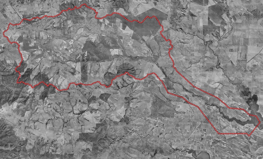
First aerial view of the Tookayerta Catchment in the 1940s
To help get people thinking, I shared a snapshot of the history and pattern of development in the region from settlement until the 1940s, before Lachie showed us exactly what has unfolded on the ground from the time of the first aerial photography (see above) until the present. In a complex catchment like this, we think it is really important to try to understand (and share) the history, nature, legacy of and reasons for the change we see in the landscape before we get to the job of considering or designing solutions. In fact, as people who were there will tell you, it is no accident that Fleurieu Swamps in this area are now so threatened – the pattern of development (and its layout/design) that unfolded from the 1890s actually made this inevitable!
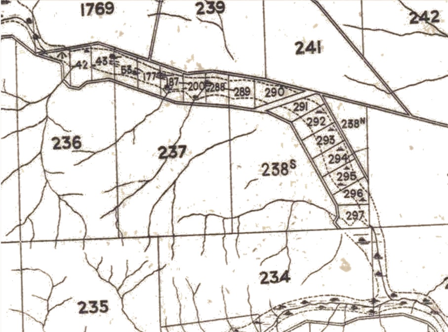
Example – The Nangkita settlement, which started during the early 1890s depression (in 1894 to be precise), deliberately targeted (and immediately drained) the swamps along the valley after the government surveyed a series a series of small, intensive “market gardening size” allotments in 1890. At this time, prior to the era of super-phosphate and sub-clover, the surrounding sandy soils on the higher ground weren’t considered suitable for “improvement”.
So to sum up, at present, a big part of getting our understanding right is making sure we talk to the people who live on the land and capture their thoughts, concerns and ideas right at the beginning of a project like this. Based on the excellent questions and really productive discussions over our BBQ lunch afterwards, I think we’re off to a good start!
We’ve now heard from some of the locals, and will be following up with others who we know are keen to chat. But if you live in the catchment and would also like to share your thoughts and ideas on the swamps in your patch (either how they are now, used to be, or could be in the future) – please send us an email or give us a call. To discuss over the next few weeks, people can contact Lachie on 0401 208 717, or .
Special thanks to Nicola Barnes and others at Natural Resources – SA Murray Darling-Basin for supporting this new and innovative project, and to the Mount Compass War Memorial Community Centre for providing us with a perfect venue on Sunday.
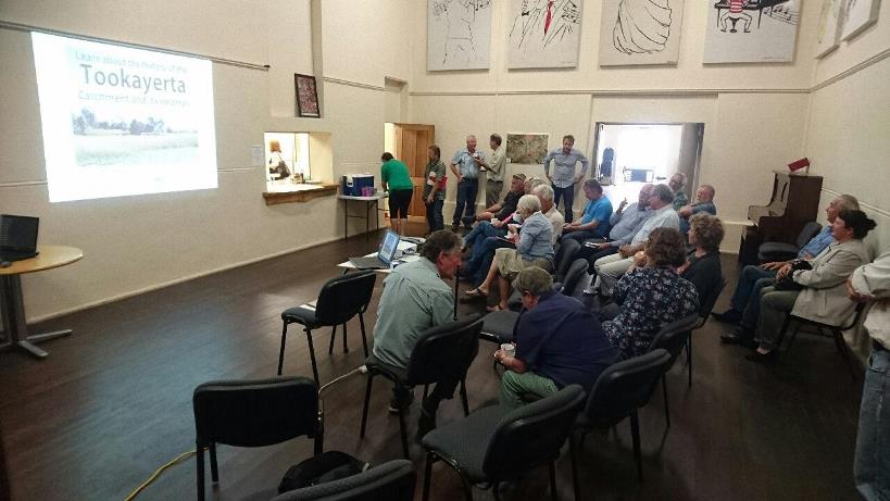
An excellent cross-section of the community came along to the Tookayerta Catchment session on Sunday the 4th of December