Wet flats a positive for both wetlands and farming at Aringa North
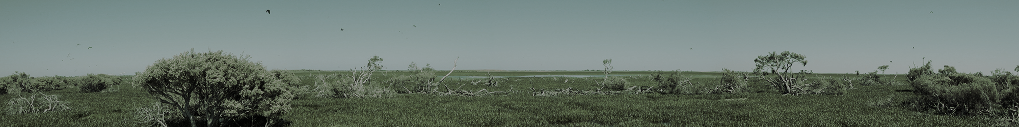
Over the past couple of years we’ve been working with Aringa North owner and manager, Hoges. A beautiful property, situated about 10 km north of Port Fairy, Aringa North has a large number of wetlands which provide habitat for brolga, swans, frogs and an enormous population of burrowing crayfish. The property also hosts an incredible diversity of native herbs and grasses. A tour of the farm quickly reveals that there is a strong element of environmental stewardship behind the family’s farming business.
The penny dropped for Hoges when the country was in the grip of what is now known as the Millenium Drought. On the back of a very dry spell, drains on his property only ran briefly and every frog seemingly took the opportunity to find a mate and invest in the next generation. So that got Hoges thinking about ecosystem resilience and he has been working with nature to achieve sustainable, agricultural outcomes ever since.
Our Australian Government funded “Wetland restoration on private land” project is aimed at working with landholders who want to reduce drainage impacts on their wetlands and was a perfect fit for what Hoges had already started. Needless to say, I was delighted to meet up, get to know his property and scope out some potential projects. The first site we have started working on includes some drained flats. As a result of the drains running through these flats, they only really hold water in the wettest of years and even then it is only for a short duration. It’s not your typical, ‘basin style’ wetland area. The land grades gently making it tricky to pick areas where water would have accumulated prior to drainage.
In 2015 we teamed up with Deakin University’s Daniel Ierodiaconou and employed a drone to fly over the flats to help us develop a digital terrain model. This proved critical in identifying points where drains could be blocked, and understanding how and where inundation would increase out as a result. The photo below shows how we have predicted inundation points and also strategic locations for some blockage points, along with a current photo showing the result on the ground.
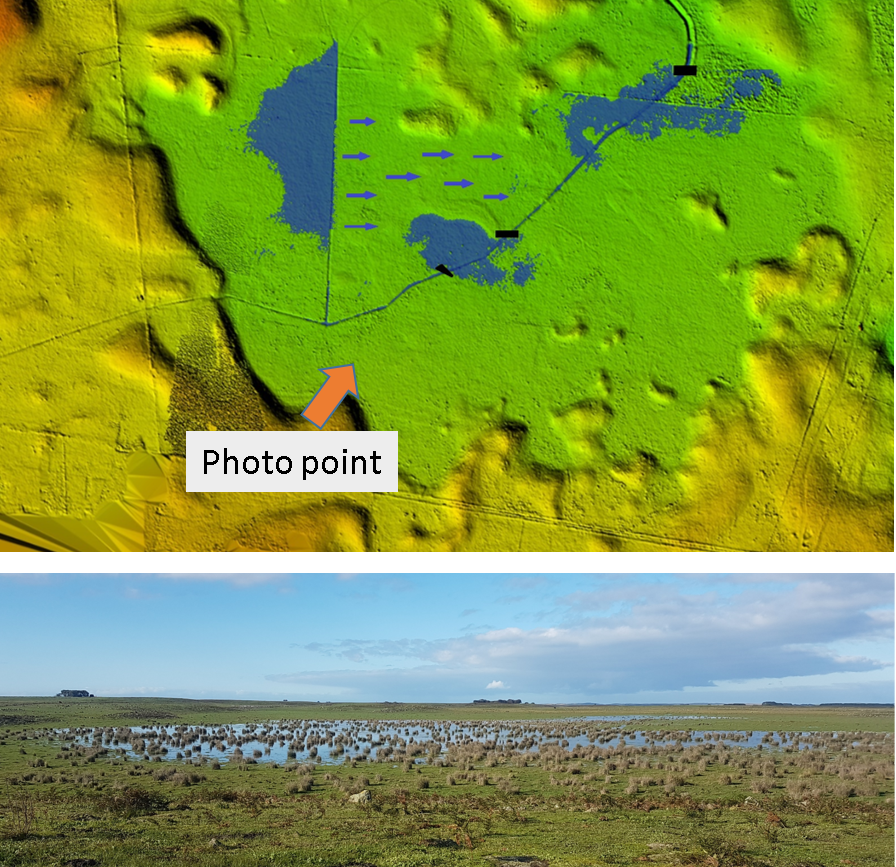
A digital terrain model showing strategic blockage points and projected inundation. The photo shows how it looks at the moment, on the back of a wet winter.
Earlier this year, NGT intern Liam Turner and I spent a couple of days putting in some sandbags and lining them with rocks at strategic points. I’ve been busting to get out and see how we fared in our estimates and I’m delighted to report that the weirs have worked and that we are now seeing a beautiful wet flat with a multitude of aquatic herbs and grasses springing to life. Suffice to say that Hoges is as happy with the outcome as I am.
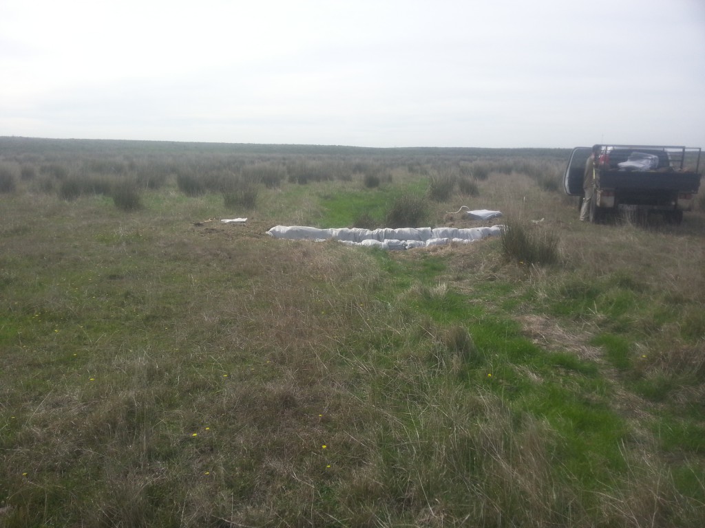
Sandbag weirs going in at Aringa North.
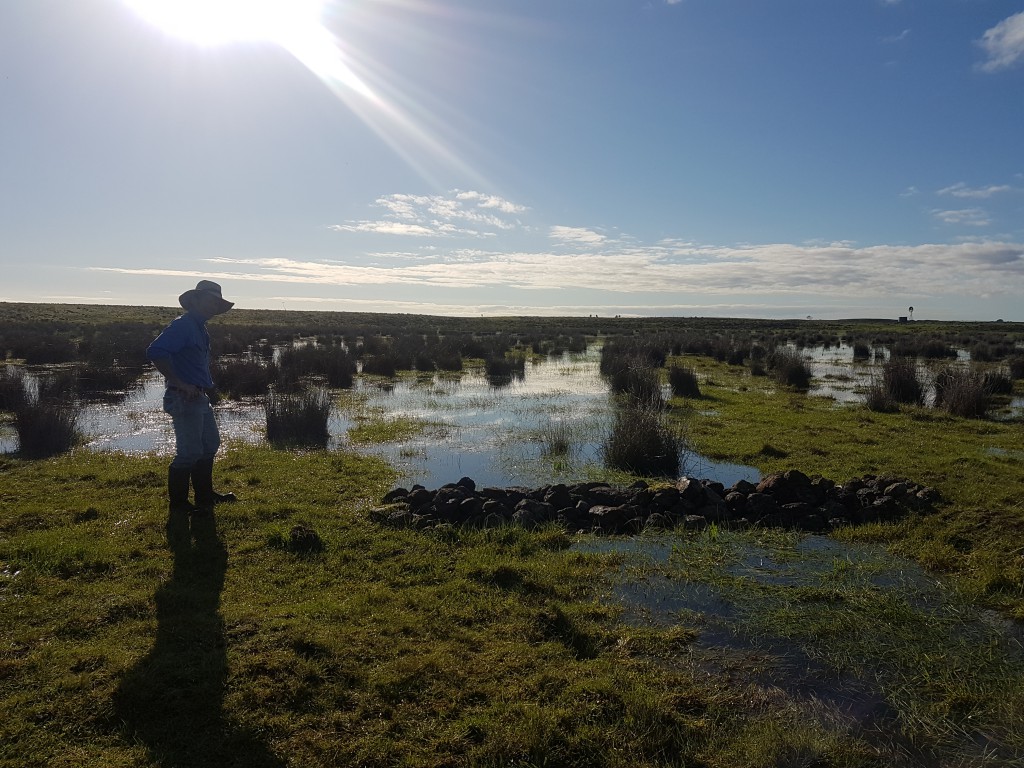
Aringa North beef farmer Hoges, admiring the wet flats.
So while a wet year may draw a lot of commentary on the need for better drainage, isn’t it nice to consider an alternative approach where the land gets a good drink, all the water doesn’t just end up where it is not wanted and some of our vulnerable wetland species are given a fighting chance?
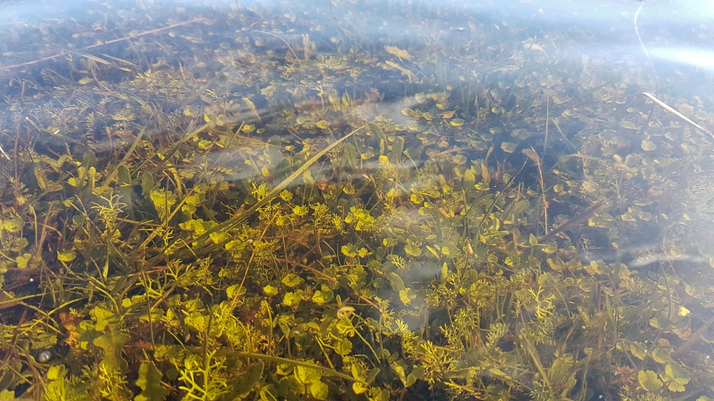
Aquatic herbs responding on the wet flats.