Another piece of the Washpool jigsaw: an 1839 map illuminates pre-colonial state of this important coastal wetland
As discussed in previous posts, Nature Glenelg Trust is currently researching the hydrological history of the Aldinga Washpool, a seasonal wetland nestled behind the coastal dunes at Sellicks Beach, south of Adelaide. The site has great potential for hydrological restoration and, by piecing together the evidence that describes its state prior to European colonisation, we hope to create a compelling vision for what could be achieved in the future. The Washpool is culturally significant to the Kaurna community, and is cherished by the wider non-Indigenous community too.
We have recently obtained an extremely useful map generously provided by Chester Schultz, who is undertaking detailed historical research into Kaurna place names in the Willunga area. According to Chester’s meticulous research, the map was made in mid-October 1839 by Richard Counsel, a member of a survey team mapping land parcels and natural features in the Hundred of Willunga. We were introduced to Chester by Gavin Malone, artist, cultural geographer and the owner of Lot 50-Kanyanyapilla.
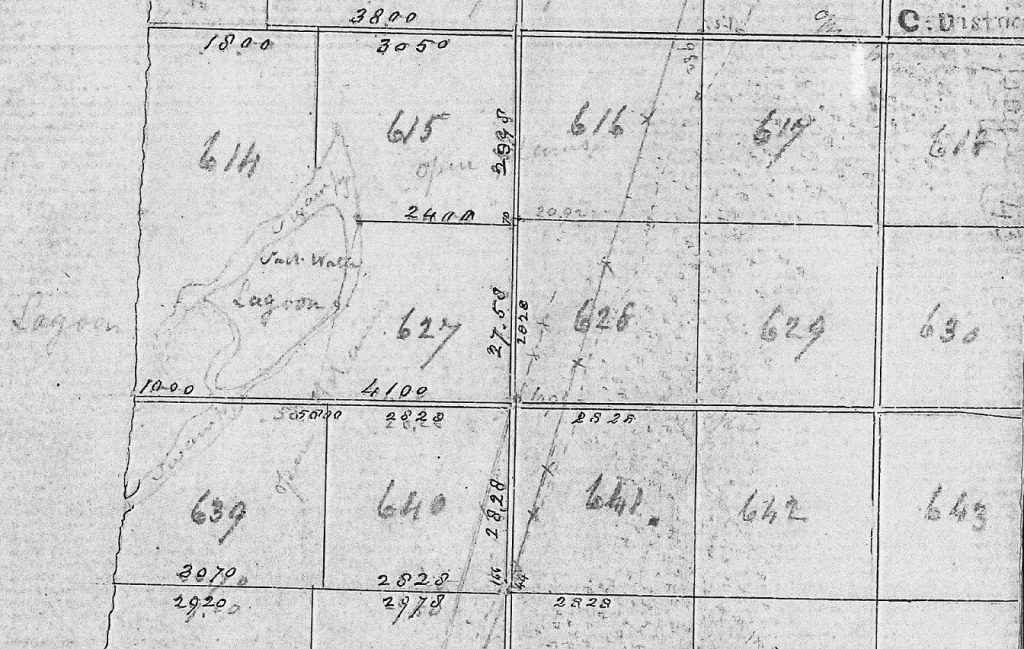
This is the earliest known European map of the Washpool we have been able to obtain so far and was made only three years after the establishment of the colony of South Australia in late 1836. It may therefore be our most accurate map of the Washpool prior to the range of degrading processes that were to follow, such as artificial drainage and sedimentation.
The map describes the central area of the Washpool as a “Salt Water Lagoon”, likely an area of open water that, according to other historical accounts we have obtained, dried up completely most years. Surrounding the salt water lagoon is a peripheral area recorded as “swampy”, likely an area of emergent vegetation (reeds and rushes, possibly including Gahnia filum and saltmarsh species) subject to seasonal or occasional inundation. The southern arm of the “swampy” ground extends to the beach and appears as an active mouth, through which outflows from the Washpool passed to sea, and possibly seawater flowed back into the Washpool during very high tides and/or storms. A northern arm of the “swampy” ground, within Section 614, where the modern-day outlet of the Washpool is located, appears to end blindly. Immediately inland of the Washpool the land is described as “open plains”. There is no distinct watercourse from inland entering the Washpool.
This map may not be the final word on the pre-colonisation state of the Washpool, but it is extremely helpful in piecing together the likely size, shape, values and hydrology of the wetland in its pristine state and we thank Chester and Gavin for providing it to us.
Full map reference: Richard Counsel 1839, Field Book 102 (Hundred of Willunga), Geographical Names Unit, SA Land Services Group, p.41. Provided by Chester Schultz, from a photocopy obtained from GNU as part of the Southern Kaurna Place Names Project, a joint project of Kaurna Warra Pintyanthi, GNU, Kaurna Tappa Iri, and four local Councils.
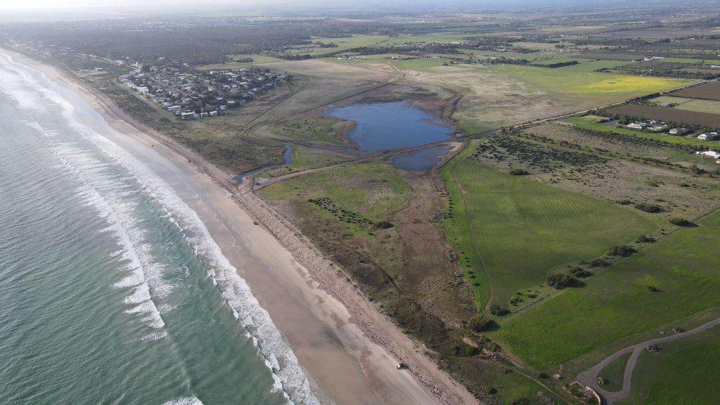
PS – For comparison, the modern appearance of the area described above is also shown in the oblique photograph below.