Exploring the hydrological restoration potential of Minyumai IPA, northern NSW
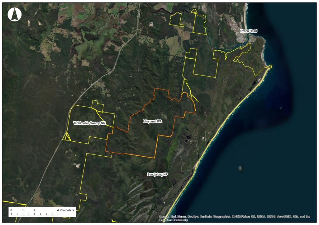
In early February Mark, Lachie and Ben had the privilege of travelling to the north coast of New South Wales to meet with members of the Bandjalang community, owners and managers of Minyumai Indigenous Protected Area (IPA). Minyumai IPA is a 2,163 hectare property of forests (including rainforest) and wetlands adjoining Bundjalung National Park and Tabbimoble Swamp Nature Reserve about six kilometres south-west of Evans Head. Minyumai has a history of past disturbance including logging and clearance and drainage of some areas to establish pasture for cattle, although much of the property retains intact vegetation. The Minyumai Land Holding Aboriginal Corporation (MLHAC) has owned and managed the property since it was handed back to Traditional Owners in 1999.
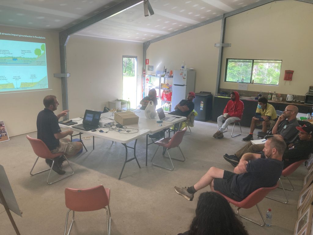
Hydrological issues at Minyumai first came to the attention of Nature Glenelg Trust when Mark met members of the MLHAC at the Restore, Regenerate, Revegetate conference in Armidale in February 2017. The opportunity to delve more deeply arose through the Environmental Restoration and Rehabilitation 2020 Program of the NSW Environmental Trust. Earlier this year, NGT secured a grant to investigate the impacts of historic drainage, plan on-ground hydrological restoration works and implement those works over three years. On February 7th we touched down in Ballina where we were picked up by Mary and Maitland of MLHAC and headed out to Minyumai for the first time.
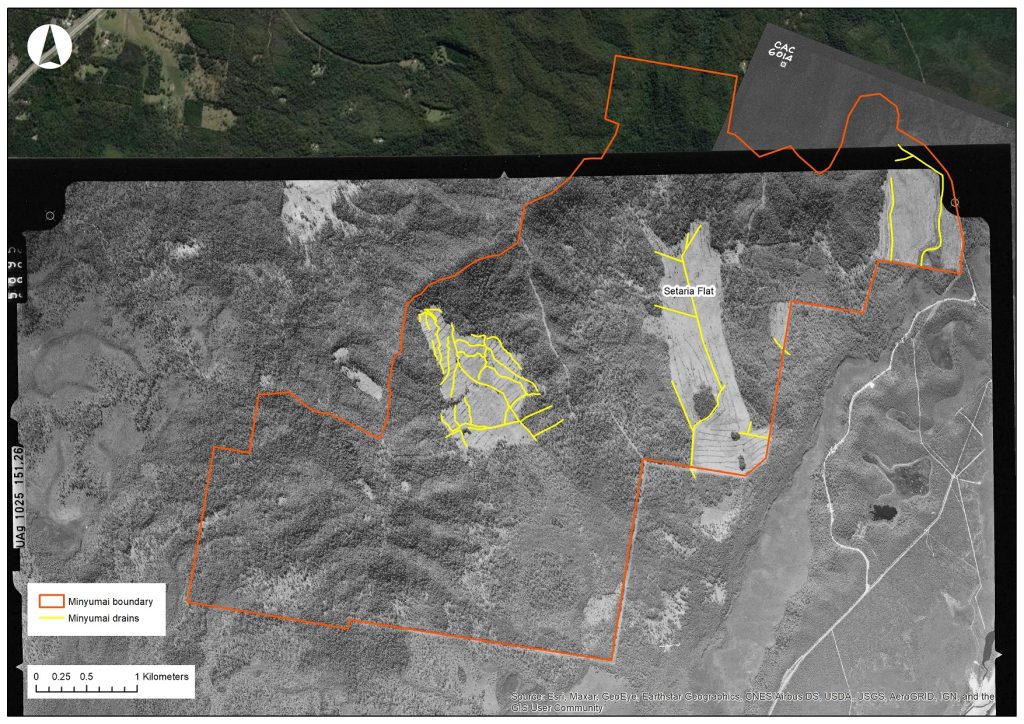
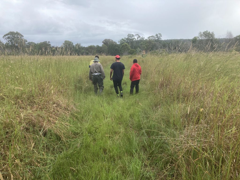
Aerial imagery of the property from 1971 reveals areas cleared for grazing and drains dug around that time. Much of the area within these clearance footprints has returned to native forest over the intervening years, through a combination of active revegetation and natural regeneration, although the ground layer remains quite weedy. An area known as Setaria Flat, due to the dominance of the introduced pasture grass Setaria sphacelata, remains relatively open. It may have been so prior to European colonisation, maintained by traditional fire regimes and possibly by its swampy hydrology, but we cannot be sure at this stage. What we do know is that Setaria Flat poses ongoing weed management challenges for the MLHAC. It is also dissected by a drain excavated in the early 1970s, prompting the question – is the Flat drier than it was historically and is this altered hydrology contributing to the weed management issues and difficulty in restoring native vegetation? With this and related questions in mind we set out with MLHAC Rangers to have a look around.
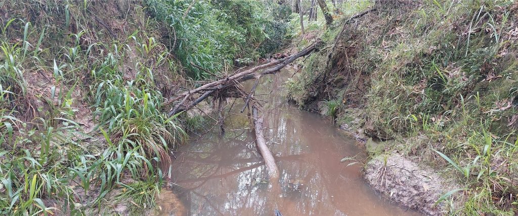
Upon arriving at the main north-to-south flowing channel we were surprised to discover how deep it is. Clearly, excavation of the original drain has created a single flowpath for surface water that has concentrated runoff and set in train a process of ongoing erosion. The drain is now deeply incised, to over four metres in places. This is hardly surprising given that the natural surface of Setaria Flat falls approximately 12 metres across 2.2 kilometres from north to south – quite a steep gradient – and also the intensity of rainfall events in this part of Australia.
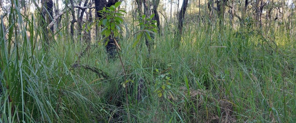
Setaria Flat is not a typical wetland, in the sense of a pool within which water is held. Rather, it is an area of relatively flat ground that receives runoff from surrounding hills and, prior to drainage, would have slowed and held shallow, flowing water, before discharging it into large swamps within Bundjalung National Park downstream. Describing the original vegetation of Setaria Flat is an important objective of the project and will help set restoration targets for the area. The lower parts of the Flat likely featured Paperbark (Melaleuca quinquenervia) forest and may have looked something like the image below. To better understand the current hydrology of Setaria Flat we installed several water level loggers; two in the drain and three on the adjacent Flat.
Since our visit to Minyumai the north coast of NSW has been devastated by floods. The homes of several MLHAC Rangers in the town of Coraki have been completely submerged. Our hearts go out to the Bandjalang community and we wish them all the best as they recover from this natural disaster. Understandably, the community is currently focused on flood recovery and addressing basic human needs. We don’t yet know how Minyumai IPA has been affected by the floods. We’re looking forward to a time when things are back on track and we can return and continue with the project to help restore this beautiful and highly biodiverse area.