Large-scale saltmarsh remediation works adjacent to Moulting Lagoon in Tasmania are now complete!
Long-term readers of the NGT newsletter will know that for the past couple of years we have been getting to know the Moulting Lagoon and Aspley Marshes Ramsar sites on the east coast of Tasmania. To refresh your memory, you can read our previous stories about this important wetland project, by clicking on this link.
On the western edge of Moulting Lagoon, our investigation into the history and eco-hydrology of Long Point, a Tasmanian Land Conservancy (TLC) property, and nearby Yards Hole, situated on a private property called The Grange, led to the development of a plan to reverse past changes that have impacted on the water regime of significant areas of saltmarsh across these sites. In addition to having a clear hydrological impact, the series of drains, dams, ponds and embankments constructed through these areas over the past 200 years, also created a disturbed footprint of land, that in most cases had displaced the saltmarsh vegetation communities previously growing there. In saltmarsh communities, which grow in very flat, low-lying areas near sea level, elevation really matters. Hence even minor artificial changes in the topography completely alter what plants will establish and grow, which is why – for example – the drier embankments throughout these areas were so prone to being invaded by woody weeds like gorse.
After a game of ‘cat and mouse’ with the weather over the past two years, due to the effects of the triple La Niña weather event that has soaked the continent (including the east coast of Tasmania) over this period, this autumn we managed to squeeze in the final phase of remedial works under the current NRM South / Australian Government funded project we have been working on.
So now that you have the background, let’s give you a sense of the work that was recently completed!
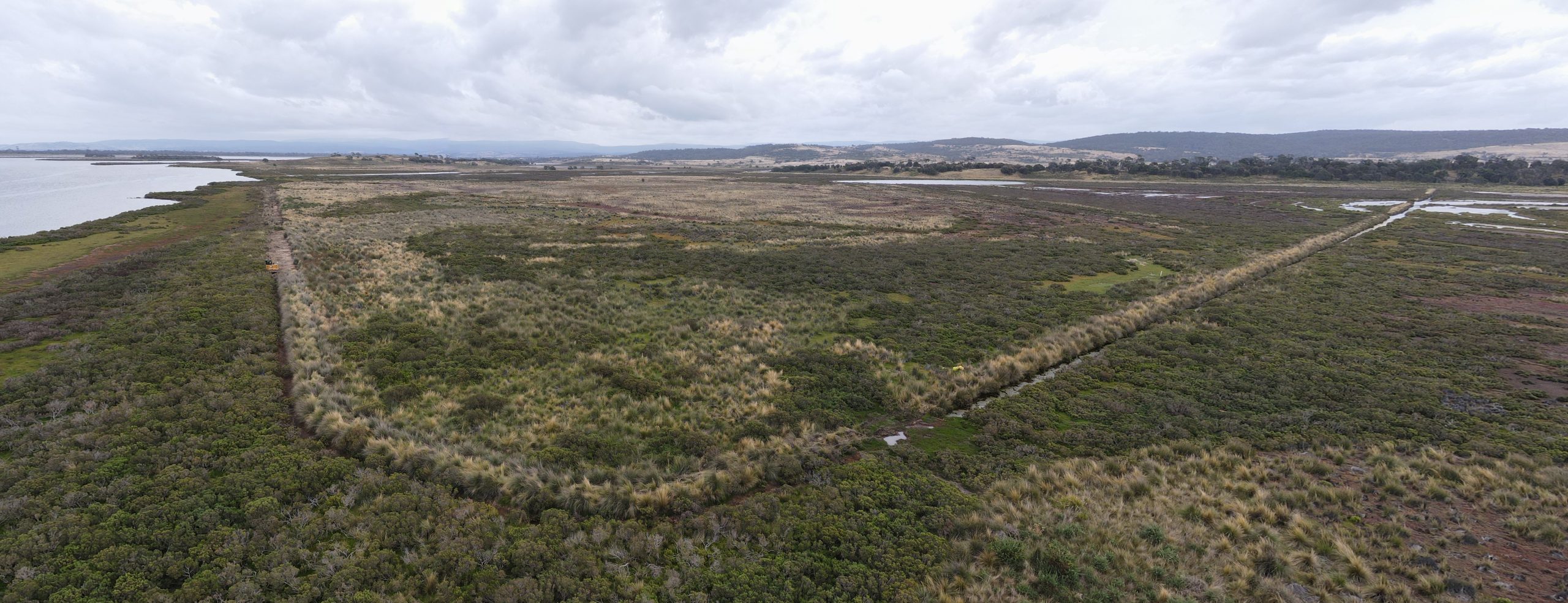
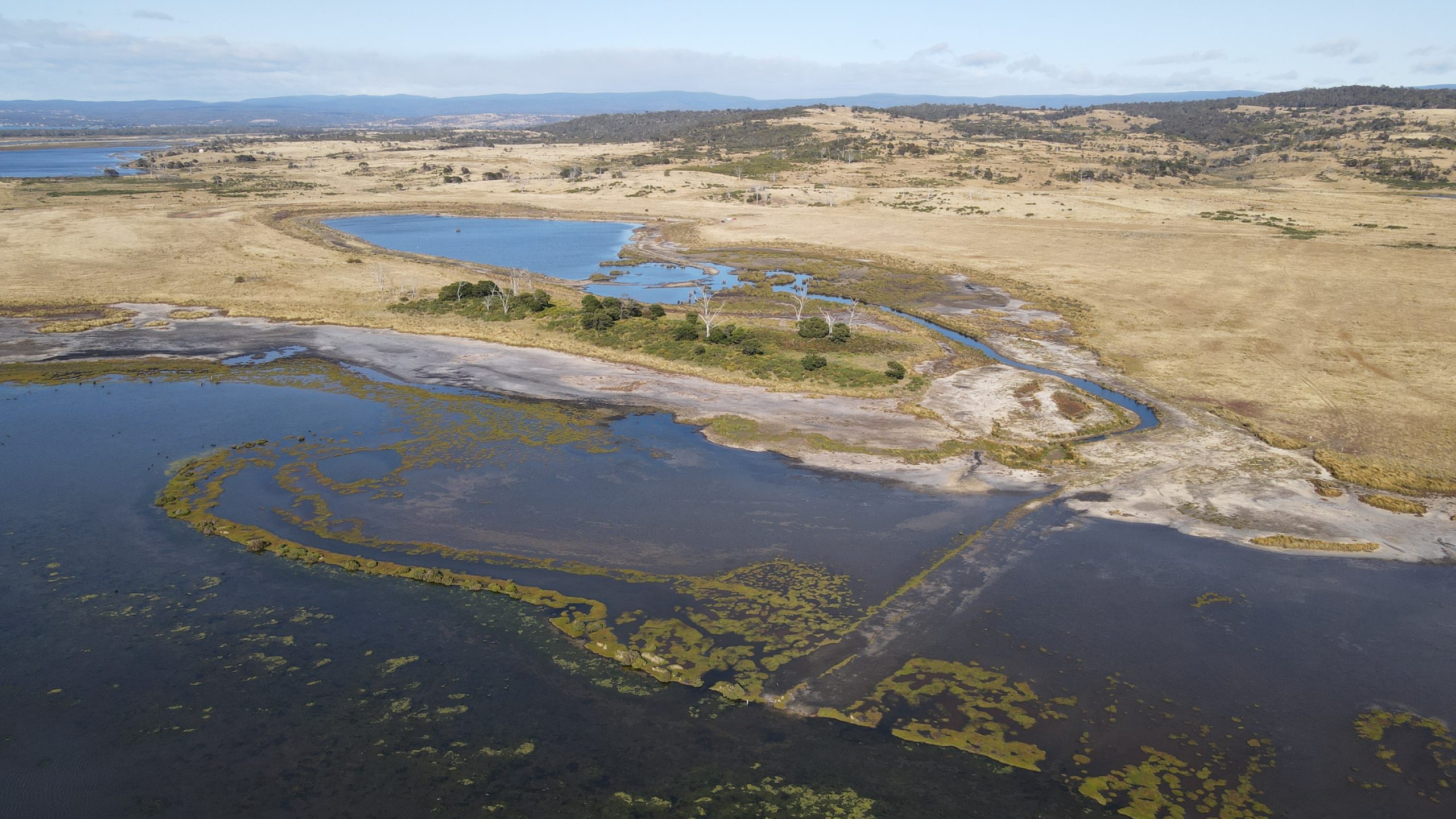
To help you get your bearings, here is an oblique aerial overview of the whole project area (looking to the south-west), after the completion of the remedial works:
1. First up, let’s take a closer look at the small dam by the entry gate to the TLC’s Long Point property (noting we made a modest start to works at this Reserve last year). Please click to see the ‘after’ image using the pdf viewer below.
In this case, it was a simple matter of putting the spoil back in the dam, levelling the area and waiting for natural regeneration to occur.
2. Next, we’ll take a look at the major aquaculture works along Barkstand Point, which were constructed in the early 1990s. Here, our remediation method involved backfilling the substantial spoil banks that were created either side of the drain when the artificial channel was dug, and carefully re-exposing the former natural surface level (which is the black ground that can be seen in the image below).
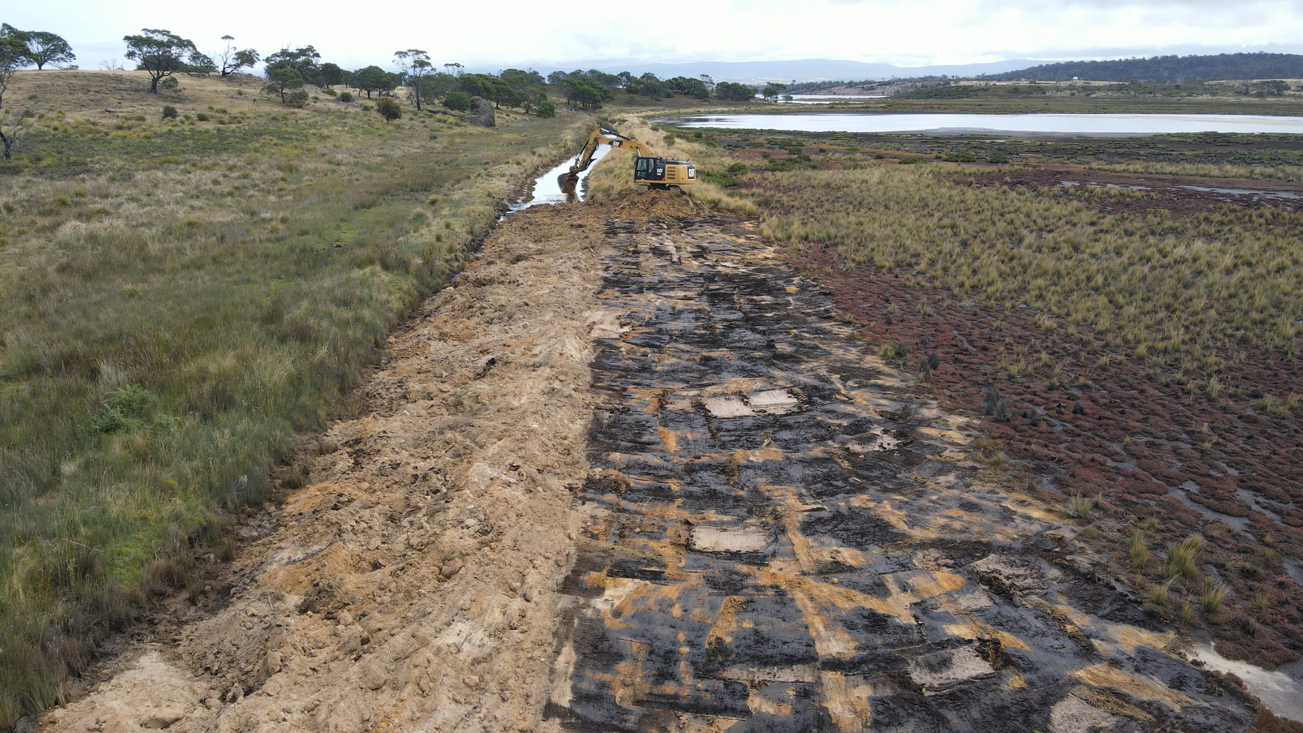
This is a tricky operation with big machines, because this accumulated former surface layer of carbon-rich sediment was only 5-10 cm thick in most places, sitting over sand, as shown below. Given the immense scale but precise nature of the task, the excavator operators did a tremendous job as we aimed to re-expose a target coverage of 80-90% of the original surface. Now we watch with interest as we await the regeneration of saltmarsh plants in this newly re-exposed former surface.

To reiterate the importance of elevation, the image below shows how weeds like gorse and thistles have been able to get a foothold on the artificial mound created by drain construction. Thankfully this zone that is prone to harbouring weeds is immediately eliminated by drain backfilling.

The large scale of the Barkstand aquaculture works can be hard to represent on a single image, so below are three perspectives to give you a sense of what was involved. Firstly, this is the view from the eastern channel outlet into Moulting Lagoon, looking west over the channel and ponds. Again, please click to page 2 in the pdf viewer below to see the after image.
eastern-end-of-BarkstandNext is the equivalent view from western end of the channel… before, during and after the works were completed.
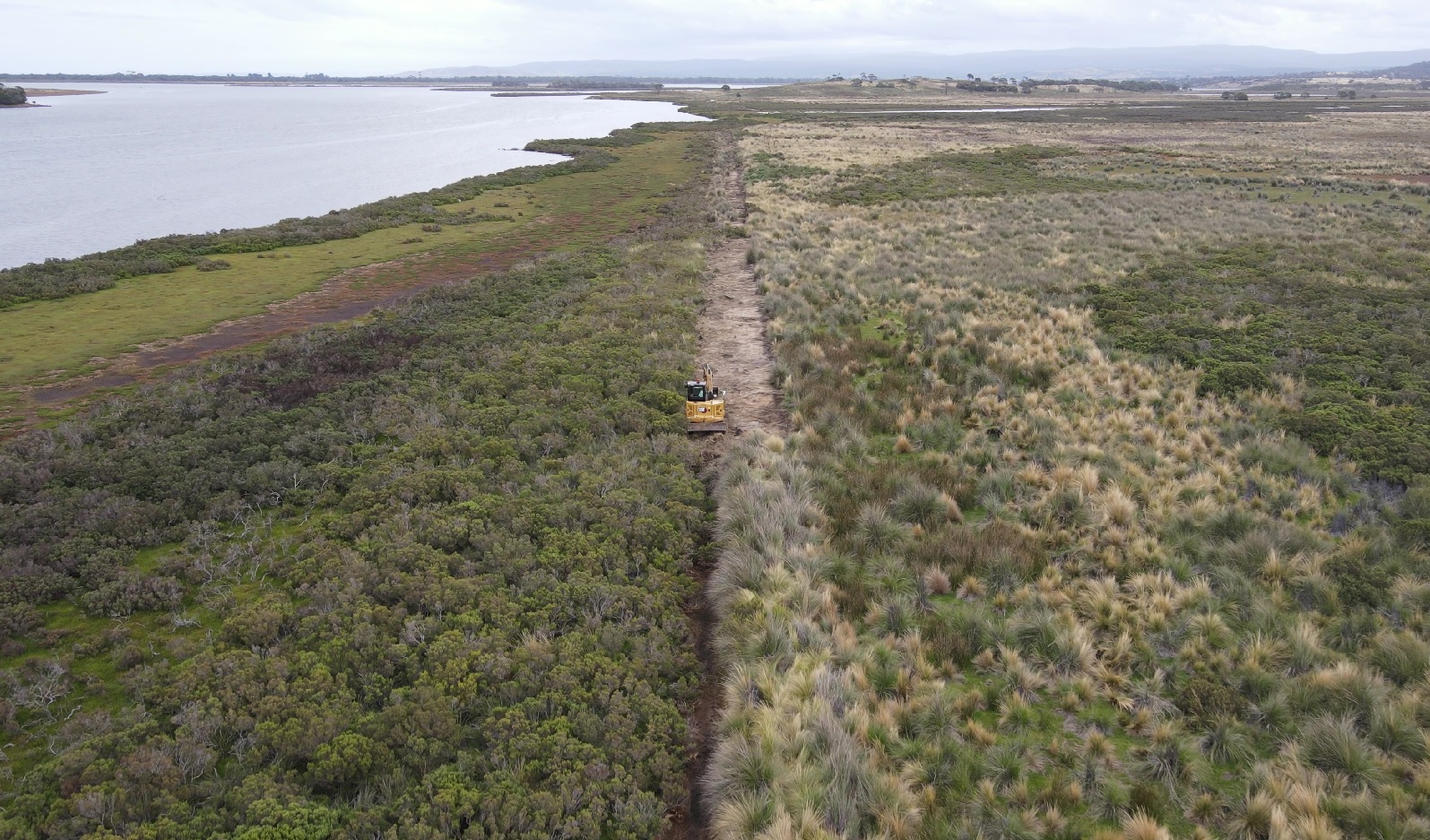
western-end-of-Barkstand-lower-angleAnd here is a bird’s eye view over the Barkstand works, showing the scale of the job – before and after.
western-end-of-Barkstand3. Next, we’ll move along to the convict-era levee banks. Given that they were built via hard labour and not machines, the footprint of these banks was not as substantial as the more recent aquaculture works – but as you can see from the images, they are still extensive. These early 1800s banks tied into surrounding higher land at either end (Barkstand Point and Long Point), in an attempt to enclose an area of about 200 acres to improve its value for grazing. The image below shows the main eastern levee bank, as the backfilling works were underway, looking south-west. Barkstand Point is to the left and Long Point is to the right.
Our goal with the method employed along these banks was to keep the remedial works within the original disturbance footprint created when the banks were constructed, as shown below. This image also shows the sudden change in vegetation either side of the embankment, which reflects the long-term change in hydrological regime caused by the levee. Including last year’s works, it took almost 10 days for the 6 tonne excavator to work from one end to the other to remove the levee via backfilling. Now just imagine being a convict gang doing that job in reverse, digging by hand!
Another view looking along one side of the main levee, before and after works, can be seen in the image below (click the pdf viewer to see the after image). This is looking east from Long Point.
Northern-levee-looking-eastThe shorter, western levee appeared to have been hit hard by previous floods, which had already breached it in a few places, and left us short of material for complete backfilling. As you will see in the before and after images below, looking from either end, the remaining spoil material was arranged into a series of backfilled sections to achieve our hydrological objectives while also providing areas for potential saltmarsh re-establishment near the former natural surface level.
western-levee4. Now let’s take a quick look at the most-recent – and shortest – drain that was cut at Long Point in the late 1990s. What appears to have been dug as a narrow, shallow connecting channel, had since eroded into a much deeper channel as tidal flows rushed (scouring it out) between Moulting Lagoon and the small wetland north of Round Hole. Although there was not sufficient material to completely backfill this channel, we are hopeful that the new ‘plug’ at each end will settle into place and have an equivalent hydrological impact.
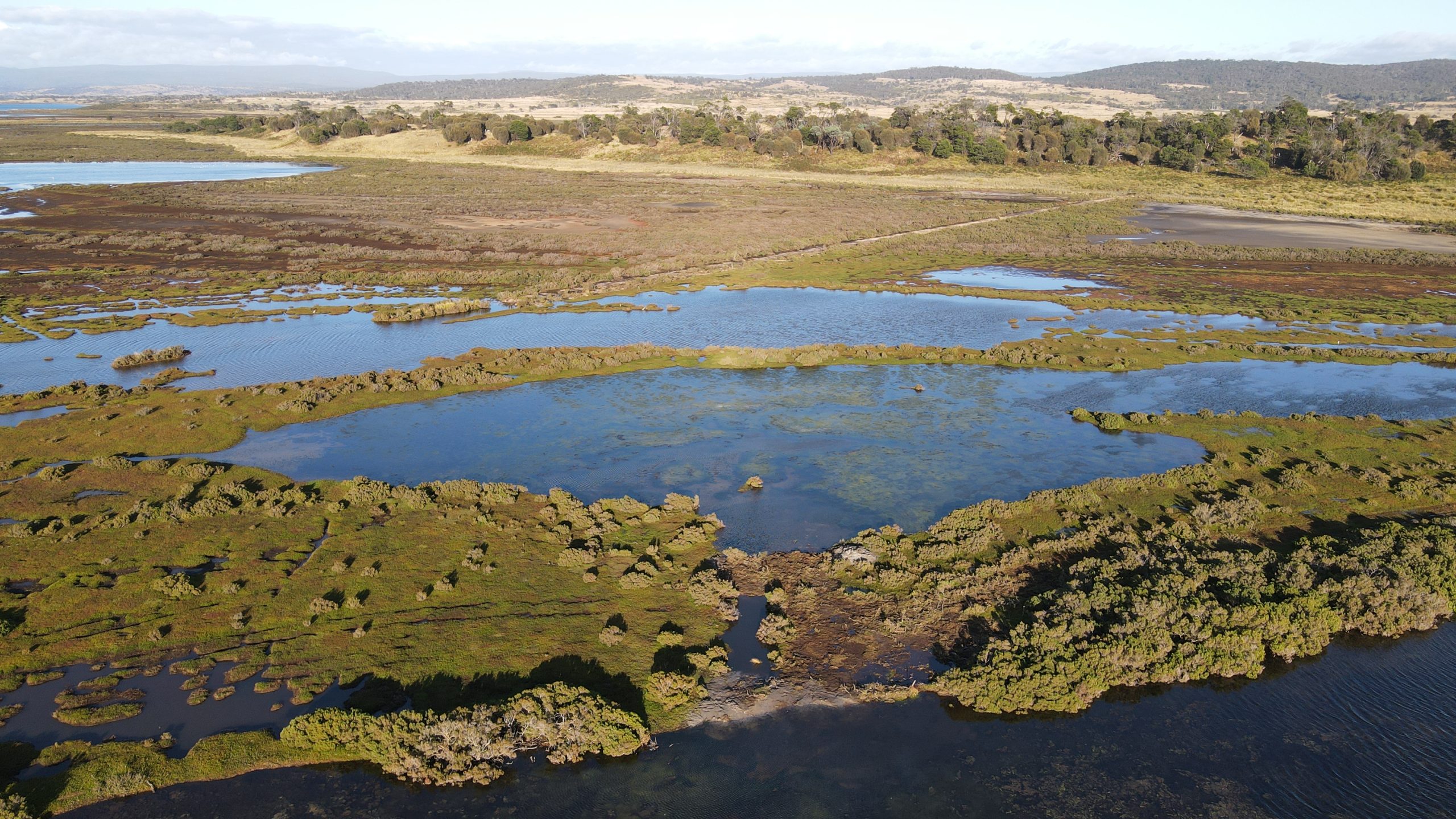
5. Finally, we were able to return again this year to Yards Hole (situated on the neighbouring property, The Grange), to complete the last of the tasks associated with the major remedial works undertaken there last year. This image shows the overview of how Yards Hole was looking in March 2023 (note the higher than normal water level in Moulting Lagoon and inundated saltmarsh in the foreground, due to a flood event in the Apsley River catchment a few days prior).
The works from last year are settling in very quickly, accelerated by the sequence of flood events experienced by the site over the past 12 months. Indeed if we zoom in to inspect more closely some of the ground remediated last year, the saltmarsh habitat recovery is now rapidly unfolding…

A big thanks to the excavator operators this year, Steve, Hugh, Duncan and Ben, for showing great interest in the work, as well as flexibility and attention to detail throughout.
To wrap up this mega-update, in a quirk of fate and timing, it turned out that we managed to complete the works just in time. As we were finishing off and leaving the site, the recent thunderstorms which initiated flows down the Swan and especially the Apsley River, were pushing up water levels in Moulting Lagoon – inundating ground upon which we had excavators working only days earlier. Beyond being a relief, this was actually also an incredibly interesting thing to witness so soon after the works, as we could see the rising water level beginning to seamlessly push flows through the saltmarsh in places where the levee bank had still been in place just a few days earlier. It is pretty amazing to see a process like this happening once more, for the first time in almost 200 years!
In summary, I think it is fair to say that we ended the recent very busy period of works in Tasmania on a real high, with clear evidence of the value of this important saltmarsh restoration work playing out before our very eyes…

The restoration works implemented by Nature Glenelg Trust have been made possible at Long Point thanks to the support of the Tasmanian Land Conservancy, and at Yards Hole thanks to the support of the private owners of The Grange, as a result of the NRM South project at Moulting Lagoon, with funding provided via the Australian Government’s National Landcare Program.