Let’s talk about ‘Project Coorong’ and the key role of complementary coastal wetland restoration in maintaining Ramsar values
On Thursday, myself and Mark from NGT headed to Meningie for a very informative and detailed workshop, where the community was given the opportunity to hear from SA Government (DEW) staff and researchers leading the scientific investigations that form part of ‘Project Coorong’; as well as ask questions, discuss what we learned and then provide feedback on the direction of the program. It was a very well attended event and community passion for the Coorong was again on full display.
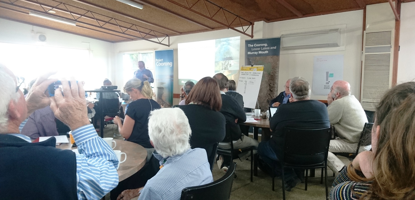
Project Manager Angus MacGregor from DEW explains ‘Project Coorong’ to attendees. Photo: Mark Bachmann
So, why are these discussions happening and what is ‘Project Coorong’?
Well, the iconic Coorong, a wetland of international importance that stretches from Goolwa for 125 km into the South East of SA, is currently in a degraded state. During the latter years of the Millennium Drought, from 2006 to 2010, freshwater inflows to the Coorong from the River Murray completely stopped for a period of nearly four years – an unprecedented event. As a consequence, water evaporating off the surface of the Coorong was replaced by seawater inflows coming the ‘wrong way’ back through the Murray Mouth. Every litre of seawater deposited 35 grams of salt into the Coorong. The salinity of the Coorong, particularly in the southern lagoon furthest from the Murray Mouth, steadily increased until in places it exceeded 200 grams per litre, nearly six times saltier than seawater.
Not surprisingly, the aquatic flora and fauna of the southern lagoon, which over recent decades had become more accustomed to a salinity of typically less than 100 grams per litre, were mostly unable to tolerate this new situation. The ecosystem collapsed. Aquatic plants and fish largely disappeared and waterbird numbers plummeted.
The return of freshwater flows from the River Murray in September 2010, and several subsequent floods, pushed salinity in the Coorong back into its normal range and it has remained mostly within that range ever since. However, the ecosystem of the southern lagoon has failed to fully recover despite considerable efforts to help it to do so, such as re-seeding with aquatic plants. Its waters remain highly turbid, thick with phytoplankton and filamentous algae that shades the bed of the lagoon, making it extremely difficult for aquatic plants to grow there.
Despite the return of favourable salinities the Coorong southern lagoon ecosystem, for the time being, appears to have transitioned into an alternative, albeit less desirable, ‘stable state’, preventing the return of clear water and beds of aquatic plants that provide nurseries for fish and food for waterbirds.
Project Coorong is the South Australian Department for Environment and Water’s $70 million, five year proposal to try to bring about the recovery of the former ecosystem of the southern lagoon and greater Coorong. Project Coorong is informed by an Action Plan that includes several proposals for works that could be undertaken or investigated. These include physical removal of algae, smarter management of freshwater inflows (from the River Murray via the barrages and South East via Salt Creek), research to better understand the source and fate of nutrients and some major engineering projects such as creating a connection between the Coorong and Lake Albert.
Of particular interest to us at NGT is the landscape-scale approach, mentioned in the Action Plan, of restoring wetland habitat in the South East to provide alternative habitat for waterbirds that are currently disadvantaged by the diminished habitat values and resources of a degraded Coorong. Of note, the Coorong and Lower Lakes Ramsar site is just the first of a chain of semi-continuous and extensive coastal wetlands of the South East region, book-ended at the Victorian border by two contiguous Ramsar sites; the Glenelg Estuary and Discovery Bay Ramsar site and Piccaninnie Ponds Ramsar site.
In between, migratory shorebirds and other waterbirds make regular movements within these coastal zone wetlands in response to habitat availability and quality. That availability however is hampered by the fact that so many wetlands (outside of the Crown Land coastal lakes) have been lost or degraded as a result of the impacts of artificial drainage within that zone. Because this is one the most reliable regions for rainfall in south-eastern Australia, we have also lost large portions of otherwise essential drought refuge habitat in the region adjacent to the Coorong, that could play a key role at the continental scale for waterbird conservation if we bring them back.
It therefore makes sound ecological sense to manage coastal zone wetlands across this zone holistically, as they are essentially part of a single, large continuous habitat complex, varying in quality, productivity and availability in space and time. The entirety of this zone is important for migratory shorebird and other waterbird populations.
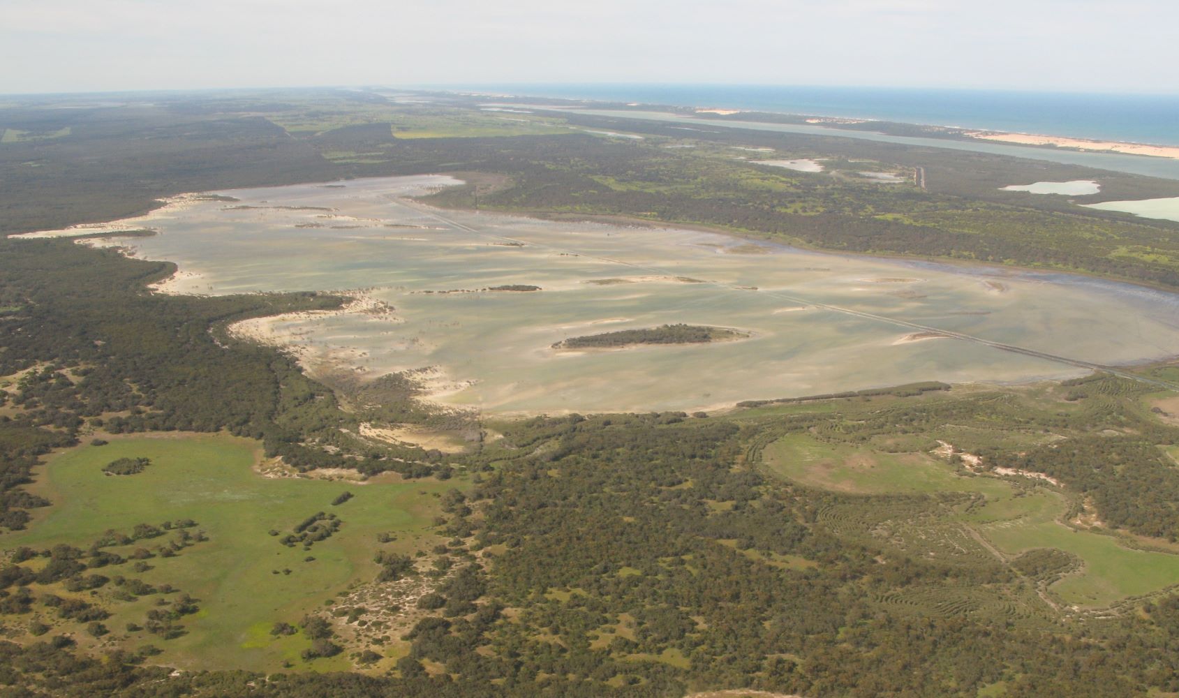
Morella Basin is an example of a South East coastal wetland that has been hydrologically restored from a dry paddock to a functional wetland that provides important complementary habitat for Coorong waterbirds. Photo: Ben Taylor, 2016.
An advantage of complementary wetland re-hydration works over some other actions proposed in the Action Plan is that benefits for waterbirds can be achieved very quickly, cost effectively and – by working specifically with natural processes and minimum disturbance – uses methods that are less prone to unintended negative environmental side effects. The urgency of the situation, with waterbird populations in the southern Coorong exhibiting severe declines, highlights the importance of providing additional alternative habitat for Coorong waterbirds as an immediate priority.
Many of the coastal zone wetlands of the South East of SA (across about 200 km of coastline between Kingston and the SA/Vic border) meet key criteria for hydrological restoration, i.e.:
- many are affected by artificial drainage, which has resulted in either a vast reduction or complete loss of waterbird wetland habitat;
- water availability and reliability remains relatively high compared to inland wetlands because groundwater declines have been less dramatic and rainfall / inflows remain more reliable in the coastal zone;
- they fall outside of the Murray Darling Basin, so there are little or no upstream diversions, and access to water for restoration is much more straightforward and cost effective;
- many occur within low lying areas that are already near, at or below mean sea level and that in some cases will lose their viability for other land uses through predicted sea level rise; and,
- overall, these wetlands maintain their potential to support reinstated wetland ecological values, making hydrological restoration (through reversal of artificial drainage) a viable and cost effective approach.
Current land tenure and use is a key impediment to wetland restoration in most circumstances (not just in this specific example), outside of the obvious exception where (in a few cases) modified wetlands occur on already reserved public land. On private land, drained wetlands have often become productive for agriculture and other industries. Hence restoration projects are complex and need to be carefully considered, discussed, assessed and negotiated with landowners – so sufficient time and a range of tools, options or incentives are likely to be required in order to turn a wetland restoration concept into something tangible.
So while none of this is simple, easy or guaranteed, we have shown at NGT over the years that the potential environmental outcomes well and truly justify the effort – as wetlands are capable of spectacular and rapid recovery when we ‘just add water’ and give them a chance to bounce back.
With this in mind, Project Coorong could take the strategic view and include a larger focus on the hydrological restoration of coastal wetlands complementary to the Coorong. In a nutshell, this way all of our eggs aren’t in one basket.
At NGT, we think this would be a really positive step and could provide major breakthrough in how we sustain the waterbird species that require the habitats and resources currently absent from the Coorong Ramsar site – building overall landscape resilience, while supporting the listed values of three adjacent coastal Ramsar sites (including the Coorong) at the same time.
A big thanks to DEW for organising the workshop and providing the opportunity to share this and other potential ideas with project staff.
If you would like to share your thoughts with us at NGT, please get in touch: .
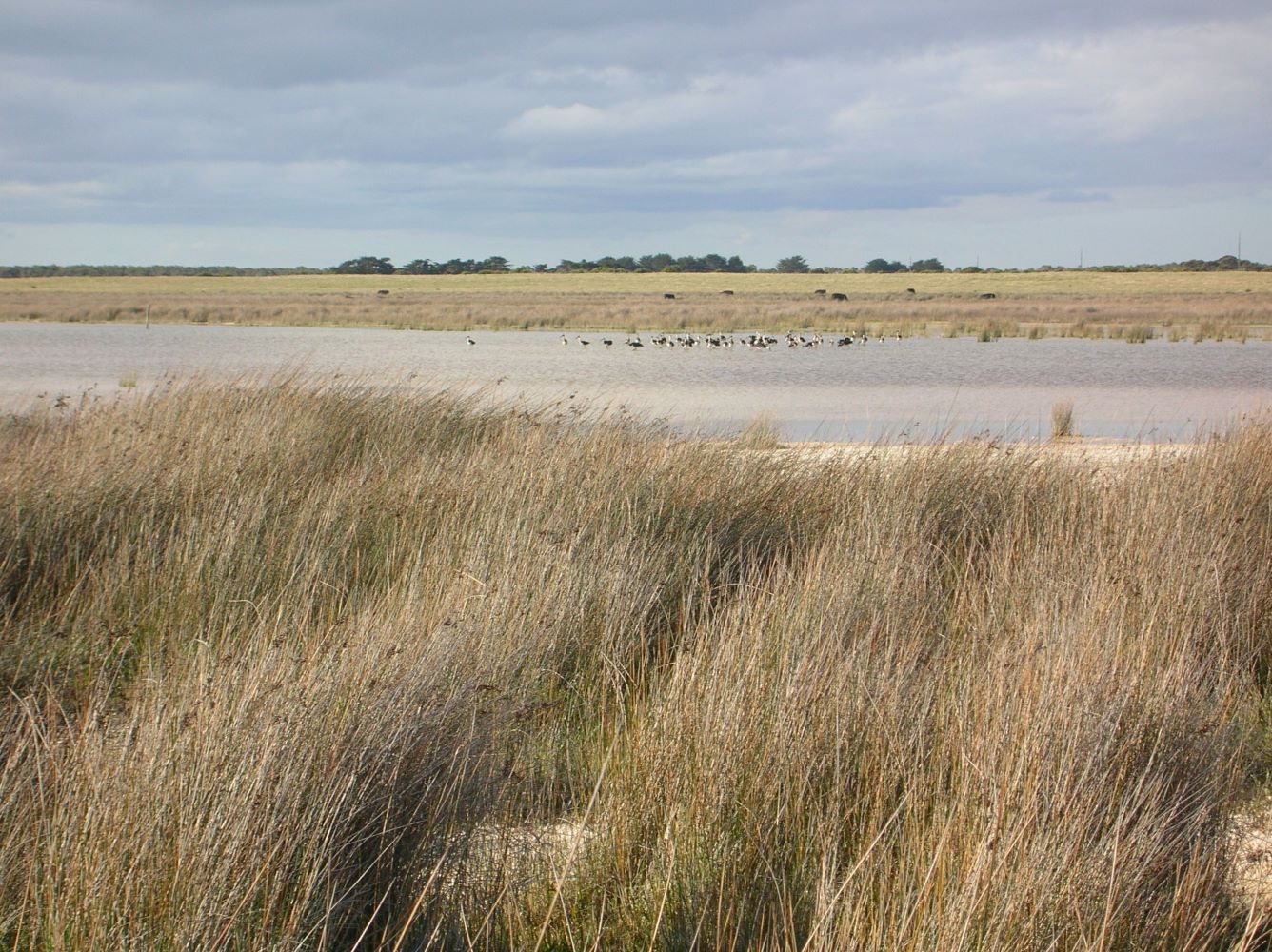
Hutt Bay Wetland near Port MacDonnell, partly owned by NGT, has had its hydrology partially restored but much more could be done in the future to improve the condition and function of this important coastal wetland. It supports many of the waterbird species that have declined in the Coorong and is situated in the extensive coastal wetland zone book-ended by the Coorong and Piccaninnie Ponds Ramsar sites – a previously continuous and connected wetland landscape. Photo: Ben Taylor, 2006.