The Apsley Marshes begin to reveal their inner workings and allow preliminary restoration options to be explored
Close to twelve months of baseline monitoring data has now been captured for the Apsley Marshes Ramsar site! The Apsley Marshes is located on the east coast of Tasmania, and you can read more about our original introduction to the Marshes here. The baseline data have enabled us to begin to untangle the modern hydrology of the Marshes complex, accounting for and interpreting the likely impact of extensive convict-era artificial drainage that continues to impact the site.
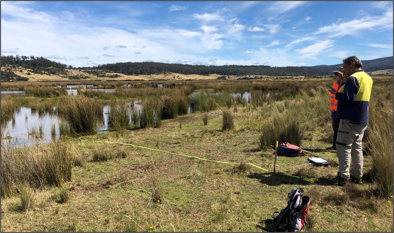
Baseline vegetation monitoring was undertaken in March, targeting several sites on the eastern and western perimeters of the central Marshes – areas we expect to be the most sensitive to changes in salinity and water regime over time. This baseline information, building on data previously collected via monitoring undertaken in 2002 (by Barnes and Visoiu) and 2013 (by DPIPWE) will enable an assessment of change in the central margins of the wetland complex and in the transition zone, where prevailing conditions grade from fresh to saline, and will continue to shift over time due to sea level rise. It will also provide pre-restoration data to underpin ongoing monitoring of the site, which includes allowing a comparison over time to measure the impact and efficacy of any future restoration activities.
Our advancing understanding and knowledge of the Apsley Marshes, which has rapidly improved over the past couple of years, has been recently compiled into an eco-hydrological assessment report for the Ramsar site. This important report will soon undergo a final round of discussion and consultation with the private owners of the Apsley Marshes, to determine what next steps might be considered suitable to form part of a future restoration project for the site.
In summary, the report key findings include that:
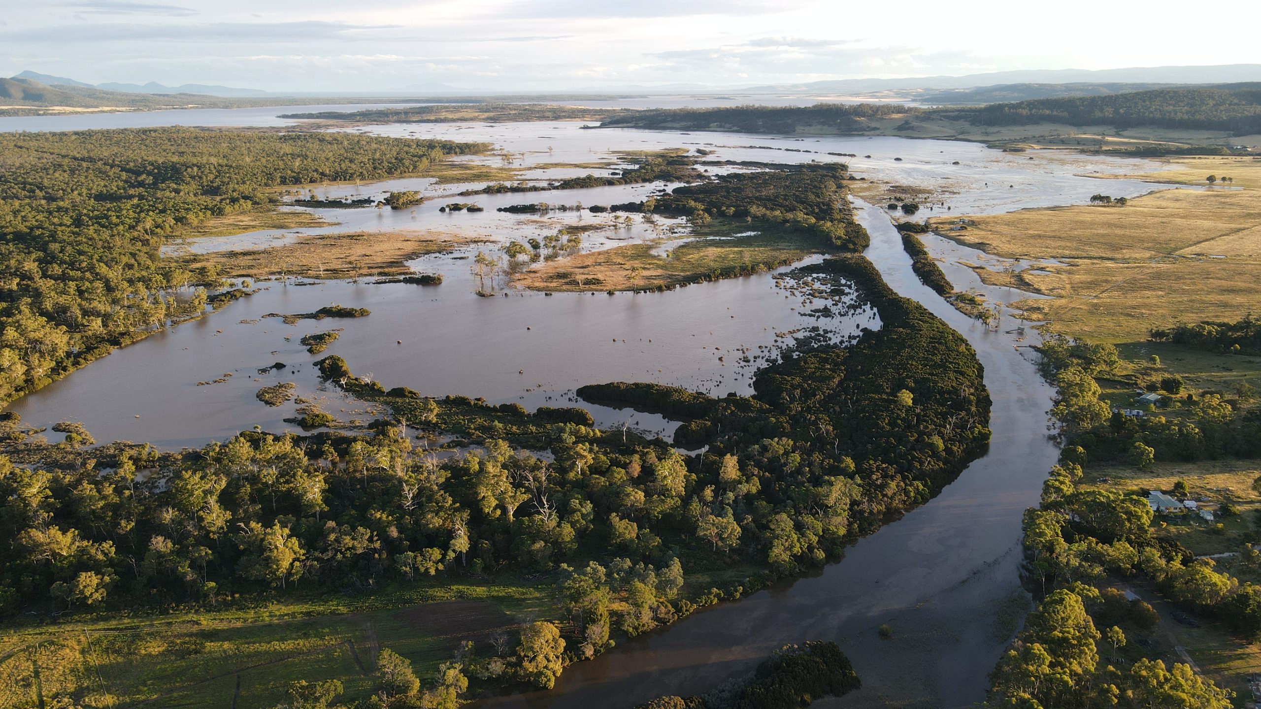
- Convict-era drains continue to influence hydrology, water quality and vegetation. They rapidly drain freshwater and potentially shallow groundwater from the site and have likely increased the ingress of saltwater over time.
- The northern freshwater end of the drainage network can dry out significantly and stop flowing in dry times. The southern end of the drainage network is consistently inundated with tidal flows. On large tides water pushes over half-way up the drains and at times, due to breaches in drains and natural drainage lines, pushes into what was freshwater marshland. This sea water then gets trapped in wetlands and increases in salinity over time with limited flushing.
- Drains in the southern part of the Marshes are over 2 m deep and are likely facilitating sea water ingress but also acting as deep groundwater drains. This effect is likely to have been exacerbated by peat subsidence experienced since drain development in the 1800s.

The aim of any future restoration works at the site would be to reinstate a more natural hydrological regime and salinity gradient across the system, seeking to limit sea water intrusion and promote peat accumulation processes through improved retention of freshwater saturation.
The site is complex and presents many challenges for restoration. Some of the many reasons for this complexity include the fact that (a) many sections of drain spoil banks are now absent, (b) access to drains and spoil banks throughout the wetland complex is poor, and (c) the underlying nature and character of the site being part of a productive farming (livestock grazing) enterprise also introduces a range of additional considerations.
A major limitation during the time of this most recent study has been that no new information on this site has yet been collected during a prolonged dry period (due to us having just experienced three, back-to-back La Niña years), and only 12 months of continuous hydrological data has been collected to date. Ideally, we would recommend capturing at least 2 years of data and the inclusion of both a wet and dry period to analyse the variations in water level, salinity regime and water balance at the site to increase our confidence in restoration options, including potential methods and access requirements.
A suite of potential restoration options and recommendations have been made which will be discussed and worked through with the private landholder in coming months, and photo point, salinity and water level monitoring will continue at this site in the interim. Although this is the final update on outcomes achieved from the recently concluded NRM South and Australian Government funded project, which officially ended in June, NGT will continue our involvement with the Apsley Marshes Ramsar site into the future, so watch this space!
This important work was supported by NRM South, with funding provided via the Australian Government’s National Landcare Program.