Mt Vandyke update: Time to start exploring habitat restoration
Since our last update, I am pleased to report that the fencing materials order has been submitted by our works officer Tom Sheehan, in readiness for us to commence building the predator-proof fence around Mt Vandyke early next year. Thanks to everyone who has shared information and ideas with us along the way so far!
While we wait for the order to come through, we’re starting to think about the habitat restoration work that will be required to recreate the type of habitat structure we want to see inside the fence – providing the cover and resources that will support and sustain the small mammals that will (or could) one day call this site home.
A good place to start, is to take a quick peek back in time at the very earliest aerial image that exists for Mt Vandyke – from 1947.
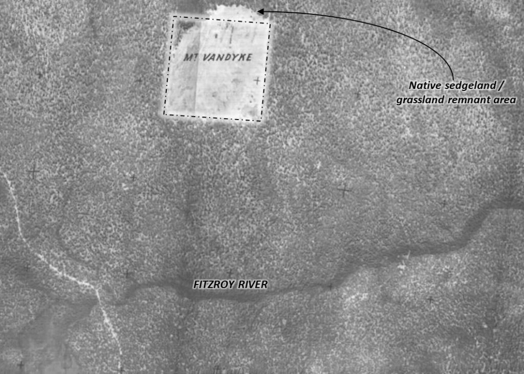
Sure enough, the earliest imagery confirms that an area of remnant sedgeland / grassland occurred outside the northern boundary of the property – which is likely to be representative of the original vegetation cover over what was locally known as the “Good Hill”. We are lucky that this area still retains an example of that original vegetation today.
From an old photo kindly provided to me by local Portland-based historian Garry Kerr, we can see from the view atop Mt Vandyke (in approximately 1950, not long after the time of the aerial image above) that the original vegetation on Mt Vandyke itself inside the fence was already being impacted by heavy grazing – after being excised several decades earlier as a separate parcel of land out of the surrounding forest. This is an image of the fire-spotter’s hut on Mt Vandyke, and Garry’s great-uncle Jack Doyle who was employed at that time to keep watch over the surrounding forest during the fire-season.
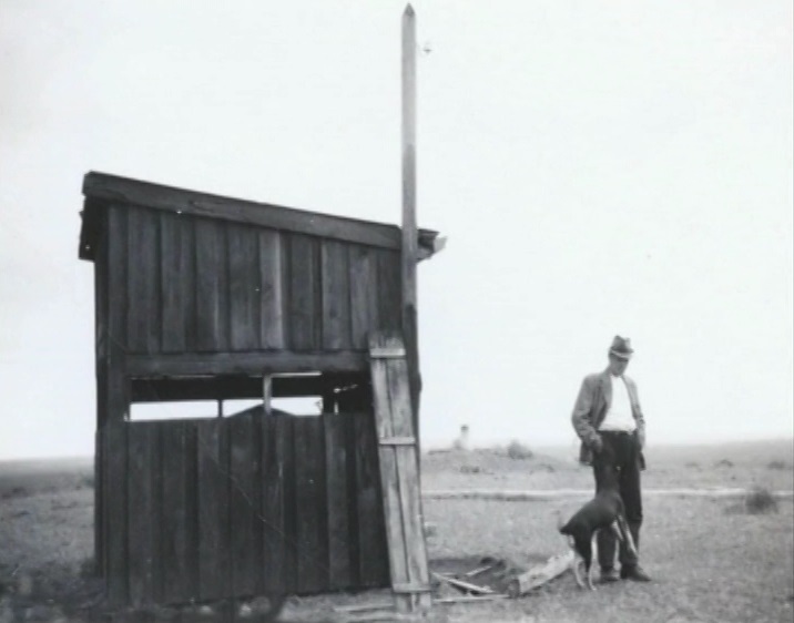
If you’d like to gain some insights from a short video about the changing fire management of the Cobboboonee forest around Mt Vandyke, which has influenced its vegetation and character, then this short video, also by Garry Kerr, is well worth watching for some additional local opinion and context.
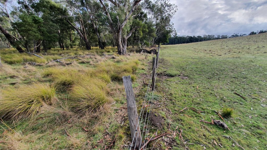
Of course, now that the property inside the fence has been largely cleared and sown to pasture, after a period under blue-gum plantation, as shown below in this image of the southern boundary, we are fortune to have remnant areas outside the boundary to use as both a guide and seed-source.
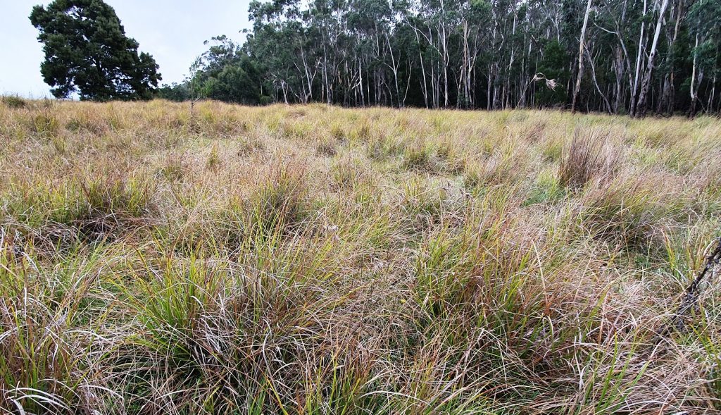
Now that we are starting to take a closer look at the groundcover plants growing outside the boundary, it is interesting to see the influence of the highly variable (winter saturated and summer dry) conditions at Mt Vandyke on the species that are present. At a glance, we have a mixture of native sedges and grasses (e.g. species of Carex, Gahnia, Themeda and others) all growing side by side.
We are keen to ask around widely and learn from the experiences of anyone out there who may have been involved in mixed sedgeland / grassland restoration work – particularly of damp meadows; those with winter saturated soils that dry out completely over the summer months.
If you have any insights you would be willing to share, then please get in touch with Rose Thompson – if the link here doesn’t work then try copying:
And by the way…
A trickle of donations have still been coming in, which has helped to further reduce the Mt Vandyke land purchase loan balance – as of today we’ve nudged the balance down to just over $132,000. Thank you again to those of you who have contributed for your wonderful support!

All donations over $2 are tax deductible.
