Kicking off a fascinating new project in Tasmania – an eco-hydrological assessment of Burdens Marsh at Sloping Main, on the Tasman Peninsula
After the success of NGT’s recent saltmarsh restoration works on the Tasmanian Land Conservancy’s (TLC) Long Point Reserve, adjacent to Moulting Lagoon, we are delighted to be working again with the TLC at Sloping Main, one of their newest Reserves situated on the Tasman Peninsula.
Earlier this year, Sloping Main was extended to incorporate an important area of saltmarsh known as Burdens Marsh. It is this wetland area where the TLC have sought NGT’s independent advice and skills in eco-hydrological assessment.

Burdens Marsh supports valuable saltmarsh habitat, but like many other similar wetlands in Tasmania, has also inherited a history of modification from a previous time when it was targeted for agricultural development – including changes to its drainage patterns and water regime. This is the part of the story that we will be taking a closer look at to fully understand the intent and impact of those changes. We will also determine whether any of these historic works require future remediation to enhance the ongoing process of habitat recovery that will accelerate now that this area is being managed and protected by the TLC for conservation in perpetuity.
Bec and I made our first visit to the site recently (in August 2023) to commence this work, and encountered the site with a much lower water level than when the image above was taken (after the heavy rainfall experienced in spring 2022). Current conditions, for comparison, are shown below:
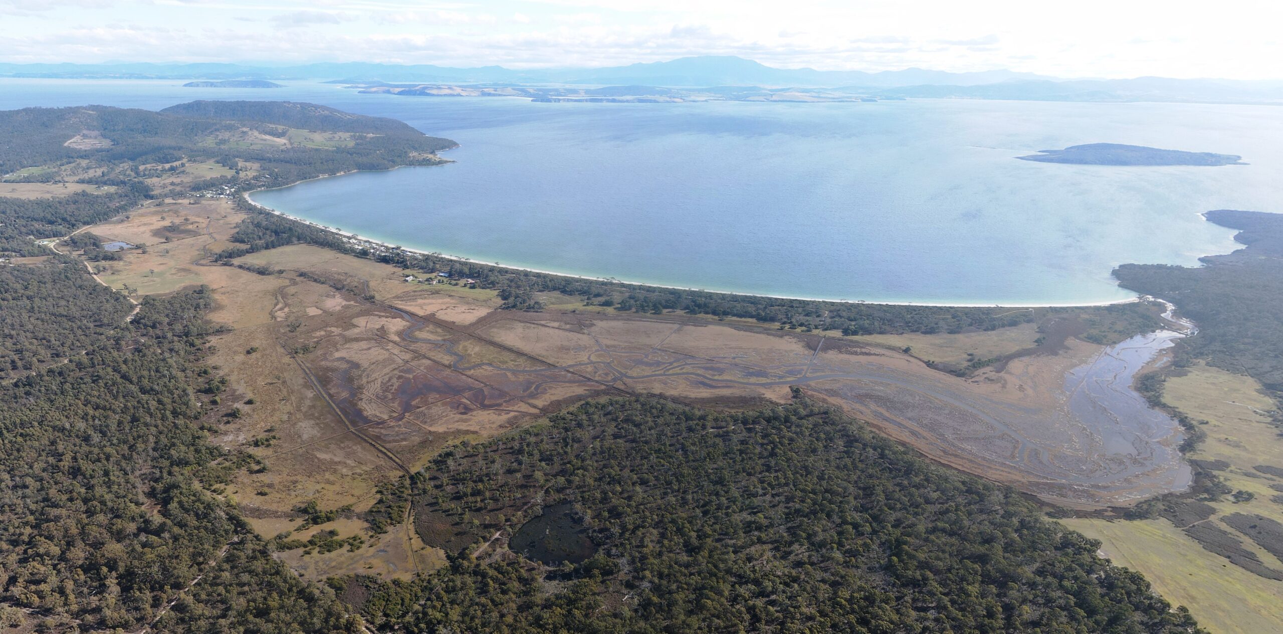
If we look more closely, it is apparent that the site has a complex management history. Yes, from a hydrological perspective in particular, there is a lot going on!
As you can see below, there are a complex network of drains, levees and structures of various shapes and sizes which we will now carefully assess. We will document their location and design, seek to determine their various purposes, and define their likely ongoing impacts on site hydrology. Setting the future potential ecological condition of Burdens Marsh on the right trajectory, relies on us developing a sound understanding of the current state of play.

We are just kicking-off this new project, meaning a lot more interesting information will emerge over the months ahead as we start to piece together the story of this site – so stay tuned.
Finally, thanks to Cath and Elise from the TLC for hosting our first visit and sharing your knowledge of this important site.

This project is being delivered by NGT in partnership with the Tasmanian Land Conservancy, with support from the Purryburry Trust