Time lapse cameras monitor our restoration of the creekline at Stipiturus CP, as the 1940s drain is permanently decommissioned!
At our recent Fleurieu Swamps Field Day we explained the latest restoration works at Stipiturus Conservation Park (CP), on the Fleurieu Peninsula south of Adelaide, but we haven’t yet informed our readers from further afield. These works mark an important milestone in the restoration of this most important Fleurieu Peninsula Swamp.
Since April 2017, NGT has been working on the creek that carries surface flows into Glenshera Swamp. Initial works involved the installation of a series of sandbag trial structures with generous help provided by many volunteers. These structures blocked flows within an artificial drain, lifted water back to the natural surface and directed it through the original, meandering creekline. In doing so, this restored habitat and provided enhanced opportunities for the natural improvement of water quality prior to inflows reaching the main part of Glenshera Swamp.
Six years on and it was finally time to convert this “trial” into a permanent reality. Over several days in early April, under Mark’s supervision, an excavator undertook the delicate task of covering the sandbag structures with soil and back-filling the drain where possible. The soil was gained from the old spoil heaps created when the drain was originally excavated in the 1940s (see our 2016 restoration options report for background). We say “delicate” because many of the original swamp gums lining the creek remain in the area and there has been some revegetation in recent years. An additional complication was that, since original drain excavation, there has been considerable erosion of the drain banks and bed, meaning that the spoil originally excavated is no longer sufficient to completely back-fill the old drain. Therefore, some sections of the drain will remain, forming seasonal pools that should complement the surrounding creek and swamp habitat. However, the drain has now been made permanently ineffective.
Following the completion of earthworks, we installed five time lapse cameras within the works area to monitor water behaviour in response to the works. Each is aimed at a different structure, as indicated in the map below:
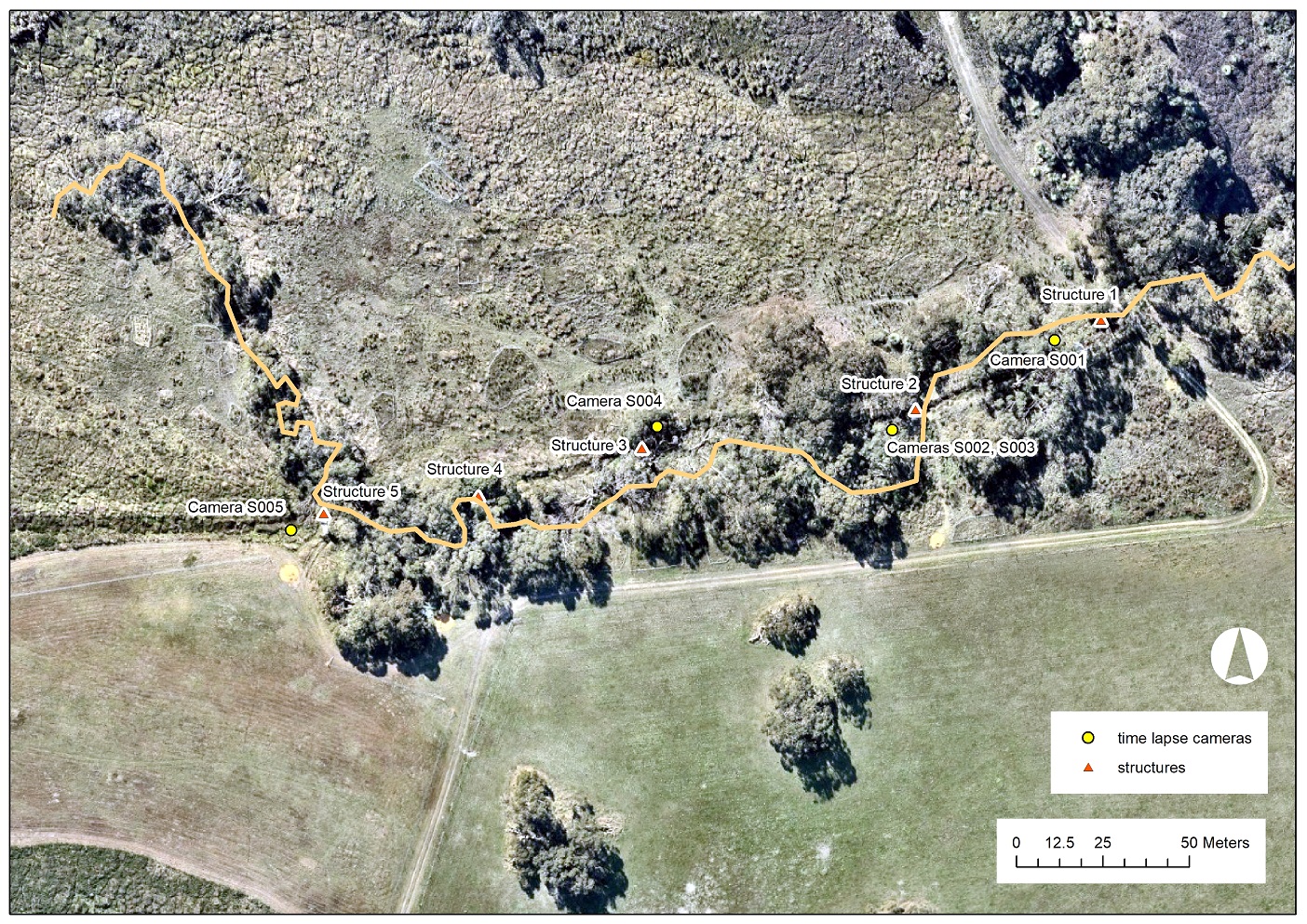
Following are videos created from the images taken by each time lapse camera. Camera S001 shows Structure 1.
The creek is dry at the beginning of the video but flows appear at about 4 seconds (the morning of the 28th of May). Water can be seen both upstream (left) and downstream (right) of the structure, with the downstream water one of the pools that have been created from the unfilled remnants of the old drain. The structure appears to be doing its job well without being over-topped by high flows, although a small flow can be seen passing around the far side of the structure at 18 seconds (i.e. on the afternoon of the 13th of June) and again at 23 seconds. We will use this information to undertake some minor adjustments to protect the integrity of the structure.
The other structures all seem to be performing well, with a minor repair of Structure 5 required. Apologies for the shaky camera of S005 – it was attached to a relatively young tree, which is obviously swaying around in the wind!
This project is being delivered by NGT in partnership with Friends of Stipiturus and Hesperilla Conservation Parks, funded by the National Parks and Wildlife Service, Friends of Parks Partnership Grants Program.